
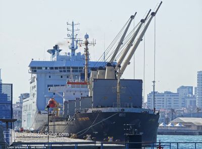
LADY SPERANZA
Bulk Carrier
Current Trip
| Time Travelled | 12 days |
|---|---|
| Remaining Time | --- |
| Distance Travelled | 1078.72 nm |
| Remaining Distance | --- |
| AVG Speed | 9.7 Knop |
| MAX Speed | 12.6 Knop |
| AVG Wind | 17.3 knots |
| MAX Wind | 28.3 knots |
| MIN Temp | 10.6°C / 51.08°F |
| MAX Temp | 19.7°C / 67.46°F |
| Djupgående | 5 m |
| Position mottagen | 8 d sen |
Current Position
| Longitud | 29.19797° |
|---|---|
| Latitude | 41.49880° |
| Status | Under way using engine |
| Fart | 10.3 Knop |
| Kurs | 356.4° |
| Område | Black Sea |
| Station | T-AIS |
| Position mottagen | 8 d sen |
Info
Information
The current position of LADY SPERANZA is in Black Sea with coordinates 41.49880° / 29.19797° as reported on 2024-04-30 17:51 by AIS to our vessel tracker app. The vessel's current speed is 10.3 Knop
The vessel LADY SPERANZA (IMO: 9200574, MMSI: 630001013) is a Bulk Carrier that was built in 2000 ( 24 År gammal ). It's sailing under the flag of [GW] Guinea-Bissau.
In this page you can find informations about the vessels current position, last detected port calls, and current voyage information. If the vessels is not in coverage by AIS you will find the latest position.
The current position of LADY SPERANZA is detected by our AIS receivers and we are not responsible for the reliability of the data. The last position was recorded while the vessel was in Coverage by the Ais receivers of our vessel tracking app.
The current draught of LADY SPERANZA as reported by AIS is 5 meters
Weather
| Temperature | 13.9°C / 57.02°F |
|---|---|
| Wind Speed | 19 knots |
| Direction | 43° NE |
| Pressure | 1019.4 hPa |
| Humidity | 89.1 % |
| Cloud Coverage | 72 % |
Featured Company
Last Port Calls
| Port | Arrival | Departure | Time In Port |
|---|---|---|---|
| 2024-04-01 06:45 | 2024-04-26 14:11 | 25 d | |
| 2024-03-23 12:44 |
Last Trips
| Origin | Departure | Destination | Arrival | Distance | |
|---|---|---|---|---|---|
| 2024-03-23 14:44 | 2024-04-01 07:45 | 1032.49 nm |
Events
| Tid | Event | Detaljer | Position / Dest | Information |
|---|---|---|---|---|
| 2024-04-30 17:55 | Status ändrad | Default Under way using engine |
41.51007 / 29.19670
RO CND
|
Fart: 10.3 kn Kurs: 356.4° |
| 2024-04-30 17:51 | UTANFÖR täckningsområde |
41.49880 / 29.19797
Black Sea
RO CND
|
Fart: 10.3 kn Kurs: 356.4° |
|
| 2024-04-30 16:13 | Byter havsområde | Turkish part of the Black Sea Turkish part of the Sea of Marmara |
41.23501 / 29.14465
Black Sea
RO CND
|
Fart: 10.8 kn Kurs: 32.3° |
| 2024-04-30 15:25 | ETA ändrat | 2024/05/01 16:00 2024/05/01 18:00 |
41.13196 / 29.07522
RO CND
|
Fart: 10.8 kn Kurs: 316.4° |
| 2024-04-30 15:09 | Status ändrad | Under way using engine Default |
41.10246 / 29.06236
RO CND
|
Fart: 8.8 kn Kurs: 6° |
| 2024-04-30 14:28 | Status ändrad | Default Under way using engine |
41.02815 / 29.00711
RO CND
|
Fart: 8.5 kn Kurs: 5.6° |
| 2024-04-30 13:49 | ETA ändrat | 2024/05/01 18:00 2024/05/01 06:00 |
40.94185 / 28.97594
RO CND
|
Fart: 10.7 kn Kurs: 30.4° |
| 2024-04-30 12:35 | Status ändrad | Under way using engine Default |
40.82590 / 28.73686
RO CND
|
Fart: 11.6 kn Kurs: 90° |
| 2024-04-30 12:30 | Status ändrad | Default Under way using engine |
40.82333 / 28.71879
RO CND
|
Fart: 11.8 kn Kurs: 96.3° |
| 2024-04-30 12:20 | Status ändrad | Under way using engine Default |
40.82468 / 28.67134
RO CND
|
Fart: 11.6 kn Kurs: 80° |