

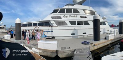
LADY SANDALS
Pleasure Craft

Current Trip
| Trip Time | 22 h, 4 mins |
|---|---|
| Trip Distance | 44.07 nm |
| AVG Speed | 8 Knop |
| MAX Speed | 12 Knop |
| Djupgående | 2.8 m |
| AVG Wind | 11.8 knots |
| MAX Wind | 13 knots |
| MIN Temp | 22.5°C / 72.5°F |
| MAX Temp | 26.2°C / 79.16°F |
| Position mottagen | 1 d sen |
Current Position
| Longitud | --- |
|---|---|
| Latitude | --- |
| Status | Under way using engine |
| Fart | |
| Kurs | 288° |
| Område | North Atlantic Ocean |
| Station | T-AIS |
| Position mottagen | 1 d sen |
Information
The current position of LADY SANDALS is in North Atlantic Ocean with coordinates 26.09043° / -80.17444° as reported on 2025-03-24 22:37 by AIS to our vessel tracker app. The vessel's current speed is 0 Knop and is currently inside the port of FORT LAUDERDALE.
The vessel LADY SANDALS (MMSI: 319010600) is a Pleasure Craft It's sailing under the flag of [KY] Cayman Is.
In this page you can find informations about the vessels current position, last detected port calls, and current voyage information. If the vessels is not in coverage by AIS you will find the latest position.
The current position of LADY SANDALS is detected by our AIS receivers and we are not responsible for the reliability of the data. The last position was recorded while the vessel was in Coverage by the Ais receivers of our vessel tracking app.
The current draught of LADY SANDALS as reported by AIS is 2.8 meters
Weather
| Temperature | 26.9°C / 80.42°F |
|---|---|
| Wind Speed | 12 knots |
| Direction | 147° SSE |
| Pressure | 1016.7 hPa |
| Humidity | 55.5 % |
| Cloud Coverage | 100 % |


Featured Company
Last Port Calls
| Port | Arrival | Departure | Time In Port |
|---|---|---|---|
| 2025-03-24 16:33 | |||
| 2025-03-17 13:40 | 2025-03-23 18:29 | 6 d | |
| 2025-03-17 07:21 |
Most Visited Ports (Last year)
| Port | Arrivals | |
|---|---|---|
| 3 | ||
| 1 |
Last Trips
| Origin | Departure | Destination | Arrival | Distance | |
|---|---|---|---|---|---|
| 2025-03-23 18:29 | 2025-03-24 16:33 | 44.07 nm | |||
| 2025-03-17 07:21 | 2025-03-17 13:40 | 49.83 nm |
Events
| Tid | Event | Detaljer | Position / Dest | Information |
|---|---|---|---|---|
| 2025-03-24 22:37 | UTANFÖR täckningsområde |
26.09043 / -80.17444
North Atlantic Ocean
[US] FORT LAUDERDALE
|
Fart: Kurs: 218.9° |
|
| 2025-03-24 21:38 | STOPPAR förflyttning |
26.09041 / -80.17471
[US] FORT LAUDERDALE
|
Fart: Kurs: 3° |
|
| 2025-03-24 20:50 | Destination ändrad | PEV WPB |
26.11800 / -80.14310
[US] FORT LAUDERDALE
|
Fart: 4 kn Kurs: 280° |
| 2025-03-24 20:33 | ANLÄNDER HAMN |
|
26.11451 / -80.12171
[US] FORT LAUDERDALE
|
Fart: 2.5 kn Kurs: 280° |
| 2025-03-24 19:10 | I täckningsområde |
26.25251 / -80.05712
North Atlantic Ocean
|
Fart: 10 kn Kurs: 190° |
|
| 2025-03-24 17:37 | UTANFÖR täckningsområde |
26.54050 / -80.01528
North Atlantic Ocean
|
Fart: 11.8 kn Kurs: 174.1° |
|
| 2025-03-24 16:33 | I täckningsområde |
26.73832 / -80.01587
North Atlantic Ocean
|
Fart: 10 kn Kurs: 157.1° |
|
| 2025-03-24 05:44 | UTANFÖR täckningsområde |
26.71166 / -80.04636
North Atlantic Ocean
|
Fart: Kurs: 61.9° |
|
| 2025-03-24 05:29 | I täckningsområde |
26.71166 / -80.04636
North Atlantic Ocean
|
Fart: Kurs: 64.7° |
|
| 2025-03-24 04:23 | UTANFÖR täckningsområde |
26.71166 / -80.04636
North Atlantic Ocean
|
Fart: Kurs: 158.1° |