
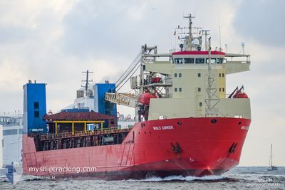
LADY MARIIA
Ro-Ro Cargo
Current Trip
TO ORDER
| Time Travelled | 3 days |
|---|---|
| Remaining Time | --- |
| Distance Travelled | 906.27 nm |
| Remaining Distance | --- |
| AVG Speed | 10.8 Knop |
| MAX Speed | 14.9 Knop |
| AVG Wind | 13.5 knots |
| MAX Wind | 25.8 knots |
| MIN Temp | 2.7°C / 36.86°F |
| MAX Temp | 9.2°C / 48.56°F |
| Djupgående | 5.6 m |
| Position mottagen | 1 m sen |
Current Position
| Longitud | --- |
|---|---|
| Latitude | --- |
| Status | Under way using engine |
| Fart | 9 Knop |
| Kurs | 238.2° |
| Område | North Sea |
| Station | T-AIS |
| Position mottagen | 1 m sen |
Info
Information
The current position of LADY MARIIA is in North Sea with coordinates 57.12100° / 8.08866° as reported on 2024-12-25 18:28 by AIS to our vessel tracker app. The vessel's current speed is 9 Knop
The vessel LADY MARIIA (IMO: 9220641, MMSI: 273292160) is a Ro-Ro Cargo that was built in 2000 ( 24 År gammal ). It's sailing under the flag of [RU] Russia.
In this page you can find informations about the vessels current position, last detected port calls, and current voyage information. If the vessels is not in coverage by AIS you will find the latest position.
The current position of LADY MARIIA is detected by our AIS receivers and we are not responsible for the reliability of the data. The last position was recorded while the vessel was in Coverage by the Ais receivers of our vessel tracking app.
The current draught of LADY MARIIA as reported by AIS is 5.6 meters
Weather
| Temperature | 9.3°C / 48.74°F |
|---|---|
| Wind Speed | 16 knots |
| Direction | 238° WSW |
| Pressure | 1027.9 hPa |
| Humidity | 92.1 % |
| Cloud Coverage | 5 % |
Featured Company
Last Port Calls
| Port | Arrival | Departure | Time In Port |
|---|---|---|---|
| 2024-12-21 05:20 | 2024-12-21 22:56 | 17 h | |
| 2024-12-20 11:44 | 2024-12-20 15:27 | 3 h | |
| 2024-12-09 05:09 | 2024-12-20 10:09 | 11 d | |
| 2024-11-24 13:57 | 2024-11-25 10:12 | 20 h | |
| 2024-11-12 07:58 | 2024-11-13 07:17 | 23 h | |
| 2024-10-28 17:38 | 2024-10-28 22:35 | 4 h |
Most Visited Ports (Last year)
| Port | Arrivals | |
|---|---|---|
| 3 | ||
| 2 | ||
| 2 | ||
| 2 | ||
| 1 | ||
| 1 |
Last Trips
| Origin | Departure | Destination | Arrival | Distance | |
|---|---|---|---|---|---|
| 2024-12-20 18:27 | 2024-12-21 08:20 | 20.34 nm | |||
| 2024-12-20 13:09 | 2024-12-20 14:44 | 17.77 nm | |||
| 2024-11-25 11:12 | 2024-12-09 08:09 | 2961.13 nm | |||
| 2024-11-13 10:17 | 2024-11-24 14:57 | 2214.10 nm | |||
| 2024-10-28 23:35 | 2024-11-12 10:58 | 2215.33 nm | |||
| 2024-08-21 11:29 | 2024-10-28 18:38 | 1730.31 nm |
Events
| Tid | Event | Detaljer | Position / Dest | Information |
|---|---|---|---|---|
| 2024-12-25 17:04 | Upptäckt i hav | Danish part of the North Sea |
57.22650 / 8.41259
North Sea
|
Fart: 9.1 kn Kurs: 237.9° |
| 2024-12-25 06:37 | Byter havsområde | Danish part of the Skaggerak Danish part of the Kattegat |
57.80111 / 10.93937
Skaggerak
|
Fart: 10.3 kn Kurs: 319.1° |
| 2024-12-25 05:17 | Byter havsområde | Danish part of the Kattegat Swedish part of the Kattegat |
57.62768 / 11.22942
Kattegat
|
Fart: 10.8 kn Kurs: 319.4° |
| 2024-12-24 15:04 | Byter havsområde | Swedish part of the Kattegat Swedish part of the Baltic Sea |
55.33697 / 12.67983
Kattegat
|
Fart: 11.4 kn Kurs: 354.5° |
| 2024-12-24 07:40 | Upptäckt i hav | Swedish part of the Baltic Sea |
55.48620 / 14.72311
Baltic Sea
|
Fart: 10.4 kn Kurs: 241.4° |
| 2024-12-24 05:50 | Upptäckt i hav | Danish part of the Kattegat |
55.64429 / 15.22045
Kattegat
|
Fart: 11 kn Kurs: 239.4° |
| 2024-12-23 22:38 | Status ändrad | Under way using engine Default |
56.32812 / 17.18135
TO ORDER
|
Fart: 10.8 kn Kurs: 233° |
| 2024-12-23 22:38 | I täckningsområde |
56.32692 / 17.17852
Baltic Sea
|
Fart: 10.7 kn Kurs: 232.5° |
|
| 2024-12-23 15:36 | Status ändrad | Default Under way using engine |
57.16456 / 18.82907
TO ORDER
|
Fart: 11.1 kn Kurs: 215.7° |
| 2024-12-23 15:35 | UTANFÖR täckningsområde |
57.16781 / 18.83341
Baltic Sea
|
Fart: 11.1 kn Kurs: 215.7° |