
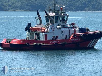
KURTARMA 17
Tug
Current Trip
CANAKKALE
| Time Travelled | 2 days |
|---|---|
| Remaining Time | --- |
| Distance Travelled | 274.46 nm |
| Remaining Distance | --- |
| AVG Speed | 9.2 Knop |
| MAX Speed | 14.4 Knop |
| AVG Wind | 4.4 knots |
| MAX Wind | 9 knots |
| MIN Temp | -3.2°C / 26.24°F |
| MAX Temp | 12.9°C / 55.22°F |
| Djupgående | 0 m |
| Position mottagen | 2 m sen |
Current Position
| Longitud | --- |
|---|---|
| Latitude | --- |
| Status | Moored |
| Fart | |
| Kurs | 4° |
| Område | Sea of Marmara |
| Station | T-AIS |
| Position mottagen | 2 m sen |
Info
Information
The current position of KURTARMA 17 is in Sea of Marmara with coordinates 40.22779° / 26.42678° as reported on 2025-02-26 15:02 by AIS to our vessel tracker app. The vessel's current speed is 0 Knop
The vessel KURTARMA 17 (IMO: 9942990, MMSI: 271051873) is a Tug It's sailing under the flag of [TR] Turkey.
In this page you can find informations about the vessels current position, last detected port calls, and current voyage information. If the vessels is not in coverage by AIS you will find the latest position.
The current position of KURTARMA 17 is detected by our AIS receivers and we are not responsible for the reliability of the data. The last position was recorded while the vessel was in Coverage by the Ais receivers of our vessel tracking app.
Weather
| Temperature | 11.3°C / 52.34°F |
|---|---|
| Wind Speed | 5 knots |
| Direction | 300° WNW |
| Pressure | 1021.8 hPa |
| Humidity | 60.9 % |
| Cloud Coverage | 34 % |
Featured Company
Last Port Calls
| Port | Arrival | Departure | Time In Port |
|---|---|---|---|
| 2025-02-23 16:23 | 2025-02-23 17:33 | 1 h | |
| 2025-02-21 18:14 | 2025-02-22 07:48 | 13 h | |
| 2025-02-19 14:36 | 2025-02-19 22:48 | 8 h | |
| 2025-02-18 22:38 | 2025-02-19 00:06 | 1 h | |
| 2025-02-18 11:23 | 2025-02-18 19:49 | 8 h | |
| 2025-02-17 16:08 | 2025-02-18 07:53 | 15 h | |
| 2025-02-16 12:16 | 2025-02-17 03:09 | 14 h | |
| 2025-02-14 18:04 | 2025-02-14 21:46 | 3 h | |
| 2025-02-14 14:04 | 2025-02-14 14:10 | 5 m | |
| 2025-02-14 12:06 | 2025-02-14 12:19 | 12 m |
Most Visited Ports (Last year)
| Port | Arrivals | |
|---|---|---|
| 239 | ||
| 182 | ||
| 55 | ||
| 49 | ||
| 17 |
Last Trips
| Origin | Departure | Destination | Arrival | Distance | |
|---|---|---|---|---|---|
| 2025-02-22 10:48 | 2025-02-23 19:23 | 113.36 nm | |||
| 2025-02-20 01:48 | 2025-02-21 21:14 | 149.70 nm | |||
| 2025-02-19 03:06 | 2025-02-19 17:36 | 98.18 nm | |||
| 2025-02-18 22:49 | 2025-02-19 01:38 | 26.90 nm | |||
| 2025-02-18 10:53 | 2025-02-18 14:23 | 33.45 nm | |||
| 2025-02-17 06:09 | 2025-02-17 19:08 | 84.37 nm | |||
| 2025-02-15 00:46 | 2025-02-16 15:16 | 80.36 nm | |||
| 2025-02-14 17:10 | 2025-02-14 21:04 | 30.18 nm | |||
| 2025-02-14 15:19 | 2025-02-14 17:04 | 18.71 nm | |||
| 2025-02-12 14:11 | 2025-02-14 15:06 | 117.57 nm |
Events
| Tid | Event | Detaljer | Position / Dest | Information |
|---|---|---|---|---|
| 2025-02-26 14:41 | Status ändrad | Moored Under way using engine |
40.22780 / 26.42679
CANAKKALE
|
Fart: Kurs: 4° |
| 2025-02-26 14:38 | STOPPAR förflyttning | 4.52 nm, North of CANAKKALE |
40.22779 / 26.42679
CANAKKALE
|
Fart: 0.1 kn Kurs: 1° |
| 2025-02-26 12:31 | Status ändrad | Under way using engine Default |
40.03979 / 26.20686
CANAKKALE
|
Fart: 7.5 kn Kurs: 266° |
| 2025-02-26 12:29 | Status ändrad | Default Under way using engine |
40.04112 / 26.21307
CANAKKALE
|
Fart: 7.9 kn Kurs: 237.5° |
| 2025-02-26 09:50 | Status ändrad | Under way using engine Default |
40.28768 / 26.54397
CANAKKALE
|
Fart: 8.3 kn Kurs: 219° |
| 2025-02-26 09:45 | Status ändrad | Default Under way using engine |
40.29487 / 26.55469
CANAKKALE
|
Fart: 8.2 kn Kurs: 237.9° |
| 2025-02-26 09:42 | Status ändrad | Under way using engine Default |
40.30053 / 26.56383
CANAKKALE
|
Fart: 7.9 kn Kurs: 233° |
| 2025-02-26 09:42 | I täckningsområde |
40.29827 / 26.55998
Sea of Marmara
|
Fart: 8.2 kn Kurs: 237.9° |
|
| 2025-02-26 06:07 | STARTAR förflyttning | 1.09 nm, South West of GELIBOLU |
40.39113 / 26.65438
CANAKKALE
|
Fart: 13.2 kn Kurs: 38° |
| 2025-02-25 18:51 | STOPPAR förflyttning | 1.93 nm, South West of GELIBOLU |
40.38321 / 26.63895
CANAKKALE
|
Fart: Kurs: 315° |