
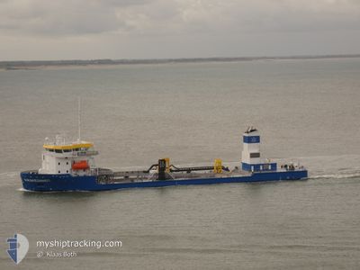
KRAKESANDT
Dredging or underwater ops
Current Trip
| Time Travelled | 7 days |
|---|---|
| Remaining Time | -11 mins |
| Distance Travelled | 403.95 nm |
| Remaining Distance | 1.76 nm |
| AVG Speed | 9 Knop |
| MAX Speed | 13.5 Knop |
| AVG Wind | 9.9 knots |
| MAX Wind | 25.1 knots |
| MIN Temp | 5.6°C / 42.08°F |
| MAX Temp | 16°C / 60.8°F |
| Djupgående | 3.7 m |
| Position mottagen | Nu |
Current Position
| Longitud | 3.51957° |
|---|---|
| Latitude | 51.46113° |
| Status | Under way using engine |
| Fart | 8.6 Knop |
| Kurs | 334.7° |
| Område | North Sea |
| Station | T-AIS |
| Position mottagen | Nu |
Info
Information
The current position of KRAKESANDT is in North Sea with coordinates 51.46113° / 3.51957° as reported on 2024-05-03 04:38 by AIS to our vessel tracker app. The vessel's current speed is 8.6 Knop and is heading at the port of VLISSINGEN STATION. The estimated time of arrival as calculated by MyShipTracking vessel tracking app is 2024-05-03 04:28 LT
The vessel KRAKESANDT (IMO: 9823807, MMSI: 244849000) is a Dredging or underwater ops It's sailing under the flag of [NL] Netherlands.
In this page you can find informations about the vessels current position, last detected port calls, and current voyage information. If the vessels is not in coverage by AIS you will find the latest position.
The current position of KRAKESANDT is detected by our AIS receivers and we are not responsible for the reliability of the data. The last position was recorded while the vessel was in Coverage by the Ais receivers of our vessel tracking app.
The current draught of KRAKESANDT as reported by AIS is 3.7 meters
Weather
| Temperature | 10.8°C / 51.44°F |
|---|---|
| Wind Speed | 20 knots |
| Direction | 252° WSW |
| Pressure | 1004.7 hPa |
| Humidity | 91.7 % |
| Cloud Coverage | 100 % |
Featured Company
Last Port Calls
| Port | Arrival | Departure | Time In Port |
|---|---|---|---|
| 2024-04-25 05:17 | 2024-04-25 09:29 | 4 h | |
| 2024-03-30 06:43 | 2024-04-02 05:07 | 2 d | |
| 2024-03-28 05:51 | 2024-03-28 09:52 | 4 h |
Most Visited Ports (Last year)
| Port | Arrivals | |
|---|---|---|
| 10 | ||
| 3 | ||
| 2 |
Last Trips
| Origin | Departure | Destination | Arrival | Distance | |
|---|---|---|---|---|---|
| 2024-04-02 07:07 | 2024-04-25 07:17 | 1488.79 nm | |||
| 2024-03-28 10:52 | 2024-03-30 07:43 | 118.13 nm | |||
| 2024-02-29 12:19 | 2024-03-28 06:51 | 1796.98 nm |
Events
| Tid | Event | Detaljer | Position / Dest | Information |
|---|---|---|---|---|
| 2024-05-03 03:55 | STARTAR förflyttning | 1.67 nm, South East of BRESKENS |
51.38714 / 3.60834
NL STEENBANK
|
Fart: 5.3 kn Kurs: 283.8° |
| 2024-05-03 03:50 | Status ändrad | Under way using engine At anchor |
51.38665 / 3.61154
NL STEENBANK
|
Fart: Kurs: 265° |
| 2024-05-03 02:59 | ETA ändrat | 2024/05/03 06:00 2024/05/03 08:00 |
51.38651 / 3.61159
NL STEENBANK
|
Fart: Kurs: 223° |
| 2024-05-02 23:02 | Djupgående ändrat | 3.7 6.7 |
51.38656 / 3.61214
NL STEENBANK
|
Fart: Kurs: 97° |
| 2024-05-02 22:56 | ETA ändrat | 2024/05/03 08:00 2024/05/02 14:30 |
51.38658 / 3.61215
NL STEENBANK
|
Fart: Kurs: 90° |
| 2024-05-02 18:04 | Destination ändrad | NL STEENBANK HOOFDPLAAT |
51.38673 / 3.61157
NL STEENBANK
|
Fart: Kurs: 293° |
| 2024-05-02 17:26 | STOPPAR förflyttning | 1.78 nm, South East of BRESKENS |
51.38668 / 3.61125
HOOFDPLAAT
|
Fart: 0.3 kn Kurs: 23° |
| 2024-05-02 17:22 | Status ändrad | At anchor Under way using engine |
51.38783 / 3.60482
HOOFDPLAAT
|
Fart: 7 kn Kurs: 113.8° |
| 2024-05-02 15:32 | Destination ändrad | HOOFDPLAAT NL STEENBANK |
51.61212 / 3.36744
HOOFDPLAAT
|
Fart: 9 kn Kurs: 153.5° |
| 2024-05-02 15:14 | Djupgående ändrat | 6.7 3.6 |
51.64989 / 3.35426
NL STEENBANK
|
Fart: 2.5 kn Kurs: 199° |