
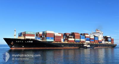
KOTA LARIS
Container Ship
Current Trip
| Time Travelled | 7 days |
|---|---|
| Remaining Time | 2 days |
| Distance Travelled | 3050.02 nm |
| Remaining Distance | 892.22 nm |
| AVG Speed | 16.8 Knop |
| MAX Speed | 21 Knop |
| AVG Wind | 10.9 knots |
| MAX Wind | 22 knots |
| MIN Temp | 14.7°C / 58.46°F |
| MAX Temp | 30.1°C / 86.18°F |
| Djupgående | 12.2 m |
| Position mottagen | 1 d sen |
Current Position
| Longitud | 118.34935° |
|---|---|
| Latitude | -35.76733° |
| Status | Under way using engine |
| Fart | 18.8 Knop |
| Kurs | 98.6° |
| Område | Indian Ocean |
| Station | T-AIS |
| Position mottagen | 1 d sen |
Info
Information
The current position of KOTA LARIS is in Indian Ocean with coordinates -35.76733° / 118.34935° as reported on 2024-05-19 00:37 by AIS to our vessel tracker app. The vessel's current speed is 18.8 Knop and is heading at the port of MELBOURNE. The estimated time of arrival as calculated by MyShipTracking vessel tracking app is 2024-05-22 11:48 LT
The vessel KOTA LARIS (IMO: 9351048, MMSI: 563133500) is a Container Ship that was built in 2008 ( 16 År gammal ). It's sailing under the flag of [SG] Singapore.
In this page you can find informations about the vessels current position, last detected port calls, and current voyage information. If the vessels is not in coverage by AIS you will find the latest position.
The current position of KOTA LARIS is detected by our AIS receivers and we are not responsible for the reliability of the data. The last position was recorded while the vessel was in Coverage by the Ais receivers of our vessel tracking app.
The current draught of KOTA LARIS as reported by AIS is 12.2 meters
Weather
| Temperature | 14.5°C / 58.1°F |
|---|---|
| Wind Speed | 8 knots |
| Direction | 17° NNE |
| Pressure | 1035.2 hPa |
| Humidity | 67 % |
| Cloud Coverage | 100 % |
Featured Company
Last Port Calls
| Port | Arrival | Departure | Time In Port |
|---|---|---|---|
| 2024-05-12 16:48 | 2024-05-13 05:17 | 12 h | |
| 2024-05-11 21:59 | 2024-05-12 15:35 | 17 h | |
| 2024-05-07 07:00 | 2024-05-09 20:44 | 2 d | |
| 2024-05-04 05:06 | 2024-05-05 09:15 | 1 d | |
| 2024-04-23 13:46 | 2024-04-24 20:39 | 1 d | |
| 2024-04-18 21:04 | 2024-04-20 18:38 | 1 d | |
| 2024-04-08 09:33 | 2024-04-09 04:09 | 18 h | |
| 2024-04-07 18:52 | 2024-04-08 08:26 | 13 h | |
| 2024-04-03 14:09 | 2024-04-05 19:41 | 2 d | |
| 2024-03-30 20:47 | 2024-04-01 00:12 | 1 d |
Last Trips
| Origin | Departure | Destination | Arrival | Distance | |
|---|---|---|---|---|---|
| 2024-05-12 15:35 | 2024-05-12 16:48 | 9.72 nm | |||
| 2024-05-09 20:44 | 2024-05-11 21:59 | 798.35 nm | |||
| 2024-05-05 09:15 | 2024-05-07 07:00 | 806.17 nm | |||
| 2024-04-24 20:39 | 2024-05-04 05:06 | 3815.08 nm | |||
| 2024-04-20 18:38 | 2024-04-23 13:46 | 1131.61 nm | |||
| 2024-04-09 04:09 | 2024-04-18 21:04 | 3933.00 nm | |||
| 2024-04-08 08:26 | 2024-04-08 09:33 | 9.50 nm | |||
| 2024-04-05 19:41 | 2024-04-07 18:52 | 803.62 nm | |||
| 2024-04-01 00:12 | 2024-04-03 14:09 | 814.07 nm | |||
| 2024-03-21 12:42 | 2024-03-30 20:47 | 3817.80 nm |
Events
| Tid | Event | Detaljer | Position / Dest | Information |
|---|---|---|---|---|
| 2024-05-19 00:42 | Status ändrad | Default Under way using engine |
-35.77159 / 118.37714
AUMEL
|
Fart: 18.8 kn Kurs: 98.6° |
| 2024-05-19 00:37 | UTANFÖR täckningsområde |
-35.76733 / 118.34935
Indian Ocean
AUMEL
|
Fart: 18.8 kn Kurs: 98.6° |
|
| 2024-05-18 21:08 | Status ändrad | Under way using engine Default |
-35.60384 / 117.05022
AUMEL
|
Fart: 17.9 kn Kurs: 97° |
| 2024-05-18 20:15 | Status ändrad | Default Under way using engine |
-35.56080 / 116.72691
AUMEL
|
Fart: 18.5 kn Kurs: 99.5° |
| 2024-05-18 20:07 | ETA ändrat | 2024/05/22 00:01 2024/05/22 01:00 |
-35.55364 / 116.67547
AUMEL
|
Fart: 18.4 kn Kurs: 101.5° |
| 2024-05-18 20:06 | Status ändrad | Under way using engine Default |
-35.55262 / 116.66993
AUMEL
|
Fart: 18.7 kn Kurs: 106° |
| 2024-05-18 19:52 | Status ändrad | Default Under way using engine |
-35.53230 / 116.57937
AUMEL
|
Fart: 18.5 kn Kurs: 105.3° |
| 2024-05-18 19:51 | Status ändrad | Under way using engine Default |
-35.53167 / 116.57616
AUMEL
|
Fart: 18.6 kn Kurs: 104° |
| 2024-05-18 19:44 | Status ändrad | Default Under way using engine |
-35.52202 / 116.52930
AUMEL
|
Fart: 18.7 kn Kurs: 118.9° |
| 2024-05-18 19:31 | Byter havsområde | Australian part of the Indian Ocean Indonesian part of the Singapore Strait |
-35.49542 / 116.45857
Indian Ocean
AUMEL
|
Fart: 19 kn Kurs: 112.2° |