
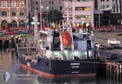
KORIMAKO
Bunkering Tanker
Current Trip
| Trip Time | 6 h, 48 mins |
|---|---|
| Trip Distance | 15.48 nm |
| AVG Speed | 5.2 Knop |
| MAX Speed | 7.7 Knop |
| Djupgående | 3.5 m |
| AVG Wind | 8.6 knots |
| MAX Wind | 11.9 knots |
| MIN Temp | 13.2°C / 55.76°F |
| MAX Temp | 17.3°C / 63.14°F |
| Position mottagen | 5 d sen |
Current Position
| Longitud | 176.18286° |
|---|---|
| Latitude | -37.64880° |
| Status | Under way using engine |
| Fart | |
| Kurs | 170° |
| Område | South Pacific Ocean |
| Station | T-AIS |
| Position mottagen | 5 d sen |
Info
Information
The current position of KORIMAKO is in South Pacific Ocean with coordinates -37.64880° / 176.18286° as reported on 2024-05-12 03:42 by AIS to our vessel tracker app. The vessel's current speed is 0 Knop and is currently inside the port of TAURANGA.
The vessel KORIMAKO (IMO: 9557161, MMSI: 512465000) is a Bunkering Tanker that was built in 2012 ( 12 År gammal ). It's sailing under the flag of [NZ] New Zealand.
In this page you can find informations about the vessels current position, last detected port calls, and current voyage information. If the vessels is not in coverage by AIS you will find the latest position.
The current position of KORIMAKO is detected by our AIS receivers and we are not responsible for the reliability of the data. The last position was recorded while the vessel was in Coverage by the Ais receivers of our vessel tracking app.
The current draught of KORIMAKO as reported by AIS is 3.5 meters
Weather
| Temperature | 14.9°C / 58.82°F |
|---|---|
| Wind Speed | 5 knots |
| Direction | 301° WNW |
| Pressure | 1022.6 hPa |
| Humidity | 43.4 % |
| Cloud Coverage | --- |
Featured Company
Most Visited Ports (Last year)
| Port | Arrivals | |
|---|---|---|
| 8 |
Events
| Tid | Event | Detaljer | Position / Dest | Information |
|---|---|---|---|---|
| 2024-05-12 03:42 | UTANFÖR täckningsområde |
-37.64880 / 176.18286
South Pacific Ocean
[NZ] TAURANGA
|
Fart: Kurs: 77.7° |
|
| 2024-05-12 03:38 | STOPPAR förflyttning |
-37.64883 / 176.18272
[NZ] TAURANGA
|
Fart: 0.2 kn Kurs: 168° |
|
| 2024-05-12 03:28 | STARTAR förflyttning |
-37.65998 / 176.17825
[NZ] TAURANGA
|
Fart: 3.4 kn Kurs: 17° |
|
| 2024-05-11 20:40 | STOPPAR förflyttning |
-37.66269 / 176.17604
[NZ] TAURANGA
|
Fart: 0.3 kn Kurs: 195° |
|
| 2024-05-11 20:30 | STARTAR förflyttning |
-37.65051 / 176.18184
[NZ] TAURANGA
|
Fart: 4.3 kn Kurs: 206° |
|
| 2024-05-11 20:05 | I täckningsområde |
-37.64877 / 176.18287
South Pacific Ocean
[NZ] TAURANGA
|
Fart: Kurs: 64.2° |
|
| 2024-05-10 22:34 | UTANFÖR täckningsområde |
-37.64891 / 176.18274
South Pacific Ocean
[NZ] TAURANGA
|
Fart: Kurs: 64.2° |
|
| 2024-05-10 22:31 | STOPPAR förflyttning |
-37.64894 / 176.18267
[NZ] TAURANGA
|
Fart: 0.3 kn Kurs: 165° |
|
| 2024-05-10 22:15 | STARTAR förflyttning |
-37.66258 / 176.18015
[NZ] TAURANGA
|
Fart: 5 kn Kurs: 354° |
|
| 2024-05-10 19:54 | STOPPAR förflyttning |
-37.66460 / 176.17985
[NZ] TAURANGA
|
Fart: 0.3 kn Kurs: 11° |