
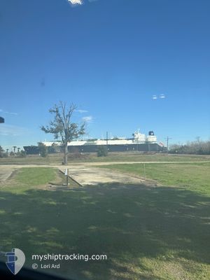
KOOL CRYSTAL
Lng Tanker
Current Trip
| Time Travelled | 17 days |
|---|---|
| Remaining Time | --- |
| Distance Travelled | 6507.73 nm |
| Remaining Distance | --- |
| AVG Speed | 15.6 Knop |
| MAX Speed | 17.9 Knop |
| AVG Wind | 11.9 knots |
| MAX Wind | 32 knots |
| MIN Temp | 14.5°C / 58.1°F |
| MAX Temp | 27.6°C / 81.68°F |
| Djupgående | 9.4 m |
| Position mottagen | 10 h, 7 m sen |
Current Position
| Longitud | --- |
|---|---|
| Latitude | --- |
| Status | Under way using engine |
| Fart | 0.1 Knop |
| Kurs | 49° |
| Område | Gulf of Mexico |
| Station | T-AIS |
| Position mottagen | 10 h, 7 m sen |
Info
Information
The current position of KOOL CRYSTAL is in Gulf of Mexico with coordinates 28.93853° / -95.30737° as reported on 2025-12-10 07:16 by AIS to our vessel tracker app. The vessel's current speed is 0.1 Knop
The vessel KOOL CRYSTAL (IMO: 9624926, MMSI: 538004985) is a Lng Tanker that was built in 2014 ( 11 År gammal ). It's sailing under the flag of [MH] Marshall Is.
In this page you can find informations about the vessels current position, last detected port calls, and current voyage information. If the vessels is not in coverage by AIS you will find the latest position.
The current position of KOOL CRYSTAL is detected by our AIS receivers and we are not responsible for the reliability of the data. The last position was recorded while the vessel was in Coverage by the Ais receivers of our vessel tracking app.
The current draught of KOOL CRYSTAL as reported by AIS is 9.4 meters
Weather
| Temperature | 21.4°C / 70.52°F |
|---|---|
| Wind Speed | 5 knots |
| Direction | 249° WSW |
| Pressure | 1016.8 hPa |
| Humidity | 64 % |
| Cloud Coverage | 1 % |
Featured Company
Last Port Calls
| Port | Arrival | Departure | Time In Port |
|---|---|---|---|
| 2025-11-22 09:43 | 2025-11-23 10:01 | 1 d | |
| 2025-11-14 12:42 | 2025-11-15 12:38 | 23 h | |
| 2025-10-30 09:07 | 2025-10-31 19:57 | 1 d |
Most Visited Ports (Last year)
| Port | Arrivals | |
|---|---|---|
| 3 | ||
| 1 | ||
| 1 | ||
| 1 | ||
| 1 |
Last Trips
| Origin | Departure | Destination | Arrival | Distance | |
|---|---|---|---|---|---|
| 2025-11-15 12:38 | 2025-11-22 09:43 | 2287.40 nm | |||
| 2025-10-31 19:57 | 2025-11-14 12:42 | 4916.70 nm | |||
| 2025-09-05 10:32 | 2025-10-30 09:07 | 12924.92 nm |
Events
| Tid | Event | Detaljer | Position / Dest | Information |
|---|---|---|---|---|
| 2025-12-10 07:31 | Status ändrad | Default Under way using engine |
28.93838 / -95.30719
USFPO
|
Fart: 0.1 kn Kurs: 49° |
| 2025-12-10 07:16 | UTANFÖR täckningsområde |
28.93853 / -95.30737
Gulf of Mexico
|
Fart: 0.1 kn Kurs: 72.2° |
|
| 2025-12-10 07:13 | STOPPAR förflyttning | 1.3 nm, East of FREEPORT (TX) |
28.93855 / -95.30755
USFPO
|
Fart: 0.2 kn Kurs: 46° |
| 2025-12-10 07:12 | Status ändrad | Under way using engine Default |
28.93875 / -95.30742
USFPO
|
Fart: 0.7 kn Kurs: 47° |
| 2025-12-10 06:59 | I täckningsområde |
28.93859 / -95.30753
Gulf of Mexico
|
Fart: 0.4 kn Kurs: 211.7° |
|
| 2025-12-10 05:15 | Status ändrad | Default Under way using engine |
28.75436 / -95.11719
USFPO
|
Fart: 14 kn Kurs: 319.7° |
| 2025-12-10 05:10 | UTANFÖR täckningsområde |
28.74038 / -95.10352
Gulf of Mexico
|
Fart: 14 kn Kurs: 319.7° |
|
| 2025-12-10 05:03 | Status ändrad | Under way using engine Default |
28.72052 / -95.08288
USFPO
|
Fart: 14 kn Kurs: 315° |
| 2025-12-10 04:47 | Status ändrad | Default Under way using engine |
28.67543 / -95.03091
USFPO
|
Fart: 15.9 kn Kurs: 315° |
| 2025-12-10 04:21 | Upptäckt i hav | United States part of the Gulf of Mexico |
28.59225 / -94.93653
Gulf of Mexico
USFPO
|
Fart: 16.8 kn Kurs: 317° |