
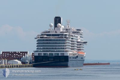
KONINGSDAM
Passenger
Current Trip
| Time Travelled | 9 h, 4 mins |
|---|---|
| Remaining Time | --- |
| Distance Travelled | 111.95 nm |
| Remaining Distance | 85.45 nm |
| AVG Speed | 12.8 Knop |
| MAX Speed | 16.5 Knop |
| AVG Wind | 6.2 knots |
| MAX Wind | 17.5 knots |
| MIN Temp | -0.8°C / 30.56°F |
| MAX Temp | 5.7°C / 42.26°F |
| Djupgående | 8.1 m |
| Position mottagen | 2 d sen |
Current Position
| Longitud | -131.48708° |
|---|---|
| Latitude | 54.35303° |
| Status | Under way using engine |
| Fart | 16.9 Knop |
| Kurs | 286.1° |
| Område | The Coastal Waters of Southeast Alaska and British Columbia |
| Station | T-AIS |
| Position mottagen | 2 d sen |
Info
Information
The current position of KONINGSDAM is in The Coastal Waters of Southeast Alaska and British Columbia with coordinates 54.35303° / -131.48708° as reported on 2024-05-06 02:13 by AIS to our vessel tracker app. The vessel's current speed is 16.9 Knop and is heading at the port of JUNEAU. The estimated time of arrival as calculated by MyShipTracking vessel tracking app is 2024-05-06 21:30 LT
The vessel KONINGSDAM (IMO: 9692557, MMSI: 244830547) is a Passenger It's sailing under the flag of [NL] Netherlands.
In this page you can find informations about the vessels current position, last detected port calls, and current voyage information. If the vessels is not in coverage by AIS you will find the latest position.
The current position of KONINGSDAM is detected by our AIS receivers and we are not responsible for the reliability of the data. The last position was recorded while the vessel was in Coverage by the Ais receivers of our vessel tracking app.
The current draught of KONINGSDAM as reported by AIS is 8.1 meters
Weather
| Temperature | 5.5°C / 41.9°F |
|---|---|
| Wind Speed | 17 knots |
| Direction | 137° SE |
| Pressure | 1012.9 hPa |
| Humidity | 91.7 % |
| Cloud Coverage | 100 % |
Featured Company
Last Port Calls
| Port | Arrival | Departure | Time In Port |
|---|---|---|---|
| 2024-05-07 13:42 | 2024-05-08 05:06 | 15 h | |
| 2024-05-06 19:50 | 2024-05-07 06:50 | 11 h | |
| 2024-05-04 13:12 | 2024-05-04 23:17 | 10 h | |
| 2024-05-02 18:34 | 2024-05-03 03:14 | 8 h | |
| 2024-04-30 14:18 | 2024-05-01 03:58 | 13 h | |
| 2024-04-29 20:38 | 2024-04-30 06:50 | 10 h | |
| 2024-04-27 13:07 | 2024-04-27 23:57 | 10 h | |
| 2024-04-26 18:27 | 2024-04-27 05:46 | 11 h | |
| 2024-04-20 15:58 | 2024-04-21 03:33 | 11 h | |
| 2024-04-18 15:57 | 2024-04-20 04:27 | 1 d |
Last Trips
| Origin | Departure | Destination | Arrival | Distance | |
|---|---|---|---|---|---|
| 2024-05-06 22:50 | 2024-05-07 05:42 | 97.87 nm | |||
| 2024-05-04 16:17 | 2024-05-06 11:50 | 784.74 nm | |||
| 2024-05-02 19:14 | 2024-05-04 06:12 | 533.39 nm | |||
| 2024-04-30 19:58 | 2024-05-02 10:34 | 535.08 nm | |||
| 2024-04-29 22:50 | 2024-04-30 06:18 | 97.83 nm | |||
| 2024-04-27 16:57 | 2024-04-29 12:38 | 783.48 nm | |||
| 2024-04-26 22:46 | 2024-04-27 06:07 | 81.87 nm | |||
| 2024-04-20 17:33 | 2024-04-26 11:27 | 2361.48 nm | |||
| 2024-04-19 18:27 | 2024-04-20 05:58 | 206.01 nm | |||
| 2024-04-17 18:09 | 2024-04-18 05:57 | 96.95 nm |
Events
| Tid | Event | Detaljer | Position / Dest | Information |
|---|---|---|---|---|
| 2024-05-08 05:06 | STARTAR förflyttning | 0.31 nm, South West of SKAGWAY |
59.44348 / -135.33389
CA VAN > US JNU
|
Fart: 4.2 kn Kurs: 59° |
| 2024-05-08 05:06 | AVGÅTT HAMN |
|
59.44348 / -135.33389
CA VAN > US JNU
|
Fart: 0.1 kn Kurs: 41° |
| 2024-05-07 13:55 | STOPPAR förflyttning |
59.44705 / -135.32396
[US] SKAGWAY
|
Fart: 0.1 kn Kurs: 49° |
|
| 2024-05-07 13:42 | ANLÄNDER HAMN |
|
59.44557 / -135.32684
[US] SKAGWAY
|
Fart: 3.2 kn Kurs: 48° |
| 2024-05-07 06:50 | AVGÅTT HAMN |
|
58.27185 / -134.36951
CA VAN > US JNU
|
Fart: 7.6 kn Kurs: 132° |
| 2024-05-07 06:38 | STARTAR förflyttning |
58.28812 / -134.40195
[US] JUNEAU
|
Fart: 5.6 kn Kurs: 158° |
|
| 2024-05-06 20:22 | STOPPAR förflyttning |
58.29792 / -134.40636
[US] JUNEAU
|
Fart: 0.2 kn Kurs: 325° |
|
| 2024-05-06 19:50 | ANLÄNDER HAMN |
|
58.27748 / -134.38117
[US] JUNEAU
|
Fart: 5.5 kn Kurs: 313° |
| 2024-05-06 02:19 | Status ändrad | Default Under way using engine |
54.35970 / -131.53035
CA VAN > US JNU
|
Fart: 16.9 kn Kurs: 286.1° |
| 2024-05-06 02:13 | UTANFÖR täckningsområde |
54.35303 / -131.48708
The Coastal Waters of Southeast Alaska and British Columbia
CA VAN > US JNU
|
Fart: 16.9 kn Kurs: 286.1° |