
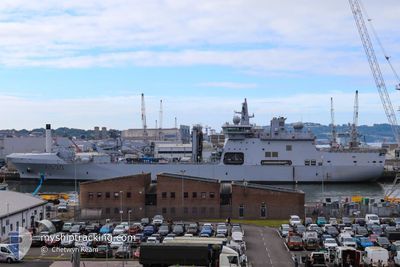
KNM MAUD
Not available
Current Trip
| Time Travelled | 7 days |
|---|---|
| Remaining Time | 20 mins |
| Distance Travelled | 1040.67 nm |
| Remaining Distance | 8.94 nm |
| AVG Speed | 10.8 Knop |
| MAX Speed | 17.5 Knop |
| AVG Wind | 10.4 knots |
| MAX Wind | 30.1 knots |
| MIN Temp | 2.5°C / 36.5°F |
| MAX Temp | 15°C / 59°F |
| Djupgående | 9 m |
| Position mottagen | Nu |
Current Position
| Longitud | 5.56023° |
|---|---|
| Latitude | 59.78646° |
| Status | Under way using engine |
| Fart | 9.7 Knop |
| Kurs | 353.6° |
| Område | North Sea |
| Station | T-AIS |
| Position mottagen | Nu |
Info
Information
The current position of KNM MAUD is in North Sea with coordinates 59.78646° / 5.56023° as reported on 2024-05-01 03:28 by AIS to our vessel tracker app. The vessel's current speed is 9.7 Knop and is heading at the port of HOYLANDSBYGDA. The estimated time of arrival as calculated by MyShipTracking vessel tracking app is 2024-05-01 03:49 LT
The vessel KNM MAUD (IMO: 9703916, MMSI: 257092200) is a Not available It's sailing under the flag of [NO] Norway.
In this page you can find informations about the vessels current position, last detected port calls, and current voyage information. If the vessels is not in coverage by AIS you will find the latest position.
The current position of KNM MAUD is detected by our AIS receivers and we are not responsible for the reliability of the data. The last position was recorded while the vessel was in Coverage by the Ais receivers of our vessel tracking app.
The current draught of KNM MAUD as reported by AIS is 9 meters
Weather
| Temperature | 9.3°C / 48.74°F |
|---|---|
| Wind Speed | 10 knots |
| Direction | 69° ENE |
| Pressure | 1020.6 hPa |
| Humidity | 80.2 % |
| Cloud Coverage | 100 % |
Featured Company
Last Port Calls
| Port | Arrival | Departure | Time In Port |
|---|---|---|---|
| 2024-04-22 05:02 | 2024-04-23 05:28 | 1 d | |
| 2024-04-19 17:47 | 2024-04-19 17:49 | 1 m |
Last Trips
| Origin | Departure | Destination | Arrival | Distance | |
|---|---|---|---|---|---|
| 2024-04-19 19:49 | 2024-04-22 07:02 | 514.25 nm | |||
| 2024-02-03 09:48 | 2024-04-19 19:47 | 3327.88 nm |
Events
| Tid | Event | Detaljer | Position / Dest | Information |
|---|---|---|---|---|
| 2024-04-30 16:26 | STARTAR förflyttning | 5.99 nm, South East of OSOYRO |
60.13065 / 5.64179
N/A
|
Fart: 6 kn Kurs: 176.5° |
| 2024-04-30 16:18 | STOPPAR förflyttning | 5.86 nm, South East of OSOYRO |
60.13277 / 5.63938
N/A
|
Fart: Kurs: 115° |
| 2024-04-30 06:45 | Byter havsområde | Norwegian part of the North Sea Norwegian part of the Norwegian Sea |
60.99584 / 4.77123
North Sea
|
Fart: 13.1 kn Kurs: 221.1° |
| 2024-04-29 11:18 | Byter havsområde | Norwegian part of the Norwegian Sea Norwegian part of the North Sea |
61.00217 / 4.46669
Norwegian Sea
|
Fart: 14.7 kn Kurs: 356.9° |
| 2024-04-29 11:04 | Status ändrad | Under way using engine Default |
60.95469 / 4.50205
N/A
|
Fart: 13.5 kn Kurs: 307° |
| 2024-04-29 11:00 | Status ändrad | Default Under way using engine |
60.94562 / 4.52660
N/A
|
Fart: 13.9 kn Kurs: 308.8° |
| 2024-04-29 09:36 | Status ändrad | Under way using engine Default |
60.62658 / 4.88750
N/A
|
Fart: 17.1 kn Kurs: 343° |
| 2024-04-29 09:33 | Status ändrad | Default Under way using engine |
60.61391 / 4.89534
N/A
|
Fart: 17.2 kn Kurs: 342.2° |
| 2024-04-29 08:57 | Status ändrad | Under way using engine Default |
60.45939 / 5.01104
N/A
|
Fart: 13 kn Kurs: 327° |
| 2024-04-29 08:48 | Status ändrad | Default Under way using engine |
60.43386 / 5.04118
N/A
|
Fart: 13.1 kn Kurs: 298.4° |