
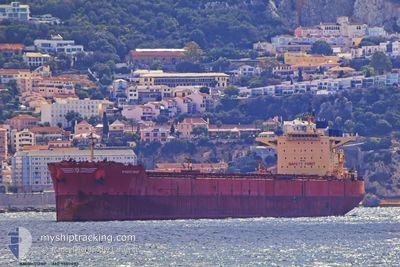
KNIGHTSHIP
Bulk Carrier
Current Trip
| Time Travelled | 31 days |
|---|---|
| Remaining Time | --- |
| Distance Travelled | 6596.62 nm |
| Remaining Distance | --- |
| AVG Speed | 11.2 Knop |
| MAX Speed | 11.2 Knop |
| AVG Wind | 12.2 knots |
| MAX Wind | 26.2 knots |
| MIN Temp | 20.5°C / 68.9°F |
| MAX Temp | 29.1°C / 84.38°F |
| Djupgående | 9.8 m |
| Position mottagen | 1 h, 5 m sen |
Current Position
| Longitud | 23.20477° |
|---|---|
| Latitude | 34.84285° |
| Status | Under way using engine |
| Fart | 10.8 Knop |
| Kurs | 282.8° |
| Område | Mediterranean Sea - Eastern Basin |
| Station | T-AIS |
| Position mottagen | 1 h, 5 m sen |
Info
Information
The current position of KNIGHTSHIP is in Mediterranean Sea - Eastern Basin with coordinates 34.84285° / 23.20477° as reported on 2024-09-09 07:39 by AIS to our vessel tracker app. The vessel's current speed is 10.8 Knop and is heading at the port of GIBRALTAR. The estimated time of arrival as calculated by MyShipTracking vessel tracking app is 2024-09-14 16:00 LT
The vessel KNIGHTSHIP (IMO: 9507893, MMSI: 636017746) is a Bulk Carrier that was built in 2010 ( 14 År gammal ). It's sailing under the flag of [LR] Liberia.
In this page you can find informations about the vessels current position, last detected port calls, and current voyage information. If the vessels is not in coverage by AIS you will find the latest position.
The current position of KNIGHTSHIP is detected by our AIS receivers and we are not responsible for the reliability of the data. The last position was recorded while the vessel was in Coverage by the Ais receivers of our vessel tracking app.
The current draught of KNIGHTSHIP as reported by AIS is 9.8 meters
Weather
| Temperature | 26.4°C / 79.52°F |
|---|---|
| Wind Speed | 15 knots |
| Direction | 43° NE |
| Pressure | 1011.7 hPa |
| Humidity | 60 % |
| Cloud Coverage | 100 % |
Featured Company
Last Port Calls
| Port | Arrival | Departure | Time In Port |
|---|---|---|---|
| 2024-08-07 18:02 | 2024-08-09 08:04 | 1 d | |
| 2024-07-10 15:42 | 2024-07-15 23:35 | 5 d | |
| 2024-07-02 08:22 |
Most Visited Ports (Last year)
| Port | Arrivals | |
|---|---|---|
| 2 | ||
| 2 | ||
| 1 | ||
| 1 | ||
| 1 | ||
| 1 |
Last Trips
| Origin | Departure | Destination | Arrival | Distance | |
|---|---|---|---|---|---|
| 2024-07-16 01:35 | 2024-08-07 13:02 | 5247.29 nm | |||
| 2024-07-02 08:22 | 2024-07-10 17:42 | 2520.28 nm |
Events
| Tid | Event | Detaljer | Position / Dest | Information |
|---|---|---|---|---|
| 2024-09-09 08:02 | Status ändrad | Default Under way using engine |
34.85806 / 23.12468
GI GIB
|
Fart: 10.8 kn Kurs: 282.8° |
| 2024-09-09 07:39 | UTANFÖR täckningsområde |
34.84285 / 23.20477
Mediterranean Sea - Eastern Basin
GI GIB
|
Fart: 10.8 kn Kurs: 282.8° |
|
| 2024-09-09 06:48 | Status ändrad | Under way using engine Default |
34.81098 / 23.39102
GI GIB
|
Fart: 10.7 kn Kurs: 283° |
| 2024-09-09 06:33 | I täckningsområde |
34.81098 / 23.39102
Mediterranean Sea - Eastern Basin
GI GIB
|
Fart: 10.7 kn Kurs: 281.8° |
|
| 2024-09-09 05:47 | Status ändrad | Default Under way using engine |
34.77367 / 23.60461
GI GIB
|
Fart: 10.6 kn Kurs: 281.8° |
| 2024-09-09 05:40 | Status ändrad | Under way using engine Default |
34.76941 / 23.62922
GI GIB
|
Fart: 10.5 kn Kurs: 282° |
| 2024-09-09 05:40 | UTANFÖR täckningsområde |
34.76941 / 23.62922
Mediterranean Sea - Eastern Basin
GI GIB
|
Fart: 10.6 kn Kurs: 281.8° |
|
| 2024-09-09 05:16 | Status ändrad | Default Under way using engine |
34.75518 / 23.71363
GI GIB
|
Fart: 10.7 kn Kurs: 281.8° |
| 2024-09-09 04:55 | Status ändrad | Under way using engine Default |
34.74097 / 23.79009
GI GIB
|
Fart: 10.7 kn Kurs: 285° |
| 2024-09-09 04:40 | Status ändrad | Default Under way using engine |
34.73000 / 23.84166
GI GIB
|
Fart: 10.7 kn Kurs: 283.6° |