
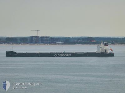
KIRA OLDENDORFF
Cargo
Current Trip
| Trip Time | 19 days |
|---|---|
| Trip Distance | 1174.76 nm |
| AVG Speed | 10.2 Knop |
| MAX Speed | 15.4 Knop |
| Djupgående | 7.5 m |
| AVG Wind | 12 knots |
| MAX Wind | 23 knots |
| MIN Temp | 18.4°C / 65.12°F |
| MAX Temp | 32.1°C / 89.78°F |
| Position mottagen | 5 h, 55 m sen |
Current Position
| Longitud | -48.50583° |
|---|---|
| Latitude | -25.50135° |
| Status | Moored |
| Fart | |
| Kurs | 260° |
| Område | South Atlantic Ocean |
| Station | T-AIS |
| Position mottagen | 5 h, 55 m sen |
Info
Information
The current position of KIRA OLDENDORFF is in South Atlantic Ocean with coordinates -25.50135° / -48.50583° as reported on 2024-04-30 11:56 by AIS to our vessel tracker app. The vessel's current speed is 0 Knop and is currently inside the port of PARANAGUA.
The vessel KIRA OLDENDORFF (IMO: 9867566, MMSI: 636019974) is a Cargo It's sailing under the flag of [LR] Liberia.
In this page you can find informations about the vessels current position, last detected port calls, and current voyage information. If the vessels is not in coverage by AIS you will find the latest position.
The current position of KIRA OLDENDORFF is detected by our AIS receivers and we are not responsible for the reliability of the data. The last position was recorded while the vessel was in Coverage by the Ais receivers of our vessel tracking app.
The current draught of KIRA OLDENDORFF as reported by AIS is 7.5 meters
Weather
| Temperature | 30.5°C / 86.9°F |
|---|---|
| Wind Speed | 4 knots |
| Direction | 106° ESE |
| Pressure | 1010.9 hPa |
| Humidity | 59.7 % |
| Cloud Coverage | 10 % |
Featured Company
Last Port Calls
Last Trips
| Origin | Departure | Destination | Arrival | Distance | |
|---|---|---|---|---|---|
| 2024-04-08 09:32 | 2024-04-27 18:31 | 1174.76 nm | |||
| 2024-04-08 07:45 | 2024-04-08 09:21 | 12.84 nm | |||
| 2024-02-20 12:17 | 2024-04-03 04:49 | 6611.08 nm | |||
| 2024-02-17 11:19 | 2024-02-17 19:45 | 108.69 nm | |||
| 2024-02-04 14:45 | 2024-02-13 18:20 | 2226.86 nm |
Events
| Tid | Event | Detaljer | Position / Dest | Information |
|---|---|---|---|---|
| 2024-04-30 11:59 | Status ändrad | Default Moored |
-25.50134 / -48.50583
[BR] PARANAGUA
|
Fart: Kurs: 260° |
| 2024-04-30 11:56 | Status ändrad | Moored Default |
-25.50135 / -48.50583
[BR] PARANAGUA
|
Fart: Kurs: 260° |
| 2024-04-30 11:56 | I täckningsområde |
-25.50135 / -48.50583
South Atlantic Ocean
[BR] PARANAGUA
|
Fart: Kurs: 323.7° |
|
| 2024-04-30 11:56 | UTANFÖR täckningsområde |
-25.50135 / -48.50583
South Atlantic Ocean
[BR] PARANAGUA
|
Fart: Kurs: 323.7° |
|
| 2024-04-27 21:53 | STOPPAR förflyttning |
-25.50134 / -48.50573
[BR] PARANAGUA
|
Fart: Kurs: 260° |
|
| 2024-04-27 21:31 | ANLÄNDER HAMN |
|
-25.49959 / -48.50498
[BR] PARANAGUA
|
Fart: 8 kn Kurs: 271° |
| 2024-04-27 20:57 | STARTAR förflyttning | 4.61 nm, East of PARANAGUA |
-25.49791 / -48.43272
BR PNG
|
Fart: 4.1 kn Kurs: 287° |
| 2024-04-26 23:38 | STOPPAR förflyttning | 4.81 nm, East of PARANAGUA |
-25.50101 / -48.42909
BR PNG
|
Fart: 0.3 kn Kurs: 298° |
| 2024-04-26 21:54 | STARTAR förflyttning | 7.2 nm, South East of ILHA DO MEL |
-25.65167 / -48.24833
BR PNG
|
Fart: 4 kn Kurs: -1° |
| 2024-04-26 21:48 | STOPPAR förflyttning | 7.37 nm, South East of ILHA DO MEL |
-25.65333 / -48.24500
BR PNG
|
Fart: Kurs: -1° |