
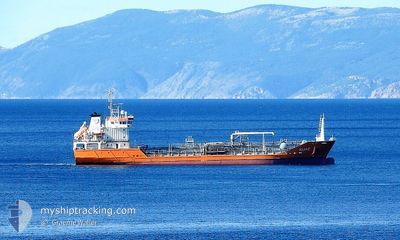
KIJAC
Oil/Chemical Tanker
Current Trip
| Time Travelled | 5 h, 38 mins |
|---|---|
| Remaining Time | --- |
| Distance Travelled | 6.84 nm |
| Remaining Distance | --- |
| AVG Speed | 9.8 Knop |
| MAX Speed | 10.5 Knop |
| AVG Wind | 1.4 knots |
| MAX Wind | 3 knots |
| MIN Temp | 18°C / 64.4°F |
| MAX Temp | 19.8°C / 67.64°F |
| Djupgående | 5.2 m |
| Position mottagen | 4 h, 48 m sen |
Current Position
| Longitud | 15.11595° |
|---|---|
| Latitude | 44.17020° |
| Status | Under way using engine |
| Fart | 10.5 Knop |
| Kurs | 313° |
| Område | Adriatic Sea |
| Station | T-AIS |
| Position mottagen | 4 h, 48 m sen |
Info
Information
The current position of KIJAC is in Adriatic Sea with coordinates 44.17020° / 15.11595° as reported on 2024-06-04 22:38 by AIS to our vessel tracker app. The vessel's current speed is 10.5 Knop and is heading at the port of BAKAR. The estimated time of arrival as calculated by MyShipTracking vessel tracking app is 2024-06-05 09:00 LT
The vessel KIJAC (IMO: 9339416, MMSI: 238255000) is a Oil/Chemical Tanker that was built in 2006 ( 18 År gammal ). It's sailing under the flag of [HR] Croatia.
In this page you can find informations about the vessels current position, last detected port calls, and current voyage information. If the vessels is not in coverage by AIS you will find the latest position.
The current position of KIJAC is detected by our AIS receivers and we are not responsible for the reliability of the data. The last position was recorded while the vessel was in Coverage by the Ais receivers of our vessel tracking app.
The current draught of KIJAC as reported by AIS is 5.2 meters
Weather
| Temperature | 20.4°C / 68.72°F |
|---|---|
| Wind Speed | 6 knots |
| Direction | 122° ESE |
| Pressure | 1015 hPa |
| Humidity | 77 % |
| Cloud Coverage | 100 % |
Featured Company
Last Port Calls
| Port | Arrival | Departure | Time In Port |
|---|---|---|---|
| 2024-06-04 09:08 | 2024-06-04 23:48 | 14 h | |
| 2024-06-03 04:17 | 2024-06-03 23:11 | 18 h | |
| 2024-06-01 22:31 | 2024-06-02 12:48 | 14 h | |
| 2024-05-31 01:20 | 2024-05-31 23:38 | 22 h | |
| 2024-05-26 05:25 | 2024-05-27 12:33 | 1 d | |
| 2024-05-24 09:44 | 2024-05-25 11:26 | 1 d | |
| 2024-05-21 22:48 | 2024-05-23 03:07 | 1 d | |
| 2024-05-20 09:15 | 2024-05-21 06:10 | 20 h | |
| 2024-05-18 18:36 | 2024-05-19 14:50 | 20 h | |
| 2024-05-16 15:45 | 2024-05-17 12:02 | 20 h |
Last Trips
| Origin | Departure | Destination | Arrival | Distance | |
|---|---|---|---|---|---|
| 2024-06-03 23:11 | 2024-06-04 09:08 | 89.86 nm | |||
| 2024-06-02 12:48 | 2024-06-03 04:17 | 153.13 nm | |||
| 2024-05-31 23:38 | 2024-06-01 22:31 | 131.55 nm | |||
| 2024-05-27 12:33 | 2024-05-31 01:20 | 447.09 nm | |||
| 2024-05-25 11:26 | 2024-05-26 05:25 | 173.67 nm | |||
| 2024-05-23 03:07 | 2024-05-24 09:44 | 183.42 nm | |||
| 2024-05-21 06:10 | 2024-05-21 22:48 | 173.38 nm | |||
| 2024-05-19 14:50 | 2024-05-20 09:15 | 174.18 nm | |||
| 2024-05-17 12:02 | 2024-05-18 18:36 | 153.51 nm | |||
| 2024-05-13 18:35 | 2024-05-16 15:45 | 132.03 nm |
Events
| Tid | Event | Detaljer | Position / Dest | Information |
|---|---|---|---|---|
| 2024-06-04 22:38 | UTANFÖR täckningsområde |
44.17020 / 15.11595
Adriatic Sea
BAKAR
|
Fart: 10.5 kn Kurs: 313° |
|
| 2024-06-04 21:48 | AVGÅTT HAMN |
|
44.08432 / 15.25407
BAKAR
|
Fart: 5.9 kn Kurs: 255° |
| 2024-06-04 21:43 | STARTAR förflyttning |
44.08697 / 15.26430
[HR] GAZENICA
|
Fart: 3.6 kn Kurs: 253° |
|
| 2024-06-04 21:28 | Destination ändrad | BAKAR ZADAR |
44.08708 / 15.26680
[HR] GAZENICA
|
Fart: Kurs: 260° |
| 2024-06-04 21:28 | ETA ändrat | 2024/06/05 07:00 2024/06/04 06:00 |
44.08708 / 15.26680
[HR] GAZENICA
|
Fart: Kurs: 260° |
| 2024-06-04 21:25 | Status ändrad | Under way using engine Moored |
44.08705 / 15.26683
[HR] GAZENICA
|
Fart: Kurs: 260° |
| 2024-06-04 14:33 | Status ändrad | Moored Default |
44.08710 / 15.26685
[HR] GAZENICA
|
Fart: Kurs: 260° |
| 2024-06-04 14:27 | I täckningsområde |
44.08710 / 15.26685
Adriatic Sea
[HR] GAZENICA
|
Fart: Kurs: 13° |
|
| 2024-06-04 13:03 | UTANFÖR täckningsområde |
44.08712 / 15.26680
Adriatic Sea
[HR] GAZENICA
|
Fart: Kurs: 230° |
|
| 2024-06-04 12:57 | I täckningsområde |
44.08708 / 15.26677
Adriatic Sea
[HR] GAZENICA
|
Fart: Kurs: 230° |