
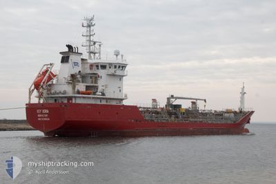
KEY BORA
Oil/Chemical Tanker
Current Trip
| Time Travelled | 1 day |
|---|---|
| Remaining Time | --- |
| Distance Travelled | 394.55 nm |
| Remaining Distance | --- |
| AVG Speed | 10.4 Knop |
| MAX Speed | 11.5 Knop |
| AVG Wind | 8.7 knots |
| MAX Wind | 11.4 knots |
| MIN Temp | 4.9°C / 40.82°F |
| MAX Temp | 7.1°C / 44.78°F |
| Djupgående | 5.2 m |
| Position mottagen | 9 h, 27 m sen |
Current Position
| Longitud | 0.91221° |
|---|---|
| Latitude | 64.01645° |
| Status | Under way using engine |
| Fart | 9.5 Knop |
| Kurs | 243.3° |
| Område | Norwegian Sea |
| Station | T-AIS |
| Position mottagen | 9 h, 27 m sen |
Info
Information
The current position of KEY BORA is in Norwegian Sea with coordinates 64.01645° / 0.91221° as reported on 2024-04-27 16:19 by AIS to our vessel tracker app. The vessel's current speed is 9.5 Knop and is heading at the port of FUGLAFJORDUR. The estimated time of arrival as calculated by MyShipTracking vessel tracking app is 2024-04-28 15:00 LT
The vessel KEY BORA (IMO: 9316024, MMSI: 236385000) is a Oil/Chemical Tanker that was built in 2006 ( 18 År gammal ). It's sailing under the flag of [GI] Gibraltar.
In this page you can find informations about the vessels current position, last detected port calls, and current voyage information. If the vessels is not in coverage by AIS you will find the latest position.
The current position of KEY BORA is detected by our AIS receivers and we are not responsible for the reliability of the data. The last position was recorded while the vessel was in Coverage by the Ais receivers of our vessel tracking app.
The current draught of KEY BORA as reported by AIS is 5.2 meters
Weather
| Temperature | 6.6°C / 43.88°F |
|---|---|
| Wind Speed | 10 knots |
| Direction | 89° E |
| Pressure | 1017.1 hPa |
| Humidity | 76.6 % |
| Cloud Coverage | 100 % |
Featured Company
Last Port Calls
| Port | Arrival | Departure | Time In Port |
|---|---|---|---|
| 2024-04-25 23:40 | 2024-04-26 09:39 | 9 h | |
| 2024-04-22 23:28 | 2024-04-23 04:16 | 4 h | |
| 2024-04-19 18:18 | 2024-04-20 11:39 | 17 h | |
| 2024-04-18 16:55 | 2024-04-19 17:19 | 1 d | |
| 2024-04-17 19:04 | 2024-04-18 03:44 | 8 h | |
| 2024-04-15 12:30 | 2024-04-16 03:23 | 14 h | |
| 2024-04-13 01:00 | 2024-04-13 15:42 | 14 h | |
| 2024-04-10 19:47 | 2024-04-11 20:12 | 1 d | |
| 2024-04-07 07:01 | 2024-04-07 13:44 | 6 h | |
| 2024-04-05 17:29 | 2024-04-06 08:53 | 15 h |
Last Trips
| Origin | Departure | Destination | Arrival | Distance | |
|---|---|---|---|---|---|
| 2024-04-23 06:16 | 2024-04-26 01:40 | 356.70 nm | |||
| 2024-04-20 13:39 | 2024-04-23 01:28 | 571.55 nm | |||
| 2024-04-19 19:19 | 2024-04-19 20:18 | 9.87 nm | |||
| 2024-04-18 05:44 | 2024-04-18 18:55 | 77.53 nm | |||
| 2024-04-16 05:23 | 2024-04-17 21:04 | 233.49 nm | |||
| 2024-04-13 16:42 | 2024-04-15 14:30 | 426.32 nm | |||
| 2024-04-11 20:12 | 2024-04-13 02:00 | 250.01 nm | |||
| 2024-04-07 15:44 | 2024-04-10 19:47 | 722.64 nm | |||
| 2024-04-06 10:53 | 2024-04-07 09:01 | 224.92 nm | |||
| 2024-04-05 19:14 | 2024-04-05 19:29 | 0.24 nm |
Events
| Tid | Event | Detaljer | Position / Dest | Information |
|---|---|---|---|---|
| 2024-04-27 16:49 | Status ändrad | Default Under way using engine |
63.98044 / .74906
FO FUG
|
Fart: 9.5 kn Kurs: 243.3° |
| 2024-04-27 16:19 | UTANFÖR täckningsområde |
64.01645 / .91221
Norwegian Sea
FO FUG
|
Fart: 9.5 kn Kurs: 243.3° |
|
| 2024-04-27 15:27 | Status ändrad | Under way using engine Default |
64.07991 / 1.19016
FO FUG
|
Fart: 9.5 kn Kurs: 239° |
| 2024-04-27 15:04 | Status ändrad | Default Under way using engine |
64.11047 / 1.31023
FO FUG
|
Fart: 9.3 kn Kurs: 239.5° |
| 2024-04-27 13:18 | Status ändrad | Under way using engine Default |
64.26000 / 1.87870
FO FUG
|
Fart: 10.1 kn Kurs: 238° |
| 2024-04-27 13:16 | Status ändrad | Default Under way using engine |
64.26412 / 1.89422
FO FUG
|
Fart: 10.2 kn Kurs: 241.1° |
| 2024-04-27 12:47 | Status ändrad | Under way using engine Default |
64.30335 / 2.05714
FO FUG
|
Fart: 10.2 kn Kurs: 241° |
| 2024-04-27 12:32 | Status ändrad | Default Under way using engine |
64.32371 / 2.14234
FO FUG
|
Fart: 10.2 kn Kurs: 241.6° |
| 2024-04-27 12:11 | Status ändrad | Under way using engine Default |
64.35307 / 2.26714
FO FUG
|
Fart: 10.1 kn Kurs: 243° |
| 2024-04-27 12:11 | I täckningsområde |
64.35307 / 2.26714
Norwegian Sea
FO FUG
|
Fart: 10.1 kn Kurs: 241.8° |