
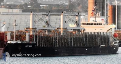
KEN BOS
Cargo
Current Trip
| Trip Time | 2 days |
|---|---|
| Trip Distance | 791.03 nm |
| AVG Speed | 12.9 Knop |
| MAX Speed | 16.2 Knop |
| Djupgående | 8.1 m |
| AVG Wind | 7.7 knots |
| MAX Wind | 14 knots |
| MIN Temp | 26.9°C / 80.42°F |
| MAX Temp | 30.4°C / 86.72°F |
| Position mottagen | 2 d sen |
Current Position
| Longitud | 104.42594° |
|---|---|
| Latitude | 1.36908° |
| Status | Under way using engine |
| Fart | 11.8 Knop |
| Kurs | 51.9° |
| Område | South China Sea |
| Station | T-AIS |
| Position mottagen | 2 d sen |
Info
Information
The current position of KEN BOS is in South China Sea with coordinates 1.36908° / 104.42594° as reported on 2024-05-14 01:01 by AIS to our vessel tracker app. The vessel's current speed is 11.8 Knop and is currently inside the port of JAKARTA.
The vessel KEN BOS (IMO: 9846146, MMSI: 352003248) is a Cargo It's sailing under the flag of [PA] Panama.
In this page you can find informations about the vessels current position, last detected port calls, and current voyage information. If the vessels is not in coverage by AIS you will find the latest position.
The current position of KEN BOS is detected by our AIS receivers and we are not responsible for the reliability of the data. The last position was recorded while the vessel was in Coverage by the Ais receivers of our vessel tracking app.
The current draught of KEN BOS as reported by AIS is 8.1 meters
Weather
| Temperature | 29.3°C / 84.74°F |
|---|---|
| Wind Speed | 11 knots |
| Direction | 74° ENE |
| Pressure | 1009.2 hPa |
| Humidity | 75.4 % |
| Cloud Coverage | 93 % |
Featured Company
Last Port Calls
| Port | Arrival | Departure | Time In Port |
|---|---|---|---|
| 2024-05-15 20:27 | |||
| 2024-05-12 04:24 | 2024-05-13 06:40 | 1 d | |
| 2024-05-08 01:42 | 2024-05-09 09:32 | 1 d | |
| 2024-04-28 06:12 | 2024-05-01 00:00 | 2 d | |
| 2024-04-24 09:57 | 2024-04-27 15:48 | 3 d | |
| 2024-04-13 04:42 | 2024-04-20 15:32 | 7 d | |
| 2024-03-21 01:28 | 2024-03-22 22:16 | 1 d | |
| 2024-03-12 21:19 |
Last Trips
| Origin | Departure | Destination | Arrival | Distance | |
|---|---|---|---|---|---|
| 2024-05-13 14:40 | 2024-05-16 03:27 | 791.03 nm | |||
| 2024-05-09 16:32 | 2024-05-12 12:24 | 821.89 nm | |||
| 2024-05-01 09:00 | 2024-05-08 08:42 | 2075.38 nm | |||
| 2024-04-28 00:48 | 2024-04-28 15:12 | 184.98 nm | |||
| 2024-04-20 23:32 | 2024-04-24 18:57 | 577.17 nm | |||
| 2024-03-23 11:16 | 2024-04-13 12:42 | 5499.85 nm | |||
| 2024-03-13 10:19 | 2024-03-21 14:28 | 364.63 nm |
Events
| Tid | Event | Detaljer | Position / Dest | Information |
|---|---|---|---|---|
| 2024-05-15 20:35 | STOPPAR förflyttning |
-6.09527 / 106.88862
[ID] JAKARTA
|
Fart: 0.2 kn Kurs: 32° |
|
| 2024-05-15 20:27 | ANLÄNDER HAMN |
|
-6.09112 / 106.88383
[ID] JAKARTA
|
Fart: 6 kn Kurs: 179° |
| 2024-05-14 01:09 | Status ändrad | Default Under way using engine |
1.38579 / 104.44677
IDJKT
|
Fart: 11.8 kn Kurs: 51.9° |
| 2024-05-14 01:01 | Byter havsområde | Malaysian part of the South China Sea Malaysian part of the Singapore Strait |
1.36908 / 104.42594
South China Sea
IDJKT
|
Fart: 11.8 kn Kurs: 51.9° |
| 2024-05-14 01:01 | Status ändrad | Under way using engine Default |
1.36908 / 104.42594
IDJKT
|
Fart: 11.6 kn Kurs: 51° |
| 2024-05-14 01:01 | UTANFÖR täckningsområde |
1.36908 / 104.42594
South China Sea
IDJKT
|
Fart: 11.8 kn Kurs: 51.9° |
|
| 2024-05-14 00:32 | Status ändrad | Default Under way using engine |
1.30809 / 104.35851
IDJKT
|
Fart: 11.7 kn Kurs: 46.9° |
| 2024-05-14 00:17 | Status ändrad | Under way using engine Default |
1.27929 / 104.31856
IDJKT
|
Fart: 13.5 kn Kurs: 73° |
| 2024-05-14 00:15 | Status ändrad | Default Under way using engine |
1.27675 / 104.30954
IDJKT
|
Fart: 13.5 kn Kurs: 73.4° |
| 2024-05-13 23:55 | Byter havsområde | Malaysian part of the Singapore Strait Indonesian part of the Singapore Strait |
1.25693 / 104.23901
Singapore Strait
IDJKT
|
Fart: 13.9 kn Kurs: 76.1° |