
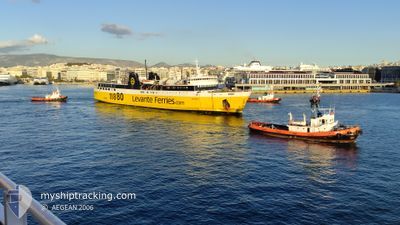
KEFALONIA
Ro-Ro/Passenger Ship
Current Trip
| Trip Time | 1 h, 15 mins |
|---|---|
| Trip Distance | 22.40 nm |
| AVG Speed | 17.1 Knop |
| MAX Speed | 18.7 Knop |
| Djupgående | 5.2 m |
| AVG Wind | 9 knots |
| MAX Wind | 14 knots |
| MIN Temp | 16.5°C / 61.7°F |
| MAX Temp | 18.5°C / 65.3°F |
| Position mottagen | 1 m sen |
Current Position
| Longitud | --- |
|---|---|
| Latitude | --- |
| Status | Under way using engine |
| Fart | |
| Kurs | 313° |
| Område | Ionian Sea |
| Station | T-AIS |
| Position mottagen | 1 m sen |
Info
Information
The current position of KEFALONIA is in Ionian Sea with coordinates 38.14902° / 20.78254° as reported on 2024-11-30 03:18 by AIS to our vessel tracker app. The vessel's current speed is 0 Knop and is currently inside the port of POROS KEFALONIA.
The vessel KEFALONIA (IMO: 7426045, MMSI: 239386000) is a Ro-Ro/Passenger Ship that was built in 1975 ( 49 År gammal ). It's sailing under the flag of [GR] Greece.
In this page you can find informations about the vessels current position, last detected port calls, and current voyage information. If the vessels is not in coverage by AIS you will find the latest position.
The current position of KEFALONIA is detected by our AIS receivers and we are not responsible for the reliability of the data. The last position was recorded while the vessel was in Coverage by the Ais receivers of our vessel tracking app.
The current draught of KEFALONIA as reported by AIS is 5.2 meters
Weather
| Temperature | 16.1°C / 60.98°F |
|---|---|
| Wind Speed | 7 knots |
| Direction | 315° NW |
| Pressure | 1015.3 hPa |
| Humidity | 77.4 % |
| Cloud Coverage | 100 % |
Featured Company
Last Port Calls
| Port | Arrival | Departure | Time In Port |
|---|---|---|---|
| 2024-11-29 22:35 | |||
| 2024-11-29 20:12 | 2024-11-29 21:20 | 1 h | |
| 2024-11-29 18:01 | 2024-11-29 18:59 | 58 m | |
| 2024-11-29 15:36 | 2024-11-29 16:45 | 1 h | |
| 2024-11-29 09:34 | 2024-11-29 14:22 | 4 h | |
| 2024-11-29 07:10 | 2024-11-29 08:20 | 1 h | |
| 2024-11-29 01:59 | 2024-11-29 05:56 | 3 h | |
| 2024-11-28 20:05 | 2024-11-28 21:09 | 1 h | |
| 2024-11-28 18:03 | 2024-11-28 18:50 | 47 m | |
| 2024-11-28 15:49 | 2024-11-28 16:45 | 56 m |
Last Trips
| Origin | Departure | Destination | Arrival | Distance | |
|---|---|---|---|---|---|
| 2024-11-29 21:20 | 2024-11-29 22:35 | 22.40 nm | |||
| 2024-11-29 18:59 | 2024-11-29 20:12 | 23.08 nm | |||
| 2024-11-29 16:45 | 2024-11-29 18:01 | 22.37 nm | |||
| 2024-11-29 14:22 | 2024-11-29 15:36 | 22.72 nm | |||
| 2024-11-29 08:20 | 2024-11-29 09:34 | 22.33 nm | |||
| 2024-11-29 05:56 | 2024-11-29 07:10 | 22.44 nm | |||
| 2024-11-28 21:09 | 2024-11-29 01:59 | 22.32 nm | |||
| 2024-11-28 18:50 | 2024-11-28 20:05 | 23.07 nm | |||
| 2024-11-28 16:45 | 2024-11-28 18:03 | 22.53 nm | |||
| 2024-11-28 14:34 | 2024-11-28 15:49 | 22.82 nm |
Events
| Tid | Event | Detaljer | Position / Dest | Information |
|---|---|---|---|---|
| 2024-11-29 20:43 | STOPPAR förflyttning |
38.14899 / 20.78251
[GR] POROS KEFALONIA
|
Fart: 0.1 kn Kurs: 306° |
|
| 2024-11-29 20:35 | ANLÄNDER HAMN |
|
38.15086 / 20.78308
[GR] POROS KEFALONIA
|
Fart: 9.5 kn Kurs: 251.7° |
| 2024-11-29 19:20 | AVGÅTT HAMN |
|
37.94157 / 21.15771
KYLL-GRPKE
|
Fart: 12.8 kn Kurs: 359° |
| 2024-11-29 19:17 | STARTAR förflyttning |
37.93528 / 21.15112
[GR] KYLLINI
|
Fart: 7.8 kn Kurs: 106° |
|
| 2024-11-29 18:22 | STOPPAR förflyttning |
37.93656 / 21.14873
[GR] KYLLINI
|
Fart: 0.2 kn Kurs: 130° |
|
| 2024-11-29 18:12 | ANLÄNDER HAMN |
|
37.93622 / 21.15622
[GR] KYLLINI
|
Fart: 10.2 kn Kurs: 228.9° |
| 2024-11-29 16:59 | AVGÅTT HAMN |
|
38.15312 / 20.78223
KYLL-GRPKE
|
Fart: 7.7 kn Kurs: 2° |
| 2024-11-29 16:58 | STARTAR förflyttning |
38.15116 / 20.78119
[GR] POROS KEFALONIA
|
Fart: 7.7 kn Kurs: 2° |
|
| 2024-11-29 16:09 | STOPPAR förflyttning |
38.14898 / 20.78249
[GR] POROS KEFALONIA
|
Fart: 0.2 kn Kurs: 304° |
|
| 2024-11-29 16:01 | ANLÄNDER HAMN |
|
38.15126 / 20.78279
[GR] POROS KEFALONIA
|
Fart: 7.8 kn Kurs: 242° |