

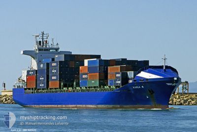
KARLA A
Container Ship

Current Trip
| Time Travelled | 1 day |
|---|---|
| Remaining Time | 22 h, 16 mins |
| Distance Travelled | 293.93 nm |
| Remaining Distance | 430.46 nm |
| AVG Speed | 11.9 Knop |
| MAX Speed | 14.6 Knop |
| AVG Wind | 4.5 knots |
| MAX Wind | 11 knots |
| MIN Temp | 9.8°C / 49.64°F |
| MAX Temp | 18°C / 64.4°F |
| Djupgående | 8 m |
| Position mottagen | 16 h, 50 m sen |
Current Position
| Longitud | --- |
|---|---|
| Latitude | --- |
| Status | Under way using engine |
| Fart | 13.8 Knop |
| Kurs | 80° |
| Område | Black Sea |
| Station | T-AIS |
| Position mottagen | 16 h, 50 m sen |
Information
The current position of KARLA A is in Black Sea with coordinates 41.36257° / 29.81049° as reported on 2025-03-26 20:24 by AIS to our vessel tracker app. The vessel's current speed is 13.8 Knop and is heading at the port of POTI. The estimated time of arrival as calculated by MyShipTracking vessel tracking app is 2025-03-28 15:31 LT
The vessel KARLA A (IMO: 9297577, MMSI: 271000744) is a Container Ship that was built in 2004 ( 21 År gammal ). It's sailing under the flag of [TR] Turkey.
In this page you can find informations about the vessels current position, last detected port calls, and current voyage information. If the vessels is not in coverage by AIS you will find the latest position.
The current position of KARLA A is detected by our AIS receivers and we are not responsible for the reliability of the data. The last position was recorded while the vessel was in Coverage by the Ais receivers of our vessel tracking app.
The current draught of KARLA A as reported by AIS is 8 meters
Weather
| Temperature | 10.3°C / 50.54°F |
|---|---|
| Wind Speed | 7 knots |
| Direction | 80° E |
| Pressure | 1013.3 hPa |
| Humidity | 85.1 % |
| Cloud Coverage | 100 % |


Featured Company
Last Port Calls
| Port | Arrival | Departure | Time In Port |
|---|---|---|---|
| 2025-03-25 03:54 | 2025-03-26 14:27 | 1 d | |
| 2025-03-20 22:06 | 2025-03-22 21:13 | 1 d | |
| 2025-03-15 05:59 | 2025-03-16 20:49 | 1 d | |
| 2025-03-11 12:57 | 2025-03-12 17:41 | 1 d | |
| 2025-03-06 00:21 | 2025-03-06 20:42 | 20 h | |
| 2025-03-04 17:06 | 2025-03-06 00:04 | 1 d | |
| 2025-02-28 18:02 | 2025-03-01 21:25 | 1 d | |
| 2025-02-25 03:07 | 2025-02-25 16:22 | 13 h | |
| 2025-02-23 06:47 | 2025-02-23 21:00 | 14 h | |
| 2025-02-19 10:01 | 2025-02-20 19:05 | 1 d |
Last Trips
| Origin | Departure | Destination | Arrival | Distance | |
|---|---|---|---|---|---|
| 2025-03-22 21:13 | 2025-03-25 03:54 | 626.62 nm | |||
| 2025-03-16 20:49 | 2025-03-20 22:06 | 697.30 nm | |||
| 2025-03-12 17:41 | 2025-03-15 05:59 | 648.13 nm | |||
| 2025-03-06 20:42 | 2025-03-11 12:57 | 621.24 nm | |||
| 2025-03-06 00:04 | 2025-03-06 00:21 | 0.67 nm | |||
| 2025-03-01 21:25 | 2025-03-04 17:06 | 623.09 nm | |||
| 2025-02-25 16:22 | 2025-02-28 18:02 | 632.76 nm | |||
| 2025-02-23 21:00 | 2025-02-25 03:07 | 21.03 nm | |||
| 2025-02-20 19:05 | 2025-02-23 06:47 | 643.31 nm | |||
| 2025-02-14 05:12 | 2025-02-19 10:01 | 651.81 nm |
Events
| Tid | Event | Detaljer | Position / Dest | Information |
|---|---|---|---|---|
| 2025-03-27 08:17 | STARTAR förflyttning | 10.71 nm, North of CIDE |
42.07792 / 32.97087
GEPTI
|
Fart: 3.5 kn Kurs: 28° |
| 2025-03-27 07:31 | STOPPAR förflyttning | 10.29 nm, North of CIDE |
42.07086 / 32.96978
GEPTI
|
Fart: 0.3 kn Kurs: 335° |
| 2025-03-26 20:26 | Status ändrad | Default Under way using engine |
41.36401 / 29.82142
GEPTI
|
Fart: 13.8 kn Kurs: 80° |
| 2025-03-26 20:24 | UTANFÖR täckningsområde |
41.36257 / 29.81049
Black Sea
GEPTI
|
Fart: 13.8 kn Kurs: 80° |
|
| 2025-03-26 18:07 | Byter havsområde | Turkish part of the Black Sea Turkish part of the Sea of Marmara |
41.22984 / 29.14445
Black Sea
GEPTI
|
Fart: 13.5 kn Kurs: 30.6° |
| 2025-03-26 15:46 | Status ändrad | Under way using engine Under way sailing |
40.87667 / 28.87570
GEPTI
|
Fart: 12.1 kn Kurs: 54.9° |
| 2025-03-26 14:49 | STARTAR förflyttning | 13.11 nm, South of AMBARLI |
40.74216 / 28.70221
GEPTI
|
Fart: 3.6 kn Kurs: 345° |
| 2025-03-26 13:56 | Status ändrad | Under way sailing Under way using engine |
40.75735 / 28.70686
GEPTI
|
Fart: 1 kn Kurs: 51° |
| 2025-03-26 12:38 | STOPPAR förflyttning | 11.46 nm, South of AMBARLI |
40.77147 / 28.71841
GEPTI
|
Fart: 0.2 kn Kurs: 23° |
| 2025-03-26 11:27 | AVGÅTT HAMN |
|
40.95488 / 28.67551
GEPTI
|
Fart: 5.5 kn Kurs: 211° |