

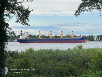
K BEREKET
Bulk Carrier

Current Trip
| Trip Time | 16 days |
|---|---|
| Trip Distance | 4161.16 nm |
| AVG Speed | 11 Knop |
| MAX Speed | 14.5 Knop |
| Djupgående | 9.3 m |
| AVG Wind | 16 knots |
| MAX Wind | 29.8 knots |
| MIN Temp | 3.5°C / 38.3°F |
| MAX Temp | 17.7°C / 63.86°F |
| Position mottagen | 2 m sen |
Current Position
| Longitud | --- |
|---|---|
| Latitude | --- |
| Status | Moored |
| Fart | |
| Kurs | 166° |
| Område | Baltic Sea |
| Station | T-AIS |
| Position mottagen | 2 m sen |
Information
The current position of K BEREKET is in Baltic Sea with coordinates 54.37138° / 18.66488° as reported on 2025-03-27 00:02 by AIS to our vessel tracker app. The vessel's current speed is 0 Knop and is currently inside the port of GDANSK.
The vessel K BEREKET (IMO: 9370408, MMSI: 636024066) is a Bulk Carrier that was built in 2008 ( 17 År gammal ). It's sailing under the flag of [LR] Liberia.
In this page you can find informations about the vessels current position, last detected port calls, and current voyage information. If the vessels is not in coverage by AIS you will find the latest position.
The current position of K BEREKET is detected by our AIS receivers and we are not responsible for the reliability of the data. The last position was recorded while the vessel was in Coverage by the Ais receivers of our vessel tracking app.
The current draught of K BEREKET as reported by AIS is 9.3 meters
Weather
| Temperature | 6.1°C / 42.98°F |
|---|---|
| Wind Speed | 5 knots |
| Direction | 332° NNW |
| Pressure | 1018.5 hPa |
| Humidity | 88.9 % |
| Cloud Coverage | 95 % |


Featured Company
Last Port Calls
| Port | Arrival | Departure | Time In Port |
|---|---|---|---|
| 2025-03-25 04:39 | |||
| 2025-03-09 02:46 |
Most Visited Ports (Last year)
| Port | Arrivals | |
|---|---|---|
| 3 | ||
| 2 | ||
| 1 | ||
| 1 | ||
| 1 | ||
| 1 |
Last Trips
| Origin | Departure | Destination | Arrival | Distance | |
|---|---|---|---|---|---|
| 2025-03-09 02:46 | 2025-03-25 04:39 | 4161.16 nm |
Events
| Tid | Event | Detaljer | Position / Dest | Information |
|---|---|---|---|---|
| 2025-03-25 04:56 | Status ändrad | Moored Under way using engine |
54.37128 / 18.66492
[PL] GDANSK
|
Fart: Kurs: 166° |
| 2025-03-25 04:32 | STOPPAR förflyttning |
54.37132 / 18.66480
[PL] GDANSK
|
Fart: 0.3 kn Kurs: 172° |
|
| 2025-03-25 03:39 | ANLÄNDER HAMN |
|
54.41543 / 18.65770
[PL] GDANSK
|
Fart: 5.3 kn Kurs: 155° |
| 2025-03-25 03:15 | STARTAR förflyttning | 4.57 nm, North of GDANSK |
54.45683 / 18.67112
PLGDN
|
Fart: 3.1 kn Kurs: 188° |
| 2025-03-25 03:00 | Status ändrad | Under way using engine At anchor |
54.45955 / 18.67167
PLGDN
|
Fart: Kurs: 188° |
| 2025-03-24 07:53 | Status ändrad | At anchor Under way using engine |
54.45780 / 18.67380
PLGDN
|
Fart: 0.1 kn Kurs: 279° |
| 2025-03-24 07:37 | STOPPAR förflyttning | 4.67 nm, North of GDANSK |
54.45853 / 18.67287
PLGDN
|
Fart: 0.3 kn Kurs: 250° |
| 2025-03-24 00:08 | I täckningsområde |
54.87158 / 17.58143
Baltic Sea
PLGDN
|
Fart: 11.3 kn Kurs: 84° |
|
| 2025-03-23 20:39 | UTANFÖR täckningsområde |
54.76728 / 16.45675
Baltic Sea
PLGDN
|
Fart: 11.7 kn Kurs: 80° |
|
| 2025-03-23 15:32 | Upptäckt i hav | Polish part of the Baltic Sea |
54.62703 / 14.85228
Baltic Sea
PLGDN
|
Fart: 10.6 kn Kurs: 82° |