
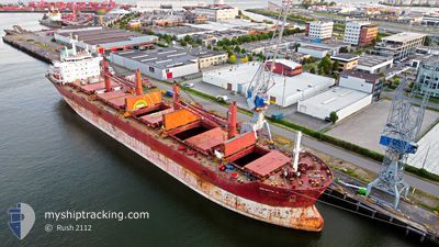
JULIETTA D
Bulk Carrier
Current Trip
| Time Travelled | 9 days |
|---|---|
| Remaining Time | 4 days |
| Distance Travelled | 174.84 nm |
| Remaining Distance | 1426.41 nm |
| AVG Speed | 11.2 Knop |
| MAX Speed | 14.3 Knop |
| AVG Wind | 5.8 knots |
| MAX Wind | 17 knots |
| MIN Temp | 10°C / 50°F |
| MAX Temp | 29.9°C / 85.82°F |
| Djupgående | 11.3 m |
| Position mottagen | 3 h, 6 m sen |
Current Position
| Longitud | -89.97093° |
|---|---|
| Latitude | 29.68982° |
| Status | Under way using engine |
| Fart | 13 Knop |
| Kurs | 152.7° |
| Område | Gulf of Mexico |
| Station | T-AIS |
| Position mottagen | 3 h, 6 m sen |
Info
Information
The current position of JULIETTA D is in Gulf of Mexico with coordinates 29.68982° / -89.97093° as reported on 2024-04-30 10:36 by AIS to our vessel tracker app. The vessel's current speed is 13 Knop and is heading at the port of SANTA MARTA. The estimated time of arrival as calculated by MyShipTracking vessel tracking app is 2024-05-04 21:33 LT
The vessel JULIETTA D (IMO: 9590618, MMSI: 215536000) is a Bulk Carrier that was built in 2013 ( 11 År gammal ). It's sailing under the flag of [MT] Malta.
In this page you can find informations about the vessels current position, last detected port calls, and current voyage information. If the vessels is not in coverage by AIS you will find the latest position.
The current position of JULIETTA D is detected by our AIS receivers and we are not responsible for the reliability of the data. The last position was recorded while the vessel was in Coverage by the Ais receivers of our vessel tracking app.
The current draught of JULIETTA D as reported by AIS is 11.3 meters
Weather
| Temperature | 23.1°C / 73.58°F |
|---|---|
| Wind Speed | 5 knots |
| Direction | 194° SSW |
| Pressure | 1015.2 hPa |
| Humidity | 83.7 % |
| Cloud Coverage | --- |
Featured Company
Last Port Calls
| Port | Arrival | Departure | Time In Port |
|---|---|---|---|
| 2024-04-18 06:16 | 2024-04-21 12:50 | 3 d | |
| 2024-03-24 06:45 | 2024-03-30 03:28 | 5 d | |
| 2024-03-14 18:21 | 2024-03-19 13:40 | 4 d | |
| 2024-03-12 16:40 | |||
| 2024-02-27 18:29 | 2024-02-29 04:39 | 1 d |
Most Visited Ports (Last year)
| Port | Arrivals | |
|---|---|---|
| 2 | ||
| 1 | ||
| 1 | ||
| 1 | ||
| 1 | ||
| 1 |
Last Trips
| Origin | Departure | Destination | Arrival | Distance | |
|---|---|---|---|---|---|
| 2024-03-30 00:28 | 2024-04-18 01:16 | 5296.87 nm | |||
| 2024-03-19 10:40 | 2024-03-24 03:45 | 1279.92 nm | |||
| 2024-03-12 13:40 | 2024-03-14 15:21 | 95.79 nm | |||
| 2024-01-24 10:04 | 2024-02-27 15:29 | 3637.29 nm |
Events
| Tid | Event | Detaljer | Position / Dest | Information |
|---|---|---|---|---|
| 2024-04-30 10:42 | Status ändrad | Default Under way using engine |
29.66861 / -89.96014
CO SMR
|
Fart: 13 kn Kurs: 152.7° |
| 2024-04-30 10:36 | UTANFÖR täckningsområde |
29.68982 / -89.97093
Gulf of Mexico
CO SMR
|
Fart: 13 kn Kurs: 152.7° |
|
| 2024-04-30 10:35 | Status ändrad | Under way using engine Default |
29.69051 / -89.97138
CO SMR
|
Fart: 12.9 kn Kurs: 156° |
| 2024-04-30 10:19 | Status ändrad | Default Under way using engine |
29.73978 / -90.00697
CO SMR
|
Fart: 11.2 kn Kurs: 156.1° |
| 2024-04-30 07:29 | Status ändrad | Under way using engine Default |
29.95520 / -90.15363
CO SMR
|
Fart: 10 kn Kurs: 46° |
| 2024-04-30 07:26 | Status ändrad | Default Under way using engine |
29.94770 / -90.16156
CO SMR
|
Fart: 9.9 kn Kurs: 61.7° |
| 2024-04-30 07:14 | Status ändrad | Under way using engine Default |
29.92710 / -90.18839
CO SMR
|
Fart: 10.5 kn Kurs: 84° |
| 2024-04-30 07:10 | Status ändrad | Default Under way using engine |
29.92236 / -90.20046
CO SMR
|
Fart: 12.9 kn Kurs: 157.7° |
| 2024-04-30 07:05 | Djupgående ändrat | 11.3 6.2 |
29.93248 / -90.21765
CO SMR
|
Fart: 13.2 kn Kurs: 168.9° |
| 2024-04-30 07:05 | Destination ändrad | CO SMR US MSY |
29.93248 / -90.21765
CO SMR
|
Fart: 13.2 kn Kurs: 168.9° |