
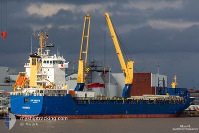
JSP VENTO
General Cargo
Current Trip
| Time Travelled | 20 h, 14 mins |
|---|---|
| Remaining Time | 13 days |
| Distance Travelled | 46.32 nm |
| Remaining Distance | 1695.33 nm |
| AVG Speed | 5.4 Knop |
| MAX Speed | 7.5 Knop |
| AVG Wind | 5.3 knots |
| MAX Wind | 8 knots |
| MIN Temp | 12.7°C / 54.86°F |
| MAX Temp | 17.9°C / 64.22°F |
| Djupgående | 6.3 m |
| Position mottagen | 11 h, 13 m sen |
Current Position
| Longitud | --- |
|---|---|
| Latitude | --- |
| Status | Under way using engine |
| Fart | 4.7 Knop |
| Kurs | 43° |
| Område | North Atlantic Ocean |
| Station | T-AIS |
| Position mottagen | 11 h, 13 m sen |
Info
Information
The current position of JSP VENTO is in North Atlantic Ocean with coordinates 28.70125° / -14.79080° as reported on 2025-03-02 07:43 by AIS to our vessel tracker app. The vessel's current speed is 4.7 Knop and is heading at the port of TERNEUZEN. The estimated time of arrival as calculated by MyShipTracking vessel tracking app is 2025-03-16 06:26 LT
The vessel JSP VENTO (IMO: 9570656, MMSI: 255806134) is a General Cargo that was built in 2011 ( 14 År gammal ). It's sailing under the flag of [PT] Portugal.
In this page you can find informations about the vessels current position, last detected port calls, and current voyage information. If the vessels is not in coverage by AIS you will find the latest position.
The current position of JSP VENTO is detected by our AIS receivers and we are not responsible for the reliability of the data. The last position was recorded while the vessel was in Coverage by the Ais receivers of our vessel tracking app.
The current draught of JSP VENTO as reported by AIS is 6.3 meters
Weather
| Temperature | 17.2°C / 62.96°F |
|---|---|
| Wind Speed | 2 knots |
| Direction | 222° SW |
| Pressure | 1012.6 hPa |
| Humidity | 68.9 % |
| Cloud Coverage | 100 % |
Featured Company
Last Port Calls
| Port | Arrival | Departure | Time In Port |
|---|---|---|---|
| 2025-03-01 13:55 | 2025-03-01 22:43 | 8 h | |
| 2025-02-14 19:05 | 2025-02-16 06:53 | 1 d | |
| 2025-01-15 08:16 | 2025-01-18 15:51 | 3 d | |
| 2025-01-06 07:47 | 2025-01-10 16:55 | 4 d |
Most Visited Ports (Last year)
| Port | Arrivals | |
|---|---|---|
| 2 | ||
| 2 | ||
| 1 | ||
| 1 | ||
| 1 | ||
| 1 |
Last Trips
| Origin | Departure | Destination | Arrival | Distance | |
|---|---|---|---|---|---|
| 2025-02-16 07:53 | 2025-03-01 13:55 | 2952.03 nm | |||
| 2025-01-18 17:51 | 2025-02-14 20:05 | 2065.18 nm | |||
| 2025-01-10 17:55 | 2025-01-15 10:16 | 936.93 nm | |||
| 2024-12-20 09:57 | 2025-01-06 08:47 | 3952.51 nm |
Events
| Tid | Event | Detaljer | Position / Dest | Information |
|---|---|---|---|---|
| 2025-03-02 08:13 | Status ändrad | Default Under way using engine |
28.73193 / -14.75572
FOR ORDER
|
Fart: 4.7 kn Kurs: 43° |
| 2025-03-02 07:43 | UTANFÖR täckningsområde |
28.70125 / -14.79080
North Atlantic Ocean
FOR ORDER
|
Fart: 4.7 kn Kurs: 40.8° |
|
| 2025-03-02 00:49 | Status ändrad | Under way using engine Default |
28.24738 / -15.22978
FOR ORDER
|
Fart: 5 kn Kurs: 41° |
| 2025-03-02 00:44 | Status ändrad | Default Under way using engine |
28.24167 / -15.23500
FOR ORDER
|
Fart: 4.9 kn Kurs: 36° |
| 2025-03-02 00:07 | Status ändrad | Under way using engine Default |
28.20220 / -15.27727
FOR ORDER
|
Fart: 5 kn Kurs: 55° |
| 2025-03-02 00:02 | Status ändrad | Default Under way using engine |
28.19667 / -15.28167
FOR ORDER
|
Fart: 4.9 kn Kurs: 56° |
| 2025-03-01 23:37 | Status ändrad | Under way using engine Default |
28.17667 / -15.31850
FOR ORDER
|
Fart: 5.8 kn Kurs: 42° |
| 2025-03-01 23:31 | Status ändrad | Default Under way using engine |
28.16980 / -15.32648
FOR ORDER
|
Fart: 6.8 kn Kurs: 46.9° |
| 2025-03-01 23:25 | Status ändrad | Under way using engine Default |
28.16235 / -15.33513
FOR ORDER
|
Fart: 6.5 kn Kurs: 44° |
| 2025-03-01 23:19 | Status ändrad | Default Under way using engine |
28.15483 / -15.34407
FOR ORDER
|
Fart: 7.1 kn Kurs: 45° |