
JONAS
Fishing
Current Trip
FISHING GROUND
| Time Travelled | 12 days |
|---|---|
| Remaining Time | --- |
| Distance Travelled | 160.91 nm |
| Remaining Distance | --- |
| AVG Speed | 6.2 Knop |
| MAX Speed | 8.8 Knop |
| AVG Wind | 8.9 knots |
| MAX Wind | 15.7 knots |
| MIN Temp | 3.1°C / 37.58°F |
| MAX Temp | 7.9°C / 46.22°F |
| Djupgående | 2.2 m |
| Position mottagen | 2 m sen |
Current Position
| Longitud | --- |
|---|---|
| Latitude | --- |
| Status | Engaged in Fishing |
| Fart | |
| Kurs | 252° |
| Område | North Sea |
| Station | T-AIS |
| Position mottagen | 2 m sen |
Info
Information
The current position of JONAS is in North Sea with coordinates 54.68225° / 8.75392° as reported on 2025-03-11 06:30 by AIS to our vessel tracker app. The vessel's current speed is 0 Knop
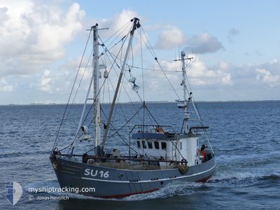
The vessel JONAS (MMSI: 211416000) is a Fishing It's sailing under the flag of [DE] Germany.
In this page you can find informations about the vessels current position, last detected port calls, and current voyage information. If the vessels is not in coverage by AIS you will find the latest position.
The current position of JONAS is detected by our AIS receivers and we are not responsible for the reliability of the data. The last position was recorded while the vessel was in Coverage by the Ais receivers of our vessel tracking app.
The current draught of JONAS as reported by AIS is 2.2 meters
Weather
| Temperature | 4.8°C / 40.64°F |
|---|---|
| Wind Speed | 6 knots |
| Direction | 328° NNW |
| Pressure | 1000.3 hPa |
| Humidity | 95.4 % |
| Cloud Coverage | 100 % |
Featured Company
Last Trips
| Origin | Departure | Destination | Arrival | Distance |
|---|
Events
| Tid | Event | Detaljer | Position / Dest | Information |
|---|---|---|---|---|
| 2025-03-10 05:57 | STOPPAR förflyttning | 3.76 nm, South East of DAGEBUELL |
54.68222 / 8.75397
FISHING GROUND
|
Fart: 0.2 kn Kurs: 240° |
| 2025-03-10 02:01 | I täckningsområde |
54.65373 / 8.02670
North Sea
|
Fart: 1.4 kn Kurs: 159.4° |
|
| 2025-03-10 00:56 | UTANFÖR täckningsområde |
54.70228 / 8.03023
North Sea
|
Fart: 2.7 kn Kurs: 203.7° |
|
| 2025-03-09 15:50 | I täckningsområde |
54.46903 / 8.39263
North Sea
|
Fart: 2.8 kn Kurs: 24.1° |
|
| 2025-03-09 13:21 | UTANFÖR täckningsområde |
54.47823 / 8.33390
North Sea
|
Fart: 2.7 kn Kurs: 217° |
|
| 2025-03-09 13:21 | I täckningsområde |
54.47823 / 8.33390
North Sea
|
Fart: 2.7 kn Kurs: 217° |
|
| 2025-03-09 12:20 | UTANFÖR täckningsområde |
54.52613 / 8.36828
North Sea
|
Fart: 2.9 kn Kurs: 221.8° |
|
| 2025-03-09 07:22 | STARTAR förflyttning | 5.35 nm, South East of WYK AUF FOHR |
54.62002 / 8.66237
FISHING GROUND
|
Fart: 5.7 kn Kurs: 251° |
| 2025-03-09 07:19 | STOPPAR förflyttning | 5.42 nm, South East of WYK AUF FOHR |
54.61997 / 8.66577
FISHING GROUND
|
Fart: 0.3 kn Kurs: 355° |
| 2025-03-09 06:32 | STARTAR förflyttning | 3.74 nm, South East of DAGEBUELL |
54.68140 / 8.75127
FISHING GROUND
|
Fart: 5.5 kn Kurs: 241.2° |