

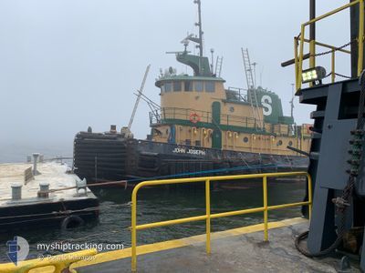
JOHN JOSEPH
Tug

Current Trip
NEW HAVEN
| Time Travelled | 1 day |
|---|---|
| Remaining Time | --- |
| Distance Travelled | 123.85 nm |
| Remaining Distance | --- |
| AVG Speed | 8.6 Knop |
| MAX Speed | 12 Knop |
| AVG Wind | 7.9 knots |
| MAX Wind | 11.3 knots |
| MIN Temp | 6.5°C / 43.7°F |
| MAX Temp | 11.2°C / 52.16°F |
| Djupgående | 4.6 m |
| Position mottagen | 10 h, 38 m sen |
Current Position
| Longitud | --- |
|---|---|
| Latitude | --- |
| Status | Under way using engine |
| Fart | 4.9 Knop |
| Kurs | 359° |
| Område | North Atlantic Ocean |
| Station | T-AIS |
| Position mottagen | 10 h, 38 m sen |
Information
The current position of JOHN JOSEPH is in North Atlantic Ocean with coordinates 41.34575° / -72.08577° as reported on 2025-03-29 07:16 by AIS to our vessel tracker app. The vessel's current speed is 4.9 Knop
The vessel JOHN JOSEPH (IMO: 7303865, MMSI: 366939780) is a Tug that was built in 1973 ( 52 År gammal ). It's sailing under the flag of [US] USA.
In this page you can find informations about the vessels current position, last detected port calls, and current voyage information. If the vessels is not in coverage by AIS you will find the latest position.
The current position of JOHN JOSEPH is detected by our AIS receivers and we are not responsible for the reliability of the data. The last position was recorded while the vessel was in Coverage by the Ais receivers of our vessel tracking app.
The current draught of JOHN JOSEPH as reported by AIS is 4.6 meters
Weather
| Temperature | 9°C / 48.2°F |
|---|---|
| Wind Speed | 8 knots |
| Direction | 40° NE |
| Pressure | 1016.3 hPa |
| Humidity | 76.7 % |
| Cloud Coverage | 81 % |


Featured Company
Last Port Calls
| Port | Arrival | Departure | Time In Port |
|---|---|---|---|
| 2025-03-27 10:27 | 2025-03-27 20:05 | 9 h | |
| 2025-03-25 14:32 | 2025-03-26 02:35 | 12 h | |
| 2025-03-22 13:06 | 2025-03-23 18:52 | 1 d | |
| 2025-03-19 12:44 | 2025-03-19 14:23 | 1 h | |
| 2025-03-16 10:56 | 2025-03-17 13:48 | 1 d | |
| 2025-03-15 23:22 | 2025-03-16 00:33 | 1 h | |
| 2025-03-15 02:28 | 2025-03-15 05:26 | 2 h | |
| 2025-03-14 16:27 | 2025-03-14 17:10 | 43 m | |
| 2025-03-14 07:09 | 2025-03-14 07:40 | 31 m | |
| 2025-03-13 16:22 | 2025-03-13 16:58 | 35 m |
Most Visited Ports (Last year)
| Port | Arrivals | |
|---|---|---|
| 149 | ||
| 90 | ||
| 3 | ||
| 1 | ||
| 1 | ||
| 1 |
Last Trips
| Origin | Departure | Destination | Arrival | Distance | |
|---|---|---|---|---|---|
| 2025-03-26 02:35 | 2025-03-27 10:27 | 165.44 nm | |||
| 2025-03-23 18:52 | 2025-03-25 14:32 | 154.44 nm | |||
| 2025-03-19 14:23 | 2025-03-22 13:06 | 507.05 nm | |||
| 2025-03-17 13:48 | 2025-03-19 12:44 | 299.51 nm | |||
| 2025-03-16 00:33 | 2025-03-16 10:56 | 94.32 nm | |||
| 2025-03-15 05:26 | 2025-03-15 23:22 | 112.13 nm | |||
| 2025-03-14 17:10 | 2025-03-15 02:28 | 47.99 nm | |||
| 2025-03-14 07:40 | 2025-03-14 16:27 | 23.24 nm | |||
| 2025-03-13 16:58 | 2025-03-14 07:09 | 48.98 nm | |||
| 2025-03-13 07:38 | 2025-03-13 16:22 | 1.64 nm |
Events
| Tid | Event | Detaljer | Position / Dest | Information |
|---|---|---|---|---|
| 2025-03-29 08:44 | STOPPAR förflyttning | 5.04 nm, North of NEW LONDON |
41.43284 / -72.09658
NEW HAVEN
|
Fart: 0.2 kn Kurs: 16° |
| 2025-03-29 07:24 | Status ändrad | Default Under way using engine |
41.35530 / -72.08662
NEW HAVEN
|
Fart: 4.9 kn Kurs: 359° |
| 2025-03-29 07:16 | UTANFÖR täckningsområde |
41.34575 / -72.08577
North Atlantic Ocean
|
Fart: 4.9 kn Kurs: 353.5° |
|
| 2025-03-29 05:58 | Status ändrad | Under way using engine Default |
41.23316 / -72.17867
NEW HAVEN
|
Fart: 8.9 kn Kurs: 69° |
| 2025-03-29 05:47 | I täckningsområde |
41.23316 / -72.17867
North Atlantic Ocean
|
Fart: 9.1 kn Kurs: 71° |
|
| 2025-03-28 15:07 | STOPPAR förflyttning | 6.78 nm, South of NEW HAVEN |
41.18592 / -72.85586
NEW HAVEN
|
Fart: 0.2 kn Kurs: 86° |
| 2025-03-28 14:42 | Status ändrad | Default Under way using engine |
41.18568 / -72.85850
NEW HAVEN
|
Fart: 8.7 kn Kurs: 60.6° |
| 2025-03-28 14:17 | Status ändrad | Under way using engine Default |
41.15472 / -72.92167
NEW HAVEN
|
Fart: 8.7 kn Kurs: 63° |
| 2025-03-28 14:17 | UTANFÖR täckningsområde |
41.15472 / -72.92167
North Atlantic Ocean
|
Fart: 8.7 kn Kurs: 60.6° |
|
| 2025-03-28 14:10 | Status ändrad | Default Under way using engine |
41.14677 / -72.94110
NEW HAVEN
|
Fart: 8.5 kn Kurs: 63.3° |