
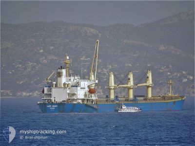
JIASHUN
Bulk Carrier
Current Trip
| Time Travelled | 19 days |
|---|---|
| Remaining Time | --- |
| Distance Travelled | 2420.53 nm |
| Remaining Distance | 1652.72 nm |
| AVG Speed | 12 Knop |
| MAX Speed | 14.1 Knop |
| AVG Wind | 10.6 knots |
| MAX Wind | 30 knots |
| MIN Temp | 24.8°C / 76.64°F |
| MAX Temp | 29.6°C / 85.28°F |
| Djupgående | 9.4 m |
| Position mottagen | 5 d sen |
Current Position
| Longitud | --- |
|---|---|
| Latitude | --- |
| Status | Under way using engine |
| Fart | 13.4 Knop |
| Kurs | 307.3° |
| Område | Malacca Strait |
| Station | T-AIS |
| Position mottagen | 5 d sen |
Info
Information
The current position of JIASHUN is in Malacca Strait with coordinates 2.55285° / 101.53038° as reported on 2024-11-21 09:16 by AIS to our vessel tracker app. The vessel's current speed is 13.4 Knop and is heading at the port of SOHAR. The estimated time of arrival as calculated by MyShipTracking vessel tracking app is 2024-12-02 19:00 LT
The vessel JIASHUN (IMO: 9228992, MMSI: 352391000) is a Bulk Carrier that was built in 2001 ( 23 År gammal ). It's sailing under the flag of [PA] Panama.
In this page you can find informations about the vessels current position, last detected port calls, and current voyage information. If the vessels is not in coverage by AIS you will find the latest position.
The current position of JIASHUN is detected by our AIS receivers and we are not responsible for the reliability of the data. The last position was recorded while the vessel was in Coverage by the Ais receivers of our vessel tracking app.
The current draught of JIASHUN as reported by AIS is 9.4 meters
Weather
| Temperature | 26.6°C / 79.88°F |
|---|---|
| Wind Speed | 12 knots |
| Direction | 314° NW |
| Pressure | 1006.8 hPa |
| Humidity | 76.2 % |
| Cloud Coverage | 100 % |
Featured Company
Last Port Calls
| Port | Arrival | Departure | Time In Port |
|---|---|---|---|
| 2024-11-05 06:20 | 2024-11-07 05:39 | 1 d | |
| 2024-11-01 13:39 | 2024-11-04 23:03 | 3 d | |
| 2024-10-02 20:24 | 2024-10-06 07:17 | 3 d | |
| 2024-09-25 04:46 | 2024-09-26 13:57 | 1 d | |
| 2024-09-13 12:56 | 2024-09-23 22:54 | 10 d | |
| 2024-09-04 13:05 |
Last Trips
| Origin | Departure | Destination | Arrival | Distance | |
|---|---|---|---|---|---|
| 2024-11-05 06:03 | 2024-11-05 13:20 | 69.78 nm | |||
| 2024-10-06 10:17 | 2024-11-01 20:39 | 4364.77 nm | |||
| 2024-09-26 17:57 | 2024-10-02 23:24 | 499.35 nm | |||
| 2024-09-24 01:54 | 2024-09-25 08:46 | 346.75 nm | |||
| 2024-09-04 16:05 | 2024-09-13 15:56 | 305.49 nm |
Events
| Tid | Event | Detaljer | Position / Dest | Information |
|---|---|---|---|---|
| 2024-11-21 09:20 | Status ändrad | Default Under way using engine |
2.56250 / 101.51801
SOHAR OMAN
|
Fart: 13.4 kn Kurs: 307.3° |
| 2024-11-21 09:16 | UTANFÖR täckningsområde |
2.55285 / 101.53038
Malacca Strait
SOHAR OMAN
|
Fart: 13.4 kn Kurs: 307.3° |
|
| 2024-11-21 09:06 | Status ändrad | Under way using engine Default |
2.52795 / 101.56211
SOHAR OMAN
|
Fart: 13.2 kn Kurs: 309° |
| 2024-11-21 09:02 | Status ändrad | Default Under way using engine |
2.51952 / 101.57253
SOHAR OMAN
|
Fart: 13.2 kn Kurs: 309.1° |
| 2024-11-21 08:53 | Status ändrad | Under way using engine Default |
2.49911 / 101.59746
SOHAR OMAN
|
Fart: 13.3 kn Kurs: 309° |
| 2024-11-21 08:51 | Status ändrad | Default Under way using engine |
2.49295 / 101.60510
SOHAR OMAN
|
Fart: 13.3 kn Kurs: 308.4° |
| 2024-11-21 06:58 | Byter havsområde | Malaysian part of the Malacca Strait Malaysian part of the Singapore Strait |
2.23946 / 101.93228
Malacca Strait
SOHAR OMAN
|
Fart: 12.8 kn Kurs: 307.2° |
| 2024-11-21 06:58 | Status ändrad | Under way using engine Default |
2.23946 / 101.93228
SOHAR OMAN
|
Fart: 12.7 kn Kurs: 308° |
| 2024-11-21 06:53 | I täckningsområde |
2.23946 / 101.93228
Malacca Strait
SOHAR OMAN
|
Fart: 12.8 kn Kurs: 307.2° |
|
| 2024-11-20 21:14 | UTANFÖR täckningsområde |
1.21151 / 103.54220
Singapore Strait
SOHAR OMAN
|
Fart: 12.2 kn Kurs: 281.4° |