
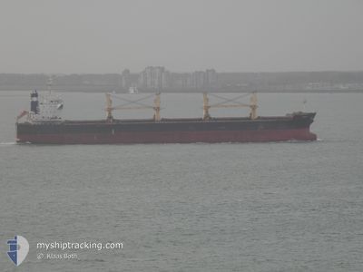
JASMINE
Bulk Carrier
Current Trip
Current Position
| Longitud | --- |
|---|---|
| Latitude | --- |
| Status | Under way using engine |
| Fart | |
| Kurs | 172° |
| Område | South Atlantic Ocean |
| Station | T-AIS |
| Position mottagen | Nu |
Info
Information
The current position of JASMINE is in South Atlantic Ocean with coordinates -23.94561° / -46.31229° as reported on 2024-12-04 22:55 by AIS to our vessel tracker app. The vessel's current speed is 0 Knop and is currently inside the port of SANTOS.
The vessel JASMINE (IMO: 9514327, MMSI: 636018362) is a Bulk Carrier that was built in 2012 ( 12 År gammal ). It's sailing under the flag of [LR] Liberia.
In this page you can find informations about the vessels current position, last detected port calls, and current voyage information. If the vessels is not in coverage by AIS you will find the latest position.
The current position of JASMINE is detected by our AIS receivers and we are not responsible for the reliability of the data. The last position was recorded while the vessel was in Coverage by the Ais receivers of our vessel tracking app.
The current draught of JASMINE as reported by AIS is 6.4 meters
Weather
| Temperature | 21.9°C / 71.42°F |
|---|---|
| Wind Speed | 13 knots |
| Direction | 92° E |
| Pressure | 1014.9 hPa |
| Humidity | 79.8 % |
| Cloud Coverage | 100 % |
Featured Company
Most Visited Ports (Last year)
| Port | Arrivals | |
|---|---|---|
| 6 | ||
| 2 | ||
| 2 |
Events
| Tid | Event | Detaljer | Position / Dest | Information |
|---|---|---|---|---|
| 2024-12-04 18:15 | Status ändrad | Under way using engine Default |
-23.94562 / -46.31225
[BR] SANTOS
|
Fart: Kurs: 172° |
| 2024-12-04 18:14 | Status ändrad | Default Under way using engine |
-23.94564 / -46.31221
[BR] SANTOS
|
Fart: Kurs: 172° |
| 2024-12-03 10:23 | STOPPAR förflyttning |
-23.94578 / -46.31139
[BR] SANTOS
|
Fart: 0.3 kn Kurs: 119° |
|
| 2024-12-03 09:48 | Status ändrad | Under way using engine Default |
-23.99128 / -46.29510
[BR] SANTOS
|
Fart: 8.5 kn Kurs: 81° |
| 2024-12-03 09:39 | Status ändrad | Default Under way using engine |
-23.99233 / -46.31642
[BR] SANTOS
|
Fart: 10.3 kn Kurs: 60° |
| 2024-12-03 09:33 | ANLÄNDER HAMN |
|
-23.99879 / -46.33269
[BR] SANTOS
|
Fart: 10.3 kn Kurs: 29.4° |
| 2024-12-03 09:08 | Status ändrad | Under way using engine Default |
-24.04397 / -46.33160
BRSSZ
|
Fart: 6.8 kn Kurs: 304° |
| 2024-12-03 09:07 | Djupgående ändrat | 6.4 6.3 |
-24.04662 / -46.32726
BRSSZ
|
Fart: 6.8 kn Kurs: 304° |
| 2024-12-03 09:07 | Destination ändrad | BRSSZ BR SSZ |
-24.04662 / -46.32726
BRSSZ
|
Fart: 6.8 kn Kurs: 304° |
| 2024-12-03 09:07 | ETA ändrat | 2025/11/30 20:00 2024/10/19 11:00 |
-24.04662 / -46.32726
BRSSZ
|
Fart: 6.8 kn Kurs: 304° |