

JAOHAR H
General Cargo

Current Trip
| Trip Time | 16 h, 18 mins |
|---|---|
| Trip Distance | 12.22 nm |
| AVG Speed | 6.3 Knop |
| MAX Speed | 7.3 Knop |
| Djupgående | 3.2 m |
| AVG Wind | 5.9 knots |
| MAX Wind | 7 knots |
| MIN Temp | 5.7°C / 42.26°F |
| MAX Temp | 11.9°C / 53.42°F |
| Position mottagen | 6 d sen |
Current Position
| Longitud | --- |
|---|---|
| Latitude | --- |
| Status | Under way using engine |
| Fart | 4 Knop |
| Kurs | 282° |
| Område | Black Sea |
| Station | T-AIS |
| Position mottagen | 6 d sen |
Information
The current position of JAOHAR H is in Black Sea with coordinates 44.10034° / 28.61097° as reported on 2025-03-21 06:17 by AIS to our vessel tracker app. The vessel's current speed is 4 Knop and is currently inside the port of MURFATLAR.
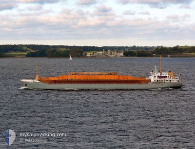
The vessel JAOHAR H (IMO: 8401511, MMSI: 667001285) is a General Cargo that was built in 1984 ( 41 År gammal ). It's sailing under the flag of [SL] Sierra Leone.
In this page you can find informations about the vessels current position, last detected port calls, and current voyage information. If the vessels is not in coverage by AIS you will find the latest position.
The current position of JAOHAR H is detected by our AIS receivers and we are not responsible for the reliability of the data. The last position was recorded while the vessel was in Coverage by the Ais receivers of our vessel tracking app.
The current draught of JAOHAR H as reported by AIS is 3.2 meters
Weather
| Temperature | 13.3°C / 55.94°F |
|---|---|
| Wind Speed | 8 knots |
| Direction | 82° E |
| Pressure | 1013.2 hPa |
| Humidity | 72.7 % |
| Cloud Coverage | 100 % |


Featured Company
Last Port Calls
| Port | Arrival | Departure | Time In Port |
|---|---|---|---|
| 2025-03-21 09:56 | |||
| 2025-02-27 09:09 | 2025-03-20 17:38 | 21 d | |
| 2025-02-18 15:41 | 2025-02-21 08:33 | 2 d | |
| 2025-01-23 12:03 | 2025-01-24 22:33 | 1 d | |
| 2025-01-14 15:17 | 2025-01-21 07:21 | 6 d | |
| 2025-01-11 18:01 | 2025-01-12 14:45 | 20 h | |
| 2025-01-11 15:06 | |||
| 2025-01-07 16:06 |
Last Trips
| Origin | Departure | Destination | Arrival | Distance | |
|---|---|---|---|---|---|
| 2025-03-20 17:38 | 2025-03-21 09:56 | 12.22 nm | |||
| 2025-02-21 08:33 | 2025-02-27 09:09 | 598.24 nm | |||
| 2025-01-24 22:33 | 2025-02-18 15:41 | 1083.46 nm | |||
| 2025-01-21 07:21 | 2025-01-23 12:03 | 8.41 nm | |||
| 2025-01-12 14:45 | 2025-01-14 15:17 | 386.03 nm | |||
| 2025-01-11 15:06 | 2025-01-11 18:01 | 2.71 nm |
Events
| Tid | Event | Detaljer | Position / Dest | Information |
|---|---|---|---|---|
| 2025-03-21 09:04 | STOPPAR förflyttning |
44.17816 / 28.39413
[RO] MURFATLAR
|
Fart: Kurs: 18° |
|
| 2025-03-21 07:56 | ANLÄNDER HAMN |
|
44.17831 / 28.39537
[RO] MURFATLAR
|
Fart: 7.1 kn Kurs: 300° |
| 2025-03-21 06:18 | Status ändrad | Default Under way using engine |
44.10041 / 28.61042
RO MURFATLAR
|
Fart: 4 kn Kurs: 282° |
| 2025-03-21 06:17 | Status ändrad | Under way using engine Default |
44.10034 / 28.61097
RO MURFATLAR
|
Fart: 0.2 kn Kurs: 272° |
| 2025-03-21 06:17 | STARTAR förflyttning | 2.95 nm, South West of CONSTANTA |
44.10034 / 28.61097
RO MURFATLAR
|
Fart: 4 kn Kurs: 282° |
| 2025-03-21 06:17 | UTANFÖR täckningsområde |
44.10034 / 28.61097
Black Sea
|
Fart: 4 kn Kurs: 280.5° |
|
| 2025-03-21 06:13 | Status ändrad | Default Under way using engine |
44.09994 / 28.61438
RO MURFATLAR
|
Fart: Kurs: 274° |
| 2025-03-20 16:55 | Status ändrad | Under way using engine Default |
44.10016 / 28.61551
RO MURFATLAR
|
Fart: 0.8 kn Kurs: 264° |
| 2025-03-20 16:54 | Status ändrad | Default Under way using engine |
44.10020 / 28.61600
RO MURFATLAR
|
Fart: 0.7 kn Kurs: 273° |
| 2025-03-20 16:34 | Status ändrad | Under way using engine Default |
44.10003 / 28.62166
RO MURFATLAR
|
Fart: Kurs: 276° |