
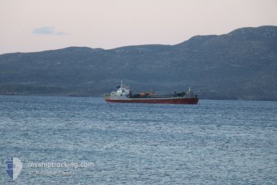
IRINI
Suction Dredger
Current Trip
| Time Travelled | 17 h, 53 mins |
|---|---|
| Remaining Time | --- |
| Distance Travelled | 99.95 nm |
| Remaining Distance | --- |
| AVG Speed | 8.5 Knop |
| MAX Speed | 9 Knop |
| AVG Wind | 10 knots |
| MAX Wind | 14.3 knots |
| MIN Temp | 12.9°C / 55.22°F |
| MAX Temp | 15.3°C / 59.54°F |
| Djupgående | 3.5 m |
| Position mottagen | 5 h, 55 m sen |
Current Position
| Longitud | --- |
|---|---|
| Latitude | --- |
| Status | Under way using engine |
| Fart | 8.3 Knop |
| Kurs | 351.3° |
| Område | Aegean Sea |
| Station | T-AIS |
| Position mottagen | 5 h, 55 m sen |
Info
Information
The current position of IRINI is in Aegean Sea with coordinates 38.31840° / 24.01150° as reported on 2025-02-16 09:24 by AIS to our vessel tracker app. The vessel's current speed is 8.3 Knop
The vessel IRINI (IMO: 6404363, MMSI: 237087500) is a Suction Dredger that was built in 1957 ( 68 År gammal ). It's sailing under the flag of [GR] Greece.
In this page you can find informations about the vessels current position, last detected port calls, and current voyage information. If the vessels is not in coverage by AIS you will find the latest position.
The current position of IRINI is detected by our AIS receivers and we are not responsible for the reliability of the data. The last position was recorded while the vessel was in Coverage by the Ais receivers of our vessel tracking app.
The current draught of IRINI as reported by AIS is 3.5 meters
Weather
| Temperature | 11.4°C / 52.52°F |
|---|---|
| Wind Speed | 4 knots |
| Direction | 173° S |
| Pressure | 1012.5 hPa |
| Humidity | 74 % |
| Cloud Coverage | 100 % |
Featured Company
Last Port Calls
| Port | Arrival | Departure | Time In Port |
|---|---|---|---|
| 2025-02-15 16:06 | 2025-02-15 21:26 | 5 h | |
| 2025-02-14 13:53 | 2025-02-15 11:41 | 21 h | |
| 2025-02-14 02:28 | 2025-02-14 10:27 | 7 h | |
| 2025-02-12 16:59 | 2025-02-13 12:39 | 19 h | |
| 2025-02-12 04:35 | 2025-02-12 16:36 | 12 h | |
| 2025-02-03 17:27 | 2025-02-11 13:14 | 7 d | |
| 2025-02-03 10:42 | 2025-02-03 14:24 | 3 h | |
| 2025-02-03 01:28 | 2025-02-03 07:40 | 6 h | |
| 2025-02-02 02:31 | 2025-02-02 14:16 | 11 h | |
| 2025-02-01 05:55 | 2025-02-01 15:27 | 9 h |
Last Trips
| Origin | Departure | Destination | Arrival | Distance | |
|---|---|---|---|---|---|
| 2025-02-15 13:41 | 2025-02-15 18:06 | 18.13 nm | |||
| 2025-02-14 12:27 | 2025-02-14 15:53 | 25.57 nm | |||
| 2025-02-13 14:39 | 2025-02-14 04:28 | 104.50 nm | |||
| 2025-02-12 18:36 | 2025-02-12 18:59 | 2.21 nm | |||
| 2025-02-11 15:14 | 2025-02-12 06:35 | 107.77 nm | |||
| 2025-02-03 16:24 | 2025-02-03 19:27 | 23.88 nm | |||
| 2025-02-03 09:40 | 2025-02-03 12:42 | 24.57 nm | |||
| 2025-02-02 16:16 | 2025-02-03 03:28 | 87.30 nm | |||
| 2025-02-01 17:27 | 2025-02-02 04:31 | 88.23 nm | |||
| 2025-01-31 11:23 | 2025-02-01 07:55 | 106.18 nm |
Events
| Tid | Event | Detaljer | Position / Dest | Information |
|---|---|---|---|---|
| 2025-02-16 10:15 | STOPPAR förflyttning | 0.6 nm, North West of MILAKI |
38.38009 / 24.04388
GRALV
|
Fart: 0.1 kn Kurs: -1° |
| 2025-02-16 09:25 | Status ändrad | Default Under way using engine |
38.32110 / 24.01124
GRALV
|
Fart: 8.3 kn Kurs: 351.3° |
| 2025-02-16 09:24 | UTANFÖR täckningsområde |
38.31840 / 24.01150
Aegean Sea
|
Fart: 8.3 kn Kurs: 351.3° |
|
| 2025-02-16 08:15 | Status ändrad | Under way using engine Default |
38.17397 / 24.09424
GRALV
|
Fart: 8.4 kn Kurs: 333° |
| 2025-02-16 08:07 | Status ändrad | Default Under way using engine |
38.15707 / 24.10458
GRALV
|
Fart: 8.3 kn Kurs: 340.5° |
| 2025-02-15 22:55 | Destination ändrad | GRALV GRALU |
37.23109 / 25.16363
GRALV
|
Fart: 8.2 kn Kurs: 296° |
| 2025-02-15 22:14 | Destination ändrad | GRALU GRJNX |
37.18724 / 25.26969
GRALU
|
Fart: 8.7 kn Kurs: 297.4° |
| 2025-02-15 21:26 | AVGÅTT HAMN |
|
37.10592 / 25.36515
GRJNX
|
Fart: 6.6 kn Kurs: 307.8° |
| 2025-02-15 21:26 | STARTAR förflyttning |
37.10519 / 25.36633
[GR] NAXOS
|
Fart: 6.1 kn Kurs: 308° |
|
| 2025-02-15 21:22 | STOPPAR förflyttning |
37.10523 / 25.36879
[GR] NAXOS
|
Fart: 0.3 kn Kurs: 511° |