
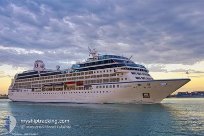
INSIGNIA
Passengers Ship
Current Trip
| Time Travelled | 6 h, 14 mins |
|---|---|
| Remaining Time | 9 h, 6 mins |
| Distance Travelled | 82.96 nm |
| Remaining Distance | 136.27 nm |
| AVG Speed | 13.8 Knop |
| MAX Speed | 15 Knop |
| AVG Wind | 9.5 knots |
| MAX Wind | 12.9 knots |
| MIN Temp | 24.9°C / 76.82°F |
| MAX Temp | 26.9°C / 80.42°F |
| Djupgående | 6 m |
| Position mottagen | 5 h, 0 m sen |
Current Position
| Longitud | --- |
|---|---|
| Latitude | --- |
| Status | Under way using engine |
| Fart | 14.8 Knop |
| Kurs | 192.9° |
| Område | Caribbean Sea |
| Station | T-AIS |
| Position mottagen | 5 h, 0 m sen |
Info
Information
The current position of INSIGNIA is in Caribbean Sea with coordinates 20.25253° / -87.09613° as reported on 2026-01-10 23:11 by AIS to our vessel tracker app. The vessel's current speed is 14.8 Knop and is heading at the port of BELIZE CITY. The estimated time of arrival as calculated by MyShipTracking vessel tracking app is 2026-01-11 07:18 LT
The vessel INSIGNIA (IMO: 9156462, MMSI: 538001663) is a Passengers Ship that was built in 1998 ( 28 År gammal ). It's sailing under the flag of [MH] Marshall Is.
In this page you can find informations about the vessels current position, last detected port calls, and current voyage information. If the vessels is not in coverage by AIS you will find the latest position.
The current position of INSIGNIA is detected by our AIS receivers and we are not responsible for the reliability of the data. The last position was recorded while the vessel was in Coverage by the Ais receivers of our vessel tracking app.
The current draught of INSIGNIA as reported by AIS is 6 meters
Weather
| Temperature | 24.7°C / 76.46°F |
|---|---|
| Wind Speed | 9 knots |
| Direction | 65° ENE |
| Pressure | 1017.5 hPa |
| Humidity | 83.7 % |
| Cloud Coverage | 96 % |
Featured Company
Last Port Calls
| Port | Arrival | Departure | Time In Port |
|---|---|---|---|
| 2026-01-10 06:18 | 2026-01-10 16:58 | 10 h | |
| 2026-01-08 06:03 | 2026-01-08 17:36 | 11 h | |
| 2026-01-05 06:44 | 2026-01-05 16:04 | 9 h | |
| 2026-01-03 06:33 | 2026-01-03 16:50 | 10 h | |
| 2026-01-02 06:30 | 2026-01-02 16:54 | 10 h | |
| 2026-01-01 06:46 | 2026-01-01 16:46 | 10 h | |
| 2025-12-31 06:16 | 2025-12-31 16:46 | 10 h | |
| 2025-12-29 05:57 | 2025-12-29 17:07 | 11 h | |
| 2025-12-26 06:08 | 2025-12-26 16:48 | 10 h | |
| 2025-12-25 06:54 | 2025-12-25 18:59 | 12 h |
Last Trips
| Origin | Departure | Destination | Arrival | Distance | |
|---|---|---|---|---|---|
| 2026-01-08 17:36 | 2026-01-10 06:18 | 516.00 nm | |||
| 2026-01-05 16:04 | 2026-01-08 06:03 | 869.54 nm | |||
| 2026-01-03 16:50 | 2026-01-05 06:44 | 513.60 nm | |||
| 2026-01-02 16:54 | 2026-01-03 06:33 | 126.57 nm | |||
| 2026-01-01 16:46 | 2026-01-02 06:30 | 103.61 nm | |||
| 2025-12-31 16:46 | 2026-01-01 06:46 | 117.91 nm | |||
| 2025-12-29 17:07 | 2025-12-31 06:16 | 513.57 nm | |||
| 2025-12-26 16:48 | 2025-12-29 05:57 | 983.89 nm | |||
| 2025-12-25 18:59 | 2025-12-26 06:08 | 110.89 nm | |||
| 2025-12-24 19:13 | 2025-12-25 06:54 | 89.04 nm |
Events
| Tid | Event | Detaljer | Position / Dest | Information |
|---|---|---|---|---|
| 2026-01-10 23:18 | Status ändrad | Default Under way using engine |
20.22500 / -87.10333
BZ BZE
|
Fart: 14.8 kn Kurs: 192.9° |
| 2026-01-10 23:11 | UTANFÖR täckningsområde |
20.25253 / -87.09613
Caribbean Sea
BZ BZE
|
Fart: 14.8 kn Kurs: 192.9° |
|
| 2026-01-10 23:06 | Status ändrad | Under way using engine Default |
20.27378 / -87.09067
BZ BZE
|
Fart: 15 kn Kurs: 194° |
| 2026-01-10 22:57 | Status ändrad | Default Under way using engine |
20.30833 / -87.08167
BZ BZE
|
Fart: 14.7 kn Kurs: 194.3° |
| 2026-01-10 21:58 | AVGÅTT HAMN |
|
20.48213 / -86.98030
BZ BZE
|
Fart: 5.4 kn Kurs: 303° |
| 2026-01-10 21:57 | STARTAR förflyttning |
20.48080 / -86.97937
[MX] COZUMEL
|
Fart: 4 kn Kurs: 326° |
|
| 2026-01-10 21:56 | Status ändrad | Under way using engine Moored |
20.48010 / -86.97905
[MX] COZUMEL
|
Fart: 1.3 kn Kurs: 341° |
| 2026-01-10 21:52 | Status ändrad | Moored Default |
20.47930 / -86.97785
[MX] COZUMEL
|
Fart: Kurs: 357° |
| 2026-01-10 21:49 | Status ändrad | Default Moored |
20.47930 / -86.97785
[MX] COZUMEL
|
Fart: Kurs: 357° |
| 2026-01-10 21:40 | Status ändrad | Moored Default |
20.47930 / -86.97787
[MX] COZUMEL
|
Fart: Kurs: 357° |