
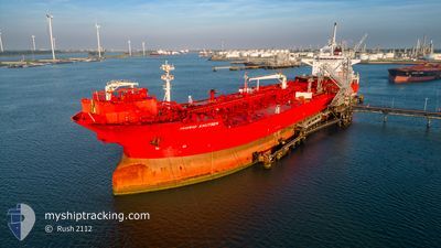
INGRID KNUTSEN
Shuttle Tanker
Current Trip
| Time Travelled | 3 days |
|---|---|
| Remaining Time | --- |
| Distance Travelled | 31.07 nm |
| Remaining Distance | --- |
| AVG Speed | 7 Knop |
| MAX Speed | 12.5 Knop |
| AVG Wind | 8.3 knots |
| MAX Wind | 13 knots |
| MIN Temp | 9.5°C / 49.1°F |
| MAX Temp | 14.6°C / 58.28°F |
| Djupgående | 9.1 m |
| Position mottagen | 3 m sen |
Current Position
| Longitud | 4.21953° |
|---|---|
| Latitude | 52.17801° |
| Status | At anchor |
| Fart | |
| Kurs | 274° |
| Område | North Sea |
| Station | T-AIS |
| Position mottagen | 3 m sen |
Info
Information
The current position of INGRID KNUTSEN is in North Sea with coordinates 52.17801° / 4.21953° as reported on 2024-05-07 04:30 by AIS to our vessel tracker app. The vessel's current speed is 0 Knop
The vessel INGRID KNUTSEN (IMO: 9649225, MMSI: 235103057) is a Shuttle Tanker that was built in 2013 ( 11 År gammal ). It's sailing under the flag of [GB] United Kingdom.
In this page you can find informations about the vessels current position, last detected port calls, and current voyage information. If the vessels is not in coverage by AIS you will find the latest position.
The current position of INGRID KNUTSEN is detected by our AIS receivers and we are not responsible for the reliability of the data. The last position was recorded while the vessel was in Coverage by the Ais receivers of our vessel tracking app.
The current draught of INGRID KNUTSEN as reported by AIS is 9.1 meters
Weather
| Temperature | 11.4°C / 52.52°F |
|---|---|
| Wind Speed | 8 knots |
| Direction | 44° NE |
| Pressure | 1016 hPa |
| Humidity | 81.8 % |
| Cloud Coverage | 93 % |
Featured Company
Last Port Calls
| Port | Arrival | Departure | Time In Port |
|---|---|---|---|
| 2024-05-01 09:27 | 2024-05-04 00:59 | 2 d | |
| 2024-04-27 06:19 | 2024-04-29 13:39 | 2 d | |
| 2024-04-02 17:52 | 2024-04-03 13:37 | 19 h | |
| 2024-03-27 00:48 | 2024-03-28 04:49 | 1 d | |
| 2024-03-21 13:47 | 2024-03-22 15:07 | 1 d | |
| 2024-03-16 21:08 | 2024-03-17 19:06 | 21 h | |
| 2024-03-02 17:59 |
Last Trips
| Origin | Departure | Destination | Arrival | Distance | |
|---|---|---|---|---|---|
| 2024-04-29 15:39 | 2024-05-01 11:27 | 499.45 nm | |||
| 2024-04-03 15:37 | 2024-04-27 08:19 | 805.19 nm | |||
| 2024-03-28 05:49 | 2024-04-02 19:52 | 720.57 nm | |||
| 2024-03-22 16:07 | 2024-03-27 01:48 | 492.05 nm | |||
| 2024-03-17 20:06 | 2024-03-21 14:47 | 176.53 nm | |||
| 2024-03-02 18:59 | 2024-03-16 22:08 | 2056.12 nm |
Events
| Tid | Event | Detaljer | Position / Dest | Information |
|---|---|---|---|---|
| 2024-05-04 21:22 | STOPPAR förflyttning | 5.2 nm, North of SCHEVENINGEN |
52.17914 / 4.21401
NL SCE
|
Fart: 0.2 kn Kurs: 122° |
| 2024-05-04 21:22 | STARTAR förflyttning | 5.2 nm, North of SCHEVENINGEN |
52.17899 / 4.21385
NL SCE
|
Fart: 3.3 kn Kurs: 122° |
| 2024-05-04 05:42 | Status ändrad | At anchor Under way using engine |
52.17773 / 4.21375
NL SCE
|
Fart: Kurs: 73° |
| 2024-05-04 03:30 | STOPPAR förflyttning | 5.12 nm, North of SCHEVENINGEN |
52.17858 / 4.21809
NL SCE
|
Fart: 0.1 kn Kurs: 211° |
| 2024-05-04 00:59 | AVGÅTT HAMN |
|
51.96814 / 4.11820
NL SCE
|
Fart: 8.9 kn Kurs: 300° |
| 2024-05-04 00:17 | STARTAR förflyttning |
51.92121 / 4.21269
[NL] ROTTERDAM
|
Fart: 3.2 kn Kurs: 320° |
|
| 2024-05-04 00:03 | Status ändrad | Under way using engine Moored |
51.91706 / 4.21432
[NL] ROTTERDAM
|
Fart: Kurs: 359° |
| 2024-05-04 00:03 | Djupgående ändrat | 9.1 12.3 |
51.91706 / 4.21432
[NL] ROTTERDAM
|
Fart: Kurs: 359° |
| 2024-05-04 00:03 | Destination ändrad | NL SCE NLRTM |
51.91706 / 4.21432
[NL] ROTTERDAM
|
Fart: Kurs: 359° |
| 2024-05-04 00:03 | ETA ändrat | 2024/05/04 02:00 2024/05/01 06:00 |
51.91706 / 4.21432
[NL] ROTTERDAM
|
Fart: Kurs: 359° |