
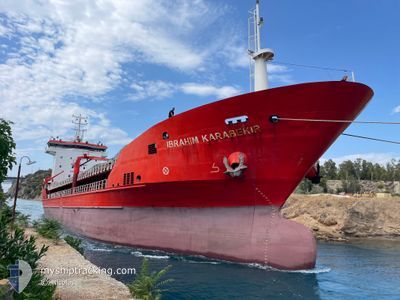
IBRAHIM KARABEKIR
General Cargo
Current Trip
| Time Travelled | 10 h, 46 mins |
|---|---|
| Remaining Time | --- |
| Distance Travelled | 17.78 nm |
| Remaining Distance | --- |
| AVG Speed | 8 Knop |
| MAX Speed | 10.8 Knop |
| AVG Wind | 11.5 knots |
| MAX Wind | 14 knots |
| MIN Temp | 2.6°C / 36.68°F |
| MAX Temp | 4.8°C / 40.64°F |
| Djupgående | 4.5 m |
| Position mottagen | 1 m sen |
Current Position
| Longitud | --- |
|---|---|
| Latitude | --- |
| Status | At anchor |
| Fart | 0.2 Knop |
| Kurs | 90° |
| Område | Sea of Marmara |
| Station | T-AIS |
| Position mottagen | 1 m sen |
Info
Information
The current position of IBRAHIM KARABEKIR is in Sea of Marmara with coordinates 40.76873° / 29.63949° as reported on 2025-02-18 01:47 by AIS to our vessel tracker app. The vessel's current speed is 0.2 Knop
The vessel IBRAHIM KARABEKIR (IMO: 9275854, MMSI: 271000724) is a General Cargo that was built in 2004 ( 21 År gammal ). It's sailing under the flag of [TR] Turkey.
In this page you can find informations about the vessels current position, last detected port calls, and current voyage information. If the vessels is not in coverage by AIS you will find the latest position.
The current position of IBRAHIM KARABEKIR is detected by our AIS receivers and we are not responsible for the reliability of the data. The last position was recorded while the vessel was in Coverage by the Ais receivers of our vessel tracking app.
The current draught of IBRAHIM KARABEKIR as reported by AIS is 4.5 meters
Weather
| Temperature | 2.6°C / 36.68°F |
|---|---|
| Wind Speed | 11 knots |
| Direction | 77° ENE |
| Pressure | 1020.8 hPa |
| Humidity | 94.3 % |
| Cloud Coverage | 100 % |
Featured Company
Last Port Calls
| Port | Arrival | Departure | Time In Port |
|---|---|---|---|
| 2025-02-03 11:47 | 2025-02-17 15:03 | 14 d | |
| 2025-01-31 01:05 | 2025-02-02 01:49 | 2 d | |
| 2025-01-21 17:25 | |||
| 2025-01-15 05:41 | 2025-01-19 22:11 | 4 d | |
| 2025-01-10 05:29 | 2025-01-11 13:25 | 1 d | |
| 2024-12-27 18:37 | 2025-01-06 17:05 | 9 d | |
| 2024-12-18 05:45 | 2024-12-20 08:04 | 2 d | |
| 2024-12-12 19:33 | 2024-12-16 22:35 | 4 d | |
| 2024-12-03 11:31 | 2024-12-04 21:29 | 1 d |
Last Trips
| Origin | Departure | Destination | Arrival | Distance | |
|---|---|---|---|---|---|
| 2025-02-02 04:49 | 2025-02-03 14:47 | 76.07 nm | |||
| 2025-01-20 00:11 | 2025-01-31 04:05 | 306.95 nm | |||
| 2025-01-20 00:11 | 2025-01-21 19:25 | 87.40 nm | |||
| 2025-01-11 17:25 | 2025-01-15 07:41 | 600.62 nm | |||
| 2025-01-06 21:05 | 2025-01-10 09:29 | 39.61 nm | |||
| 2024-12-20 10:04 | 2024-12-27 22:37 | 1271.70 nm | |||
| 2024-12-16 23:35 | 2024-12-18 07:45 | 302.63 nm | |||
| 2024-12-05 00:29 | 2024-12-12 20:33 | 1423.14 nm | |||
| 2024-11-29 21:16 | 2024-12-03 14:31 | 165.06 nm |
Events
| Tid | Event | Detaljer | Position / Dest | Information |
|---|---|---|---|---|
| 2025-02-18 00:38 | Status ändrad | At anchor Default |
40.76807 / 29.63966
TRIZT
|
Fart: 0.1 kn Kurs: 68° |
| 2025-02-18 00:35 | Status ändrad | Default At anchor |
40.76806 / 29.63956
TRIZT
|
Fart: 0.3 kn Kurs: 49° |
| 2025-02-17 18:35 | Status ändrad | At anchor Default |
40.76870 / 29.64020
TRIZT
|
Fart: Kurs: 79° |
| 2025-02-17 18:32 | Status ändrad | Default At anchor |
40.76875 / 29.64025
TRIZT
|
Fart: Kurs: 62° |
| 2025-02-17 18:29 | Destination ändrad | TRIZT TRIZM |
40.76864 / 29.64025
TRIZT
|
Fart: Kurs: 62° |
| 2025-02-17 17:50 | STOPPAR förflyttning | 1.36 nm, South East of HEREKE |
40.76897 / 29.64029
TRIZM
|
Fart: 0.3 kn Kurs: 74° |
| 2025-02-17 17:33 | Status ändrad | At anchor Under way sailing |
40.76940 / 29.63877
TRIZM
|
Fart: 2.7 kn Kurs: 68° |
| 2025-02-17 16:07 | STARTAR förflyttning | 2.03 nm, South of GEBZE |
40.71998 / 29.37292
TRIZM
|
Fart: 3.9 kn Kurs: 79° |
| 2025-02-17 15:49 | STOPPAR förflyttning | 2.38 nm, South of GEBZE |
40.71525 / 29.36563
TRIZM
|
Fart: 0.3 kn Kurs: 82° |
| 2025-02-17 15:03 | AVGÅTT HAMN |
|
40.70581 / 29.44578
TRIZM
|
Fart: 7 kn Kurs: 273° |