
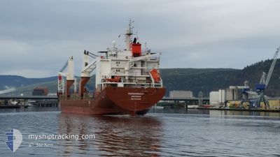
HUDSONGRACHT
General Cargo
Current Trip
| Time Travelled | 4 days |
|---|---|
| Remaining Time | --- |
| Distance Travelled | 1449.17 nm |
| Remaining Distance | --- |
| AVG Speed | 12.5 Knop |
| MAX Speed | 17.3 Knop |
| AVG Wind | 16.6 knots |
| MAX Wind | 36 knots |
| MIN Temp | -14.4°C / 6.08°F |
| MAX Temp | 17.1°C / 62.78°F |
| Djupgående | 7.8 m |
| Position mottagen | 4 d sen |
Current Position
| Longitud | --- |
|---|---|
| Latitude | --- |
| Status | Under way using engine |
| Fart | 11.3 Knop |
| Kurs | 41.5° |
| Område | Gulf of St-Lawrence |
| Station | T-AIS |
| Position mottagen | 4 d sen |
Info
Information
The current position of HUDSONGRACHT is in Gulf of St-Lawrence with coordinates 47.16997° / -70.64293° as reported on 2025-12-30 14:11 by AIS to our vessel tracker app. The vessel's current speed is 11.3 Knop and is heading at the port of ALGECIRAS. The estimated time of arrival as calculated by MyShipTracking vessel tracking app is 2026-01-07 13:00 LT
The vessel HUDSONGRACHT (IMO: 9433262, MMSI: 244030000) is a General Cargo that was built in 2008 ( 18 År gammal ). It's sailing under the flag of [NL] Netherlands.
In this page you can find informations about the vessels current position, last detected port calls, and current voyage information. If the vessels is not in coverage by AIS you will find the latest position.
The current position of HUDSONGRACHT is detected by our AIS receivers and we are not responsible for the reliability of the data. The last position was recorded while the vessel was in Coverage by the Ais receivers of our vessel tracking app.
The current draught of HUDSONGRACHT as reported by AIS is 7.8 meters
Weather
| Temperature | 17.1°C / 62.78°F |
|---|---|
| Wind Speed | 13 knots |
| Direction | 228° SW |
| Pressure | 1016.9 hPa |
| Humidity | 90.9 % |
| Cloud Coverage | 100 % |
Featured Company
Last Port Calls
| Port | Arrival | Departure | Time In Port |
|---|---|---|---|
| 2025-12-30 06:41 | 2025-12-30 06:51 | 10 m | |
| 2025-12-29 18:58 | 2025-12-29 20:23 | 1 h | |
| 2025-12-29 09:48 | 2025-12-29 15:08 | 5 h | |
| 2025-12-24 13:12 | 2025-12-24 13:51 | 38 m | |
| 2025-12-22 09:21 | 2025-12-22 10:02 | 41 m | |
| 2025-12-08 08:22 | 2025-12-20 18:22 | 12 d | |
| 2025-12-05 17:13 | 2025-12-05 18:02 | 48 m | |
| 2025-12-03 05:40 | 2025-12-03 06:21 | 40 m | |
| 2025-11-30 12:06 | 2025-11-30 13:02 | 55 m | |
| 2025-11-17 15:09 | 2025-11-17 23:13 | 8 h |
Most Visited Ports (Last year)
| Port | Arrivals | |
|---|---|---|
| 8 | ||
| 8 | ||
| 8 | ||
| 4 | ||
| 2 | ||
| 2 |
Last Trips
| Origin | Departure | Destination | Arrival | Distance | |
|---|---|---|---|---|---|
| 2025-12-29 20:23 | 2025-12-30 06:41 | 129.79 nm | |||
| 2025-12-29 15:08 | 2025-12-29 18:58 | 7.88 nm | |||
| 2025-12-24 13:51 | 2025-12-29 09:48 | 307.22 nm | |||
| 2025-12-22 10:02 | 2025-12-24 13:12 | 524.50 nm | |||
| 2025-12-20 18:22 | 2025-12-22 09:21 | 377.48 nm | |||
| 2025-12-05 18:02 | 2025-12-08 08:22 | 349.81 nm | |||
| 2025-12-03 06:21 | 2025-12-05 17:13 | 523.53 nm | |||
| 2025-11-30 13:02 | 2025-12-03 05:40 | 304.29 nm | |||
| 2025-11-17 23:13 | 2025-11-30 12:06 | 3682.24 nm | |||
| 2025-11-15 13:56 | 2025-11-17 15:09 | 586.90 nm |
Events
| Tid | Event | Detaljer | Position / Dest | Information |
|---|---|---|---|---|
| 2025-12-30 14:18 | Status ändrad | Default Under way using engine |
47.18705 / -70.62058
ESALG
|
Fart: 11.3 kn Kurs: 41.5° |
| 2025-12-30 14:11 | UTANFÖR täckningsområde |
47.16997 / -70.64293
Gulf of St-Lawrence
ESALG
|
Fart: 11.3 kn Kurs: 41.5° |
|
| 2025-12-30 14:06 | Status ändrad | Under way using engine Default |
47.15641 / -70.65987
ESALG
|
Fart: 11.2 kn Kurs: 35° |
| 2025-12-30 14:02 | Status ändrad | Default Under way using engine |
47.14774 / -70.66848
ESALG
|
Fart: 11.5 kn Kurs: 34.2° |
| 2025-12-30 11:53 | STARTAR förflyttning | 0.19 nm, South East of QUEBEC |
46.82055 / -71.19115
ESALG
|
Fart: 7.1 kn Kurs: 36° |
| 2025-12-30 11:51 | AVGÅTT HAMN |
|
46.81883 / -71.19337
ESALG
|
Fart: 4.1 kn Kurs: 67° |
| 2025-12-30 11:41 | ANLÄNDER HAMN |
|
46.81681 / -71.19678
[CA] QUEBEC
|
Fart: 0.6 kn Kurs: 195° |
| 2025-12-30 11:24 | STOPPAR förflyttning | 0.16 nm, South of QUEBEC |
46.81997 / -71.19388
ESALG
|
Fart: 0.3 kn Kurs: 196° |
| 2025-12-30 10:28 | Status ändrad | Under way using engine Default |
46.72343 / -71.37156
ESALG
|
Fart: 15.1 kn Kurs: 77° |
| 2025-12-30 10:27 | Status ändrad | Default Under way using engine |
46.72241 / -71.37804
ESALG
|
Fart: 15.2 kn Kurs: 77.2° |