
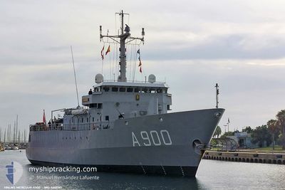
HNLMS MERCUUR
Not available
Current Trip
| Trip Time | 1 day |
|---|---|
| Trip Distance | 386.37 nm |
| AVG Speed | 6.7 Knop |
| MAX Speed | 11.1 Knop |
| Djupgående | 0 m |
| AVG Wind | 14.5 knots |
| MAX Wind | 19.4 knots |
| MIN Temp | 15.1°C / 59.18°F |
| MAX Temp | 19.5°C / 67.1°F |
| Position mottagen | 1 d sen |
Current Position
| Longitud | 8.76893° |
|---|---|
| Latitude | 58.45871° |
| Status | Under way using engine |
| Fart | |
| Kurs | 1° |
| Område | Skaggerak |
| Station | T-AIS |
| Position mottagen | 1 d sen |
Info
Information
The current position of HNLMS MERCUUR is in Skaggerak with coordinates 58.45871° / 8.76893° as reported on 2024-09-06 08:35 by AIS to our vessel tracker app. The vessel's current speed is 0 Knop and is currently inside the port of ARENDAL.
The vessel HNLMS MERCUUR (MMSI: 245974000) is a Not available It's sailing under the flag of [NL] Netherlands.
In this page you can find informations about the vessels current position, last detected port calls, and current voyage information. If the vessels is not in coverage by AIS you will find the latest position.
The current position of HNLMS MERCUUR is detected by our AIS receivers and we are not responsible for the reliability of the data. The last position was recorded while the vessel was in Coverage by the Ais receivers of our vessel tracking app.
Weather
| Temperature | 19.3°C / 66.74°F |
|---|---|
| Wind Speed | 9 knots |
| Direction | 46° NE |
| Pressure | 1026.1 hPa |
| Humidity | 66.8 % |
| Cloud Coverage | --- |
Featured Company
Last Port Calls
| Port | Arrival | Departure | Time In Port |
|---|---|---|---|
| 2024-09-06 08:06 | |||
| 2024-08-29 11:32 | 2024-09-04 08:15 | 5 d | |
| 2024-08-28 12:37 | 2024-08-29 07:49 | 19 h | |
| 2024-07-05 11:01 | 2024-08-28 08:11 | ||
| 2024-07-04 07:16 | 2024-07-05 07:03 | 23 h | |
| 2024-07-01 08:15 |
Last Trips
| Origin | Departure | Destination | Arrival | Distance | |
|---|---|---|---|---|---|
| 2024-09-04 10:15 | 2024-09-06 10:06 | 386.37 nm | |||
| 2024-08-29 09:49 | 2024-08-29 13:32 | 14.62 nm | |||
| 2024-08-28 10:11 | 2024-08-28 14:37 | 14.78 nm | |||
| 2024-07-05 09:03 | 2024-07-05 13:01 | 26.78 nm | |||
| 2024-07-01 10:15 | 2024-07-04 09:16 | 665.70 nm |
Events
| Tid | Event | Detaljer | Position / Dest | Information |
|---|---|---|---|---|
| 2024-09-06 08:35 | UTANFÖR täckningsområde |
58.45871 / 8.76893
Skaggerak
[NO] ARENDAL
|
Fart: Kurs: 309.7° |
|
| 2024-09-06 08:06 | ANLÄNDER HAMN |
|
58.45773 / 8.76936
[NO] ARENDAL
|
Fart: 1.7 kn Kurs: 327° |
| 2024-09-06 07:37 | STOPPAR förflyttning | 0.25 nm, South East of ARENDAL |
58.45531 / 8.77642
|
Fart: 0.2 kn Kurs: 335° |
| 2024-09-05 20:40 | Byter havsområde | Norwegian part of the Skaggerak Norwegian part of the North Sea |
57.50708 / 7.92101
Skaggerak
|
Fart: 8 kn Kurs: 27.7° |
| 2024-09-05 20:23 | Byter havsområde | Norwegian part of the North Sea Danish part of the North Sea |
57.47160 / 7.88705
North Sea
|
Fart: 8.2 kn Kurs: 31.3° |
| 2024-09-05 02:30 | Upptäckt i hav | Danish part of the North Sea |
55.50341 / 5.93869
North Sea
|
Fart: 10.8 kn Kurs: 14.3° |
| 2024-09-05 02:30 | I täckningsområde |
55.50341 / 5.93869
North Sea
|
Fart: 10.8 kn Kurs: 14.3° |
|
| 2024-09-05 01:17 | UTANFÖR täckningsområde |
55.29372 / 5.82945
North Sea
|
Fart: 10.6 kn Kurs: 26.6° |
|
| 2024-09-05 01:07 | Byter havsområde | German part of the North Sea Dutch part of the North Sea |
55.26605 / 5.81110
North Sea
|
Fart: 10.5 kn Kurs: 18.8° |
| 2024-09-05 01:06 | I täckningsområde |
55.26605 / 5.81110
North Sea
|
Fart: 10.5 kn Kurs: 18.8° |