
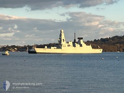
HMS DAUNTLESS
Military ops
Current Trip
| Trip Time | --- |
|---|---|
| Trip Distance | --- |
| AVG Speed | --- |
| MAX Speed | --- |
| Djupgående | --- |
| AVG Wind | --- |
| MAX Wind | --- |
| MIN Temp | --- |
| MAX Temp | --- |
| Position mottagen | 7 d sen |
Current Position
| Longitud | --- |
|---|---|
| Latitude | --- |
| Status | Under way using engine |
| Fart | |
| Kurs | 91° |
| Område | English Channel |
| Station | T-AIS |
| Position mottagen | 7 d sen |
Info
Information
The current position of HMS DAUNTLESS is in English Channel with coordinates 50.80703° / -1.10840° as reported on 2025-11-30 08:59 by AIS to our vessel tracker app. The vessel's current speed is 0 Knop and is currently inside the port of PORTSMOUTH.
The vessel HMS DAUNTLESS (MMSI: 234586000) is a Military ops It's sailing under the flag of [GB] United Kingdom.
In this page you can find informations about the vessels current position, last detected port calls, and current voyage information. If the vessels is not in coverage by AIS you will find the latest position.
The current position of HMS DAUNTLESS is detected by our AIS receivers and we are not responsible for the reliability of the data. The last position was recorded while the vessel was in Coverage by the Ais receivers of our vessel tracking app.
Weather
| Temperature | 6.1°C / 42.98°F |
|---|---|
| Wind Speed | 12 knots |
| Direction | 286° WNW |
| Pressure | 1015.3 hPa |
| Humidity | 78 % |
| Cloud Coverage | 4 % |
Featured Company
Last Port Calls
| Port | Arrival | Departure | Time In Port |
|---|---|---|---|
| 2025-11-30 08:48 | |||
| 2025-11-15 17:31 | |||
| 2025-11-05 16:27 | |||
| 2025-10-30 05:25 |
Most Visited Ports (Last year)
| Port | Arrivals | |
|---|---|---|
| 5 | ||
| 4 | ||
| 3 | ||
| 2 | ||
| 2 | ||
| 2 |
Last Trips
| Origin | Departure | Destination | Arrival | Distance | |
|---|---|---|---|---|---|
| 2025-11-05 16:27 | 2025-11-15 17:31 | 647.76 nm | |||
| 2025-09-02 12:10 | 2025-10-30 05:25 | 5252.95 nm |
Events
| Tid | Event | Detaljer | Position / Dest | Information |
|---|---|---|---|---|
| 2025-11-30 08:59 | UTANFÖR täckningsområde |
50.80703 / -1.10840
English Channel
[GB] PORTSMOUTH
|
Fart: Kurs: 123.2° |
|
| 2025-11-30 08:49 | STOPPAR förflyttning |
50.80722 / -1.10850
[GB] PORTSMOUTH
|
Fart: Kurs: 90° |
|
| 2025-11-30 08:48 | ANLÄNDER HAMN |
|
50.80727 / -1.10860
[GB] PORTSMOUTH
|
Fart: 0.6 kn Kurs: 92° |
| 2025-11-30 06:43 | I täckningsområde |
50.52318 / -1.09760
English Channel
|
Fart: 19.2 kn Kurs: 82.2° |
|
| 2025-11-29 20:09 | UTANFÖR täckningsområde |
50.31282 / -4.17310
English Channel
|
Fart: 14.1 kn Kurs: 172° |
|
| 2025-11-29 19:56 | STARTAR förflyttning | 1.37 nm, South of PLYMOUTH |
50.34062 / -4.14882
I
|
Fart: 4.1 kn Kurs: 247° |
| 2025-11-29 18:37 | Status ändrad | Under way using engine At anchor |
50.34220 / -4.14717
I
|
Fart: Kurs: 297° |
| 2025-11-29 18:17 | Status ändrad | At anchor Under way using engine |
50.34270 / -4.14805
I
|
Fart: 1.1 kn Kurs: 307° |
| 2025-11-29 17:18 | Status ändrad | Under way using engine At anchor |
50.34183 / -4.14827
I
|
Fart: Kurs: 313° |
| 2025-11-29 16:18 | Status ändrad | At anchor Under way using engine |
50.34240 / -4.14915
I
|
Fart: 0.4 kn Kurs: 303° |