

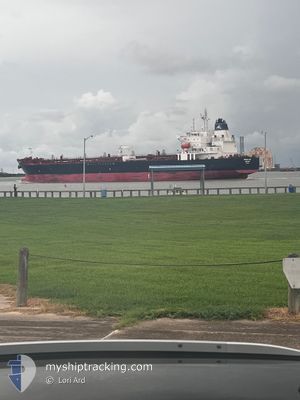
HEROLDS BAY
Tanker

Current Trip
| Time Travelled | 1 day |
|---|---|
| Remaining Time | --- |
| Distance Travelled | 411.03 nm |
| Remaining Distance | --- |
| AVG Speed | 14.6 Knop |
| MAX Speed | 15.7 Knop |
| AVG Wind | 13.9 knots |
| MAX Wind | 19.7 knots |
| MIN Temp | 25.8°C / 78.44°F |
| MAX Temp | 29.3°C / 84.74°F |
| Djupgående | 9.2 m |
| Position mottagen | 1 d sen |
Current Position
| Longitud | --- |
|---|---|
| Latitude | --- |
| Status | Under way using engine |
| Fart | 13.5 Knop |
| Kurs | 181.1° |
| Område | Caribbean Sea |
| Station | T-AIS |
| Position mottagen | 1 d sen |
Information
The current position of HEROLDS BAY is in Caribbean Sea with coordinates 18.32762° / -70.00548° as reported on 2025-03-28 15:16 by AIS to our vessel tracker app. The vessel's current speed is 13.5 Knop and is heading at the port of BEAUMONT. The estimated time of arrival as calculated by MyShipTracking vessel tracking app is 2025-04-02 03:00 LT
The vessel HEROLDS BAY (IMO: 9967251, MMSI: 563194700) is a Tanker It's sailing under the flag of [SG] Singapore.
In this page you can find informations about the vessels current position, last detected port calls, and current voyage information. If the vessels is not in coverage by AIS you will find the latest position.
The current position of HEROLDS BAY is detected by our AIS receivers and we are not responsible for the reliability of the data. The last position was recorded while the vessel was in Coverage by the Ais receivers of our vessel tracking app.
The current draught of HEROLDS BAY as reported by AIS is 9.2 meters
Weather
| Temperature | 26.9°C / 80.42°F |
|---|---|
| Wind Speed | 12 knots |
| Direction | 125° SE |
| Pressure | 1015.2 hPa |
| Humidity | 72.1 % |
| Cloud Coverage | 20 % |


Featured Company
Last Port Calls
| Port | Arrival | Departure | Time In Port |
|---|---|---|---|
| 2025-03-26 02:54 | 2025-03-28 10:48 | 2 d | |
| 2025-03-23 10:43 | 2025-03-24 12:16 | 1 d | |
| 2025-03-20 00:13 | 2025-03-21 13:47 | 1 d | |
| 2025-03-13 08:54 | 2025-03-14 18:50 | 1 d | |
| 2025-01-20 05:06 | 2025-01-24 02:53 | 3 d | |
| 2024-12-31 19:44 | 2025-01-02 14:00 | 1 d |
Most Visited Ports (Last year)
| Port | Arrivals | |
|---|---|---|
| 4 | ||
| 4 | ||
| 4 | ||
| 2 | ||
| 2 | ||
| 2 |
Last Trips
| Origin | Departure | Destination | Arrival | Distance | |
|---|---|---|---|---|---|
| 2025-03-24 12:16 | 2025-03-26 02:54 | 440.99 nm | |||
| 2025-03-21 13:47 | 2025-03-23 10:43 | 542.12 nm | |||
| 2025-03-14 18:50 | 2025-03-20 00:13 | 1581.39 nm | |||
| 2025-01-24 02:53 | 2025-03-13 08:54 | 3107.35 nm | |||
| 2025-01-02 14:00 | 2025-01-20 05:06 | 3169.85 nm | |||
| 2024-12-22 04:05 | 2024-12-31 19:44 | 2245.77 nm |
Events
| Tid | Event | Detaljer | Position / Dest | Information |
|---|---|---|---|---|
| 2025-03-28 15:30 | Status ändrad | Default Under way using engine |
18.27525 / -70.01162
BEAUMONT
|
Fart: 13.5 kn Kurs: 181.1° |
| 2025-03-28 15:16 | UTANFÖR täckningsområde |
18.32762 / -70.00548
Caribbean Sea
BEAUMONT
|
Fart: 13.5 kn Kurs: 181.1° |
|
| 2025-03-28 15:00 | Djupgående ändrat | 9.2 11.7 |
18.38417 / -70.01266
BEAUMONT
|
Fart: 9.3 kn Kurs: 166.4° |
| 2025-03-28 15:00 | Destination ändrad | BEAUMONT CRISTOBAL |
18.38417 / -70.01266
BEAUMONT
|
Fart: 9.3 kn Kurs: 166.4° |
| 2025-03-28 15:00 | ETA ändrat | 2025/04/02 08:00 2025/03/20 01:00 |
18.38417 / -70.01266
BEAUMONT
|
Fart: 9.3 kn Kurs: 166.4° |
| 2025-03-28 14:50 | Status ändrad | Under way using engine Default |
18.40267 / -70.01655
CRISTOBAL
|
Fart: 6 kn Kurs: 175° |
| 2025-03-28 14:48 | STARTAR förflyttning | 0.75 nm, South of RIO HAINA |
18.40620 / -70.01685
CRISTOBAL
|
Fart: 6 kn Kurs: 175° |
| 2025-03-28 14:48 | AVGÅTT HAMN |
|
18.40620 / -70.01685
CRISTOBAL
|
Fart: 2.2 kn Kurs: 171° |
| 2025-03-28 14:40 | I täckningsområde |
18.39899 / -70.01630
Caribbean Sea
|
Fart: 5.6 kn Kurs: 178.6° |
|
| 2025-03-26 05:56 | UTANFÖR täckningsområde |
18.38201 / -70.01332
Caribbean Sea
|
Fart: 6.3 kn Kurs: 353.1° |