
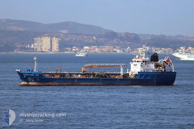
HERCULES 400
Tanker
Current Trip
| Time Travelled | 11 h, 19 mins |
|---|---|
| Remaining Time | 4 days |
| Distance Travelled | 55.01 nm |
| Remaining Distance | 656.52 nm |
| AVG Speed | 5.1 Knop |
| MAX Speed | 7.5 Knop |
| AVG Wind | 12.1 knots |
| MAX Wind | 20 knots |
| MIN Temp | 14.3°C / 57.74°F |
| MAX Temp | 20.3°C / 68.54°F |
| Djupgående | 6.1 m |
| Position mottagen | 2 h, 53 m sen |
Current Position
| Longitud | -6.08359° |
|---|---|
| Latitude | 35.95226° |
| Status | Under way using engine |
| Fart | 6.5 Knop |
| Kurs | 267.3° |
| Område | North Atlantic Ocean |
| Station | T-AIS |
| Position mottagen | 2 h, 53 m sen |
Info
Information
The current position of HERCULES 400 is in North Atlantic Ocean with coordinates 35.95226° / -6.08359° as reported on 2024-05-22 01:13 by AIS to our vessel tracker app. The vessel's current speed is 6.5 Knop and is heading at the port of LAS PALMAS. The estimated time of arrival as calculated by MyShipTracking vessel tracking app is 2024-05-26 09:24 LT
The vessel HERCULES 400 (IMO: 9644952, MMSI: 255707000) is a Tanker It's sailing under the flag of [PT] Portugal.
In this page you can find informations about the vessels current position, last detected port calls, and current voyage information. If the vessels is not in coverage by AIS you will find the latest position.
The current position of HERCULES 400 is detected by our AIS receivers and we are not responsible for the reliability of the data. The last position was recorded while the vessel was in Coverage by the Ais receivers of our vessel tracking app.
The current draught of HERCULES 400 as reported by AIS is 6.1 meters
Weather
| Temperature | 17.5°C / 63.5°F |
|---|---|
| Wind Speed | 14 knots |
| Direction | 1° N |
| Pressure | 1019 hPa |
| Humidity | 73 % |
| Cloud Coverage | --- |
Featured Company
Last Port Calls
| Port | Arrival | Departure | Time In Port |
|---|---|---|---|
| 2024-05-21 08:16 | 2024-05-21 16:47 | 8 h | |
| 2024-05-20 11:50 | 2024-05-21 07:49 | 19 h | |
| 2024-05-19 03:49 | 2024-05-19 03:53 | 3 m | |
| 2024-05-18 12:02 | 2024-05-18 12:18 | 16 m | |
| 2024-05-15 19:20 | 2024-05-15 19:21 | 1 m | |
| 2024-05-15 10:06 | 2024-05-15 10:13 | 6 m | |
| 2024-05-14 08:39 | 2024-05-14 20:54 | 12 h | |
| 2024-05-14 08:19 | 2024-05-14 08:23 | 4 m | |
| 2024-05-13 19:49 | 2024-05-14 00:07 | 4 h | |
| 2024-05-12 21:30 | 2024-05-13 12:54 | 15 h |
Last Trips
| Origin | Departure | Destination | Arrival | Distance | |
|---|---|---|---|---|---|
| 2024-05-21 09:49 | 2024-05-21 10:16 | 2.51 nm | |||
| 2024-05-19 05:53 | 2024-05-20 13:50 | 16.07 nm | |||
| 2024-05-18 14:18 | 2024-05-19 05:49 | 9.14 nm | |||
| 2024-05-15 21:21 | 2024-05-18 14:02 | 19.78 nm | |||
| 2024-05-15 12:13 | 2024-05-15 21:20 | 5.83 nm | |||
| 2024-05-14 22:54 | 2024-05-15 12:06 | 1.44 nm | |||
| 2024-05-14 10:23 | 2024-05-14 10:39 | 1.50 nm | |||
| 2024-05-14 02:07 | 2024-05-14 10:19 | 3.41 nm | |||
| 2024-05-13 14:54 | 2024-05-13 21:49 | 5.19 nm | |||
| 2024-05-11 15:34 | 2024-05-12 23:30 | 10.48 nm |
Events
| Tid | Event | Detaljer | Position / Dest | Information |
|---|---|---|---|---|
| 2024-05-22 01:44 | Status ändrad | Default Under way using engine |
35.95047 / -6.15086
LAS PALMAS
|
Fart: 6.5 kn Kurs: 267.3° |
| 2024-05-22 01:13 | UTANFÖR täckningsområde |
35.95226 / -6.08359
North Atlantic Ocean
LAS PALMAS
|
Fart: 6.5 kn Kurs: 267.3° |
|
| 2024-05-22 00:23 | Byter havsområde | Moroccan part of the North Atlantic Ocean Moroccan part of the Strait of Gibraltar |
35.94982 / -5.97093
North Atlantic Ocean
LAS PALMAS
|
Fart: 6.2 kn Kurs: 265.9° |
| 2024-05-21 23:47 | Upptäckt i hav | Moroccan part of the Strait of Gibraltar |
35.95037 / -5.88846
Strait of Gibraltar
LAS PALMAS
|
Fart: 6.8 kn Kurs: 269.9° |
| 2024-05-21 18:51 | ETA ändrat | 2024/05/28 08:00 2024/05/26 16:30 |
36.03771 / -5.39277
LAS PALMAS
|
Fart: 2.6 kn Kurs: 241° |
| 2024-05-21 18:22 | Djupgående ändrat | 6.1 6.2 |
36.05631 / -5.38028
LAS PALMAS
|
Fart: 2.3 kn Kurs: 236° |
| 2024-05-21 18:17 | Djupgående ändrat | 6.2 6.1 |
36.05933 / -5.37806
LAS PALMAS
|
Fart: 2.7 kn Kurs: 232° |
| 2024-05-21 17:59 | Byter havsområde | Spanish part of the Strait of Gibraltar Gibraltarian part of the Strait of Gibraltar |
36.07473 / -5.37502
Strait of Gibraltar
LAS PALMAS
|
Fart: 3.8 kn Kurs: 199.7° |
| 2024-05-21 17:09 | STARTAR förflyttning | 0.8 nm, West of GIBRALTAR |
36.14956 / -5.37887
LAS PALMAS
|
Fart: 3.1 kn Kurs: 195° |
| 2024-05-21 16:55 | STOPPAR förflyttning | 0.72 nm, West of GIBRALTAR |
36.15143 / -5.37667
LAS PALMAS
|
Fart: 0.3 kn Kurs: 239° |