

HELME
General Cargo

Current Trip
| Time Travelled | 9 days |
|---|---|
| Remaining Time | 2 days |
| Distance Travelled | 2712.29 nm |
| Remaining Distance | 774.93 nm |
| AVG Speed | 12.9 Knop |
| MAX Speed | 17.2 Knop |
| AVG Wind | 13.2 knots |
| MAX Wind | 27.2 knots |
| MIN Temp | -0.7°C / 30.74°F |
| MAX Temp | 17.8°C / 64.04°F |
| Djupgående | 7.6 m |
| Position mottagen | 1 m sen |
Current Position
| Longitud | --- |
|---|---|
| Latitude | --- |
| Status | Under way using engine |
| Fart | 13.4 Knop |
| Kurs | 75.1° |
| Område | Alboran Sea |
| Station | T-AIS |
| Position mottagen | 1 m sen |
Information
The current position of HELME is in Alboran Sea with coordinates 36.22310° / -3.22671° as reported on 2025-03-29 01:40 by AIS to our vessel tracker app. The vessel's current speed is 13.4 Knop and is heading at the port of LIVORNO. The estimated time of arrival as calculated by MyShipTracking vessel tracking app is 2025-03-31 09:53 LT
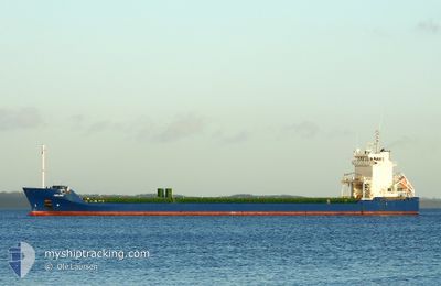
The vessel HELME (IMO: 9504140, MMSI: 210504000) is a General Cargo that was built in 2011 ( 14 År gammal ). It's sailing under the flag of [CY] Cyprus.
In this page you can find informations about the vessels current position, last detected port calls, and current voyage information. If the vessels is not in coverage by AIS you will find the latest position.
The current position of HELME is detected by our AIS receivers and we are not responsible for the reliability of the data. The last position was recorded while the vessel was in Coverage by the Ais receivers of our vessel tracking app.
The current draught of HELME as reported by AIS is 7.6 meters
Weather
| Temperature | 17.2°C / 62.96°F |
|---|---|
| Wind Speed | 4 knots |
| Direction | 354° N |
| Pressure | 1016.7 hPa |
| Humidity | 80.9 % |
| Cloud Coverage | --- |


Featured Company
Last Port Calls
| Port | Arrival | Departure | Time In Port |
|---|---|---|---|
| 2025-03-18 12:22 | 2025-03-19 20:18 | 1 d | |
| 2025-03-13 10:01 | 2025-03-18 05:30 | 4 d | |
| 2025-03-07 02:45 | 2025-03-10 18:57 | 3 d | |
| 2025-03-04 01:22 | 2025-03-04 06:35 | 5 h | |
| 2025-02-23 15:58 | 2025-02-25 16:45 | 2 d | |
| 2025-02-20 05:02 | 2025-02-21 13:59 | 1 d | |
| 2025-02-10 17:01 | 2025-02-12 17:37 | 2 d | |
| 2025-02-05 15:13 | 2025-02-07 14:33 | 1 d | |
| 2025-01-27 21:28 | 2025-01-29 03:14 | 1 d | |
| 2025-01-22 07:14 | 2025-01-22 20:36 | 13 h |
Last Trips
| Origin | Departure | Destination | Arrival | Distance | |
|---|---|---|---|---|---|
| 2025-03-18 06:30 | 2025-03-18 13:22 | 87.34 nm | |||
| 2025-03-10 19:57 | 2025-03-13 11:01 | 700.64 nm | |||
| 2025-03-04 07:35 | 2025-03-07 03:45 | 896.15 nm | |||
| 2025-02-25 17:45 | 2025-03-04 02:22 | 171.78 nm | |||
| 2025-02-21 14:59 | 2025-02-23 16:58 | 635.19 nm | |||
| 2025-02-12 19:37 | 2025-02-20 06:02 | 2028.66 nm | |||
| 2025-02-07 15:33 | 2025-02-10 19:01 | 956.42 nm | |||
| 2025-01-29 04:14 | 2025-02-05 16:13 | 1044.38 nm | |||
| 2025-01-22 21:36 | 2025-01-27 22:28 | 1039.74 nm | |||
| 2025-01-16 18:57 | 2025-01-22 08:14 | 1039.48 nm |
Events
| Tid | Event | Detaljer | Position / Dest | Information |
|---|---|---|---|---|
| 2025-03-28 18:26 | Byter havsområde | Spanish part of the Alboran Sea Spanish part of the Strait of Gibraltar |
35.97633 / -5.31778
Alboran Sea
ITLIV
|
Fart: 15.8 kn Kurs: 80.3° |
| 2025-03-28 18:17 | Byter havsområde | Spanish part of the Strait of Gibraltar Moroccan part of the Strait of Gibraltar |
35.96956 / -5.36714
Strait of Gibraltar
ITLIV
|
Fart: 16.7 kn Kurs: 80.1° |
| 2025-03-28 16:54 | Byter havsområde | Moroccan part of the Strait of Gibraltar Spanish part of the North Atlantic Ocean |
35.90748 / -5.81020
Strait of Gibraltar
ITLIV
|
Fart: 15.4 kn Kurs: 86.2° |
| 2025-03-28 16:54 | Status ändrad | Under way using engine Default |
35.90748 / -5.81020
ITLIV
|
Fart: 15.2 kn Kurs: 85° |
| 2025-03-28 16:52 | I täckningsområde |
35.90748 / -5.81020
Strait of Gibraltar
ITLIV
|
Fart: 15.4 kn Kurs: 86.2° |
|
| 2025-03-28 15:12 | Status ändrad | Default Under way using engine |
35.92609 / -6.31709
ITLIV
|
Fart: 13.9 kn Kurs: 106° |
| 2025-03-28 15:10 | UTANFÖR täckningsområde |
35.92846 / -6.32777
North Atlantic Ocean
ITLIV
|
Fart: 13.9 kn Kurs: 106° |
|
| 2025-03-28 15:00 | Status ändrad | Under way using engine Default |
35.93925 / -6.37378
ITLIV
|
Fart: 13.7 kn Kurs: 106° |
| 2025-03-28 14:56 | Status ändrad | Default Under way using engine |
35.94344 / -6.39165
ITLIV
|
Fart: 13.7 kn Kurs: 107.1° |
| 2025-03-28 14:28 | Status ändrad | Under way using engine Default |
35.97271 / -6.51383
ITLIV
|
Fart: 13.5 kn Kurs: 102° |