

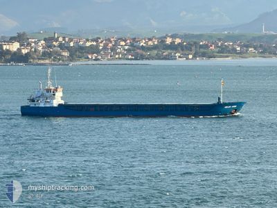
HELEN ANNA
General Cargo

Current Trip
GBSIL
| Time Travelled | 6 h, 50 mins |
|---|---|
| Remaining Time | --- |
| Distance Travelled | 63.39 nm |
| Remaining Distance | --- |
| AVG Speed | 9.4 Knop |
| MAX Speed | 10.5 Knop |
| AVG Wind | 15.1 knots |
| MAX Wind | 17.7 knots |
| MIN Temp | 7°C / 44.6°F |
| MAX Temp | 7.5°C / 45.5°F |
| Djupgående | 5.6 m |
| Position mottagen | 37 m sen |
Current Position
| Longitud | --- |
|---|---|
| Latitude | --- |
| Status | Under way using engine |
| Fart | 10.2 Knop |
| Kurs | 211.4° |
| Område | Irish Sea and St. George's Channel |
| Station | T-AIS |
| Position mottagen | 37 m sen |
Information
The current position of HELEN ANNA is in Irish Sea and St. George's Channel with coordinates 54.03306° / -4.23931° as reported on 2025-03-29 04:21 by AIS to our vessel tracker app. The vessel's current speed is 10.2 Knop
The vessel HELEN ANNA (IMO: 9582867, MMSI: 305639000) is a General Cargo that was built in 2010 ( 15 År gammal ). It's sailing under the flag of [AG] Antigua Barbuda.
In this page you can find informations about the vessels current position, last detected port calls, and current voyage information. If the vessels is not in coverage by AIS you will find the latest position.
The current position of HELEN ANNA is detected by our AIS receivers and we are not responsible for the reliability of the data. The last position was recorded while the vessel was in Coverage by the Ais receivers of our vessel tracking app.
The current draught of HELEN ANNA as reported by AIS is 5.6 meters
Weather
| Temperature | 7.5°C / 45.5°F |
|---|---|
| Wind Speed | 16 knots |
| Direction | 268° W |
| Pressure | 1018.3 hPa |
| Humidity | 79.1 % |
| Cloud Coverage | 100 % |


Featured Company
Last Port Calls
| Port | Arrival | Departure | Time In Port |
|---|---|---|---|
| 2025-03-27 10:02 | 2025-03-28 22:08 | 1 d | |
| 2025-03-16 09:56 | 2025-03-17 21:41 | 1 d | |
| 2025-03-11 01:17 | 2025-03-11 16:27 | 15 h | |
| 2025-03-05 06:11 | 2025-03-05 20:44 | 14 h | |
| 2025-03-03 18:00 | 2025-03-04 17:15 | 23 h | |
| 2025-02-16 06:55 | 2025-02-18 23:25 | 2 d | |
| 2025-02-08 09:40 | 2025-02-10 23:46 | 2 d | |
| 2025-02-06 14:48 | 2025-02-07 16:21 | 1 d | |
| 2025-02-03 09:05 | 2025-02-04 22:13 | 1 d | |
| 2025-02-01 03:14 | 2025-02-01 19:11 | 15 h |
Last Trips
| Origin | Departure | Destination | Arrival | Distance | |
|---|---|---|---|---|---|
| 2025-03-17 21:41 | 2025-03-27 10:02 | 1354.36 nm | |||
| 2025-03-11 16:27 | 2025-03-16 09:56 | 486.08 nm | |||
| 2025-03-05 20:44 | 2025-03-11 01:17 | 1118.91 nm | |||
| 2025-03-04 17:15 | 2025-03-05 06:11 | 105.21 nm | |||
| 2025-02-18 23:25 | 2025-03-03 18:00 | 1723.08 nm | |||
| 2025-02-10 23:46 | 2025-02-16 06:55 | 1065.08 nm | |||
| 2025-02-07 16:21 | 2025-02-08 09:40 | 140.93 nm | |||
| 2025-02-04 22:13 | 2025-02-06 14:48 | 198.57 nm | |||
| 2025-02-01 19:11 | 2025-02-03 09:05 | 201.16 nm | |||
| 2025-01-28 19:23 | 2025-02-01 03:14 | 673.15 nm |
Events
| Tid | Event | Detaljer | Position / Dest | Information |
|---|---|---|---|---|
| 2025-03-29 04:28 | Status ändrad | Default Under way using engine |
54.01600 / -4.25717
GBSIL
|
Fart: 10.2 kn Kurs: 211.4° |
| 2025-03-29 04:21 | Upptäckt i hav | United Kingdom part of the Irish Sea and St. George's Channel |
54.03306 / -4.23931
Irish Sea and St. George's Channel
|
Fart: 10.2 kn Kurs: 211.4° |
| 2025-03-29 04:21 | Status ändrad | Under way using engine Default |
54.03306 / -4.23931
GBSIL
|
Fart: 10.3 kn Kurs: 211° |
| 2025-03-29 04:08 | I täckningsområde |
54.03306 / -4.23931
Irish Sea and St. George's Channel
|
Fart: 10.2 kn Kurs: 211.4° |
|
| 2025-03-28 22:08 | AVGÅTT HAMN |
|
54.86961 / -3.40587
GBSIL
|
Fart: 4.6 kn Kurs: 303° |
| 2025-03-28 22:04 | STARTAR förflyttning |
54.86972 / -3.39861
[GB] SILLOTH
|
Fart: 4.6 kn Kurs: 303° |
|
| 2025-03-27 10:08 | STOPPAR förflyttning |
54.86767 / -3.39266
[GB] SILLOTH
|
Fart: 0.3 kn Kurs: 110° |
|
| 2025-03-27 10:02 | ANLÄNDER HAMN |
|
54.86855 / -3.39626
[GB] SILLOTH
|
Fart: 2.9 kn Kurs: 141° |
| 2025-03-27 07:51 | STARTAR förflyttning | 1.47 nm, North West of WORKINGTON |
54.65736 / -3.59949
GBSIL
|
Fart: 5.3 kn Kurs: 28° |
| 2025-03-24 04:03 | STOPPAR förflyttning | 2.28 nm, North West of WORKINGTON |
54.67229 / -3.61066
GBSIL
|
Fart: 0.3 kn Kurs: 169° |