
HARMONY II
Exhibition Ship
Current Trip
| Trip Time | 8 days |
|---|---|
| Trip Distance | 371.13 nm |
| AVG Speed | 6.4 Knop |
| MAX Speed | 9.2 Knop |
| Djupgående | 3.2 m |
| AVG Wind | 9.4 knots |
| MAX Wind | 20.6 knots |
| MIN Temp | 20.7°C / 69.26°F |
| MAX Temp | 26.6°C / 79.88°F |
| Position mottagen | 2 m sen |
Current Position
| Longitud | -0.32808° |
|---|---|
| Latitude | 39.45899° |
| Status | Under way using engine |
| Fart | |
| Kurs | 93° |
| Område | Balearic Sea |
| Station | T-AIS |
| Position mottagen | 2 m sen |
Info
Information
The current position of HARMONY II is in Balearic Sea with coordinates 39.45899° / -0.32808° as reported on 2024-09-17 21:43 by AIS to our vessel tracker app. The vessel's current speed is 0 Knop and is currently inside the port of VALENCIA.
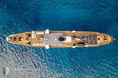
The vessel HARMONY II (IMO: 5242627, MMSI: 225995883) is a Exhibition Ship that was built in 1955 ( 69 År gammal ). It's sailing under the flag of [ES] Spain.
In this page you can find informations about the vessels current position, last detected port calls, and current voyage information. If the vessels is not in coverage by AIS you will find the latest position.
The current position of HARMONY II is detected by our AIS receivers and we are not responsible for the reliability of the data. The last position was recorded while the vessel was in Coverage by the Ais receivers of our vessel tracking app.
The current draught of HARMONY II as reported by AIS is 3.2 meters
Weather
| Temperature | 23.3°C / 73.94°F |
|---|---|
| Wind Speed | 11 knots |
| Direction | 127° SE |
| Pressure | 1013.9 hPa |
| Humidity | 67.6 % |
| Cloud Coverage | 16 % |
Featured Company
Last Trips
Events
| Tid | Event | Detaljer | Position / Dest | Information |
|---|---|---|---|---|
| 2024-09-16 05:55 | STOPPAR förflyttning |
39.45875 / -.32661
[ES] VALENCIA
|
Fart: 0.2 kn Kurs: 191° |
|
| 2024-09-16 05:39 | ANLÄNDER HAMN |
|
39.46295 / -.30958
[ES] VALENCIA
|
Fart: 4.5 kn Kurs: 176° |
| 2024-09-16 05:14 | STARTAR förflyttning | 1.26 nm, East of VALENCIA |
39.43586 / -.28111
VALENCIA
|
Fart: 3.3 kn Kurs: 255° |
| 2024-09-16 05:02 | STOPPAR förflyttning | 1.34 nm, East of VALENCIA |
39.43707 / -.27923
VALENCIA
|
Fart: 0.3 kn Kurs: 249° |
| 2024-09-16 04:22 | Djupgående ändrat | 3.2 3 |
39.42101 / -.22789
VALENCIA
|
Fart: 6.9 kn Kurs: 297.2° |
| 2024-09-16 04:22 | Destination ändrad | VALENCIA IBIZA |
39.42101 / -.22789
VALENCIA
|
Fart: 6.9 kn Kurs: 297.2° |
| 2024-09-16 04:22 | ETA ändrat | 2024/09/16 07:00 |
39.42101 / -.22789
VALENCIA
|
Fart: 6.9 kn Kurs: 297.2° |
| 2024-09-16 04:05 | I täckningsområde |
39.40815 / -.19425
Balearic Sea
|
Fart: 7.6 kn Kurs: 295.2° |
|
| 2024-09-15 19:02 | UTANFÖR täckningsområde |
38.87679 / 1.14924
Balearic Sea
|
Fart: 7.9 kn Kurs: 302° |
|
| 2024-09-15 18:12 | STARTAR förflyttning | 6.4 nm, South of SANT ANTONI |
38.86940 / 1.29035
IBIZA
|
Fart: 4.9 kn Kurs: 231° |