
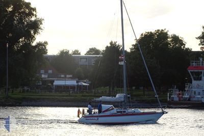
HARLEKIN
Sailing
Current Trip
| Trip Time | 3 h, 54 mins |
|---|---|
| Trip Distance | 23.30 nm |
| AVG Speed | 5.6 Knop |
| MAX Speed | 9.2 Knop |
| Djupgående | --- |
| AVG Wind | 8.7 knots |
| MAX Wind | 9.8 knots |
| MIN Temp | 17.4°C / 63.32°F |
| MAX Temp | 18.2°C / 64.76°F |
| Position mottagen | 5 d sen |
Current Position
| Longitud | 6.93066° |
|---|---|
| Latitude | 53.32960° |
| Status | Default |
| Fart | |
| Kurs | --- |
| Område | North Sea |
| Station | T-AIS |
| Position mottagen | 5 d sen |
Info
Information
The current position of HARLEKIN is in North Sea with coordinates 53.32960° / 6.93066° as reported on 2024-05-11 17:41 by AIS to our vessel tracker app. The vessel's current speed is 0 Knop and is currently inside the port of DELFZIJL.
The vessel HARLEKIN (MMSI: 211492390) is a Sailing It's sailing under the flag of [DE] Germany.
In this page you can find informations about the vessels current position, last detected port calls, and current voyage information. If the vessels is not in coverage by AIS you will find the latest position.
The current position of HARLEKIN is detected by our AIS receivers and we are not responsible for the reliability of the data. The last position was recorded while the vessel was in Coverage by the Ais receivers of our vessel tracking app.
Weather
| Temperature | 17.4°C / 63.32°F |
|---|---|
| Wind Speed | 9 knots |
| Direction | 70° ENE |
| Pressure | 1022.7 hPa |
| Humidity | 76.8 % |
| Cloud Coverage | 2 % |
Featured Company
Events
| Tid | Event | Detaljer | Position / Dest | Information |
|---|---|---|---|---|
| 2024-05-11 17:41 | UTANFÖR täckningsområde |
53.32960 / 6.93066
North Sea
[NL] DELFZIJL
|
Fart: Kurs: 129.8° |
|
| 2024-05-11 16:57 | STOPPAR förflyttning |
53.32960 / 6.93066
[NL] DELFZIJL
|
Fart: Kurs: 511° |
|
| 2024-05-11 16:57 | ANLÄNDER HAMN |
|
53.32960 / 6.93066
[NL] DELFZIJL
|
Fart: 2.4 kn Kurs: 511° |
| 2024-05-11 16:19 | Byter havsområde | Dutch part of the North Sea German part of the North Sea |
53.31647 / 7.00626
North Sea
|
Fart: 5.1 kn Kurs: 228.3° |
| 2024-05-11 13:03 | AVGÅTT HAMN |
|
53.21012 / 7.42437
|
Fart: 4.3 kn Kurs: 286.3° |
| 2024-05-11 12:49 | STARTAR förflyttning |
53.21487 / 7.44766
[DE] LEER
|
Fart: 5.4 kn Kurs: 236.3° |
|
| 2024-05-11 11:29 | I täckningsområde |
53.21905 / 7.44941
North Sea
[DE] LEER
|
Fart: Kurs: 353° |
|
| 2024-05-10 10:58 | UTANFÖR täckningsområde |
53.21906 / 7.44945
North Sea
[DE] LEER
|
Fart: 0.4 kn Kurs: 229.1° |
|
| 2024-05-10 10:18 | I täckningsområde |
53.21945 / 7.45001
North Sea
[DE] LEER
|
Fart: 3.5 kn Kurs: 330.5° |