

GYAS
Other Type

Current Trip
VOERDE
| Time Travelled | 5 days |
|---|---|
| Remaining Time | --- |
| Distance Travelled | 0.11 nm |
| Remaining Distance | --- |
| AVG Speed | 3.5 Knop |
| MAX Speed | 3.5 Knop |
| AVG Wind | 9.2 knots |
| MAX Wind | 10 knots |
| MIN Temp | 14.6°C / 58.28°F |
| MAX Temp | 15.2°C / 59.36°F |
| Djupgående | 2.3 m |
| Position mottagen | 5 d sen |
Current Position
| Longitud | --- |
|---|---|
| Latitude | --- |
| Status | Under way using engine |
| Fart | |
| Kurs | --- |
| Område | North Sea |
| Station | T-AIS |
| Position mottagen | 5 d sen |
Information
The current position of GYAS is in North Sea with coordinates 51.63055° / 6.64597° as reported on 2025-04-22 12:53 by AIS to our vessel tracker app. The vessel's current speed is 0 Knop
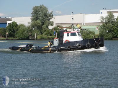
The vessel GYAS (MMSI: 244780905) is a Other Type It's sailing under the flag of [NL] Netherlands.
In this page you can find informations about the vessels current position, last detected port calls, and current voyage information. If the vessels is not in coverage by AIS you will find the latest position.
The current position of GYAS is detected by our AIS receivers and we are not responsible for the reliability of the data. The last position was recorded while the vessel was in Coverage by the Ais receivers of our vessel tracking app.
The current draught of GYAS as reported by AIS is 2.3 meters
Weather
| Temperature | 14.7°C / 58.46°F |
|---|---|
| Wind Speed | 8 knots |
| Direction | 249° WSW |
| Pressure | 1017.2 hPa |
| Humidity | 67.8 % |
| Cloud Coverage | 84 % |


Featured Company
Last Port Calls
| Port | Arrival | Departure | Time In Port |
|---|---|---|---|
| 2025-04-16 18:46 | 2025-04-22 00:12 | 5 d | |
| 2025-04-14 11:17 | 2025-04-15 08:17 | 21 h | |
| 2025-04-13 13:15 | 2025-04-14 06:41 | 17 h | |
| 2025-04-13 10:57 | 2025-04-13 11:27 | 29 m | |
| 2025-04-10 16:39 | 2025-04-13 10:48 | 2 d | |
| 2025-04-10 15:38 | 2025-04-10 16:03 | 25 m | |
| 2025-04-09 13:40 | 2025-04-10 13:26 | 23 h | |
| 2025-04-09 09:02 | 2025-04-09 12:34 | 3 h | |
| 2025-03-25 09:08 | 2025-04-09 07:44 | 14 d | |
| 2025-03-24 13:43 | 2025-03-25 08:12 | 18 h |
Last Trips
| Origin | Departure | Destination | Arrival | Distance | |
|---|---|---|---|---|---|
| 2025-04-15 08:17 | 2025-04-16 18:46 | 99.66 nm | |||
| 2025-04-14 06:41 | 2025-04-14 11:17 | 10.83 nm | |||
| 2025-04-13 11:27 | 2025-04-13 13:15 | 2.26 nm | |||
| 2025-04-13 10:48 | 2025-04-13 10:57 | 0.01 nm | |||
| 2025-04-10 16:03 | 2025-04-10 16:39 | 2.77 nm | |||
| 2025-04-10 13:26 | 2025-04-10 15:38 | 12.26 nm | |||
| 2025-04-09 12:34 | 2025-04-09 13:40 | 8.64 nm | |||
| 2025-04-09 07:44 | 2025-04-09 09:02 | 8.42 nm | |||
| 2025-03-25 08:12 | 2025-03-25 09:08 | 4.97 nm | |||
| 2025-03-24 09:31 | 2025-03-24 13:43 | 16.88 nm |
Events
| Tid | Event | Detaljer | Position / Dest | Information |
|---|---|---|---|---|
| 2025-04-22 12:53 | UTANFÖR täckningsområde |
51.63055 / 6.64597
North Sea
|
Fart: Kurs: 317.4° |
|
| 2025-04-22 10:11 | STOPPAR förflyttning | 2.09 nm, South East of WESEL |
51.63045 / 6.64570
VOERDE
|
Fart: Kurs: 511° |
| 2025-04-22 10:08 | I täckningsområde |
51.63043 / 6.64573
North Sea
|
Fart: 0.5 kn Kurs: 340.4° |
|
| 2025-04-21 22:12 | AVGÅTT HAMN |
|
51.63077 / 6.64727
VOERDE
|
Fart: 6.3 kn Kurs: 220.4° |