
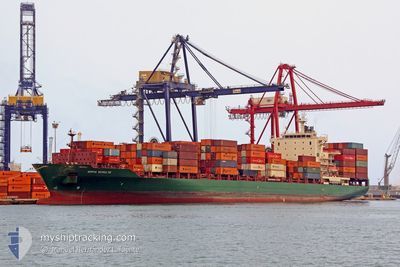
GSL MERCER
Container Ship
Current Trip
| Time Travelled | 6 h, 39 mins |
|---|---|
| Remaining Time | --- |
| Distance Travelled | 12.08 nm |
| Remaining Distance | --- |
| AVG Speed | 10 Knop |
| MAX Speed | 11.7 Knop |
| AVG Wind | 3.5 knots |
| MAX Wind | 6 knots |
| MIN Temp | 26.8°C / 80.24°F |
| MAX Temp | 28.1°C / 82.58°F |
| Djupgående | 9.1 m |
| Position mottagen | 1 d sen |
Current Position
| Longitud | -76.36149° |
|---|---|
| Latitude | 10.21296° |
| Status | Under way using engine |
| Fart | 11.7 Knop |
| Kurs | 259.8° |
| Område | Caribbean Sea |
| Station | T-AIS |
| Position mottagen | 1 d sen |
Info
Information
The current position of GSL MERCER is in Caribbean Sea with coordinates 10.21296° / -76.36149° as reported on 2024-05-02 22:47 by AIS to our vessel tracker app. The vessel's current speed is 11.7 Knop
The vessel GSL MERCER (IMO: 9337274, MMSI: 636018378) is a Container Ship that was built in 2007 ( 17 År gammal ). It's sailing under the flag of [LR] Liberia.
In this page you can find informations about the vessels current position, last detected port calls, and current voyage information. If the vessels is not in coverage by AIS you will find the latest position.
The current position of GSL MERCER is detected by our AIS receivers and we are not responsible for the reliability of the data. The last position was recorded while the vessel was in Coverage by the Ais receivers of our vessel tracking app.
The current draught of GSL MERCER as reported by AIS is 9.1 meters
Weather
| Temperature | 27.9°C / 82.22°F |
|---|---|
| Wind Speed | 6 knots |
| Direction | 346° NNW |
| Pressure | 1008.6 hPa |
| Humidity | 69.8 % |
| Cloud Coverage | 100 % |
Featured Company
Last Port Calls
| Port | Arrival | Departure | Time In Port |
|---|---|---|---|
| 2024-05-03 23:57 | 2024-05-04 12:54 | 12 h | |
| 2024-05-02 03:34 | 2024-05-02 18:13 | 14 h | |
| 2024-04-19 02:45 | 2024-04-20 13:23 | 1 d | |
| 2024-04-13 18:08 | 2024-04-16 10:31 | 2 d | |
| 2024-04-03 07:12 | 2024-04-04 00:35 | 17 h | |
| 2024-04-01 17:19 | 2024-04-02 17:09 | 23 h | |
| 2024-03-30 23:15 | 2024-03-31 15:35 | 16 h | |
| 2024-03-25 22:12 | 2024-03-26 10:31 | 12 h | |
| 2024-03-20 18:48 | 2024-03-22 05:22 | 1 d | |
| 2024-03-12 16:31 |
Most Visited Ports (Last year)
| Port | Arrivals | |
|---|---|---|
| 12 | ||
| 11 | ||
| 11 | ||
| 11 | ||
| 9 | ||
| 7 |
Last Trips
| Origin | Departure | Destination | Arrival | Distance | |
|---|---|---|---|---|---|
| 2024-05-02 13:13 | 2024-05-03 18:57 | 284.54 nm | |||
| 2024-04-20 10:23 | 2024-05-01 22:34 | 2425.60 nm | |||
| 2024-04-16 06:31 | 2024-04-18 23:45 | 1134.42 nm | |||
| 2024-04-03 19:35 | 2024-04-13 14:08 | 3135.31 nm | |||
| 2024-04-02 12:09 | 2024-04-03 02:12 | 23.48 nm | |||
| 2024-03-31 10:35 | 2024-04-01 12:19 | 285.68 nm | |||
| 2024-03-26 06:31 | 2024-03-30 18:15 | 1038.41 nm | |||
| 2024-03-22 02:22 | 2024-03-25 18:12 | 1267.39 nm | |||
| 2024-03-02 19:51 | 2024-03-12 12:31 | 3068.11 nm | |||
| 2024-03-01 19:17 | 2024-03-01 21:21 | 14.37 nm |
Events
| Tid | Event | Detaljer | Position / Dest | Information |
|---|---|---|---|---|
| 2024-05-04 14:23 | STOPPAR förflyttning | 5.04 nm, North of LAS MINAS |
9.47519 / -79.82021
PACTB
|
Fart: 0.3 kn Kurs: 226° |
| 2024-05-04 12:54 | AVGÅTT HAMN |
|
9.36821 / -79.89220
PACTB
|
Fart: 3.2 kn Kurs: 258° |
| 2024-05-04 12:50 | STARTAR förflyttning |
9.36622 / -79.88671
[PA] MANZANILLO
|
Fart: 3.2 kn Kurs: 258° |
|
| 2024-05-03 23:58 | STOPPAR förflyttning |
9.36708 / -79.88430
[PA] MANZANILLO
|
Fart: 0.1 kn Kurs: 247° |
|
| 2024-05-03 23:57 | ANLÄNDER HAMN |
|
9.36708 / -79.88430
[PA] MANZANILLO
|
Fart: 1.5 kn Kurs: 247° |
| 2024-05-03 21:52 | STARTAR förflyttning | 6.42 nm, North of SAMBA BONITA |
9.49242 / -79.87175
PACTB
|
Fart: 4.6 kn Kurs: 277° |
| 2024-05-03 19:13 | STOPPAR förflyttning | 6.2 nm, North West of SAMBA BONITA |
9.48497 / -79.88029
PACTB
|
Fart: 0.3 kn Kurs: 33° |
| 2024-05-02 22:47 | Status ändrad | Default Under way using engine |
10.21296 / -76.36149
PACTB
|
Fart: 11.7 kn Kurs: 259.8° |
| 2024-05-02 22:47 | Status ändrad | Under way using engine Default |
10.21296 / -76.36149
PACTB
|
Fart: 11.6 kn Kurs: 262° |
| 2024-05-02 22:47 | UTANFÖR täckningsområde |
10.21296 / -76.36149
Caribbean Sea
PACTB
|
Fart: 11.7 kn Kurs: 259.8° |