
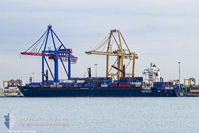
GSL ALICE
Container Ship
Current Trip
| Trip Time | 16 h, 0 mins |
|---|---|
| Trip Distance | 143.74 nm |
| AVG Speed | 15.3 Knop |
| MAX Speed | 18.5 Knop |
| Djupgående | 12.5 m |
| AVG Wind | 8.3 knots |
| MAX Wind | 12 knots |
| MIN Temp | 25.2°C / 77.36°F |
| MAX Temp | 28.7°C / 83.66°F |
| Position mottagen | 9 d sen |
Current Position
| Longitud | --- |
|---|---|
| Latitude | --- |
| Status | Under way using engine |
| Fart | 16.8 Knop |
| Kurs | 179.7° |
| Område | North Atlantic Ocean |
| Station | T-AIS |
| Position mottagen | 9 d sen |
Info
Information
The current position of GSL ALICE is in North Atlantic Ocean with coordinates 13.94886° / -17.74403° as reported on 2024-11-23 09:13 by AIS to our vessel tracker app. The vessel's current speed is 16.8 Knop and is currently inside the port of MALABO.
The vessel GSL ALICE (IMO: 9509164, MMSI: 636017907) is a Container Ship that was built in 2014 ( 10 År gammal ). It's sailing under the flag of [LR] Liberia.
In this page you can find informations about the vessels current position, last detected port calls, and current voyage information. If the vessels is not in coverage by AIS you will find the latest position.
The current position of GSL ALICE is detected by our AIS receivers and we are not responsible for the reliability of the data. The last position was recorded while the vessel was in Coverage by the Ais receivers of our vessel tracking app.
The current draught of GSL ALICE as reported by AIS is 12.5 meters
Weather
| Temperature | 26.4°C / 79.52°F |
|---|---|
| Wind Speed | 2 knots |
| Direction | 295° WNW |
| Pressure | 1012.8 hPa |
| Humidity | 72.4 % |
| Cloud Coverage | 45 % |
Featured Company
Last Port Calls
| Port | Arrival | Departure | Time In Port |
|---|---|---|---|
| 2024-12-02 07:36 | |||
| 2024-11-30 08:42 | 2024-12-01 15:36 | 1 d | |
| 2024-11-27 01:56 | 2024-11-28 01:20 | 23 h | |
| 2024-11-18 20:36 | 2024-11-19 14:03 | 17 h | |
| 2024-11-14 21:35 | 2024-11-16 02:02 | 1 d | |
| 2024-11-10 12:26 | 2024-11-11 19:02 | 1 d | |
| 2024-10-26 16:13 | 2024-10-27 19:52 | 1 d | |
| 2024-10-22 08:44 | 2024-10-23 18:55 | 1 d | |
| 2024-10-19 15:01 | 2024-10-19 22:05 | 7 h | |
| 2024-10-18 13:41 | 2024-10-19 07:37 | 17 h |
Last Trips
| Origin | Departure | Destination | Arrival | Distance | |
|---|---|---|---|---|---|
| 2024-12-01 15:36 | 2024-12-02 07:36 | 143.74 nm | |||
| 2024-11-28 01:20 | 2024-11-30 08:42 | 753.46 nm | |||
| 2024-11-19 14:03 | 2024-11-27 01:56 | 3033.09 nm | |||
| 2024-11-16 02:02 | 2024-11-18 20:36 | 215.41 nm | |||
| 2024-11-11 19:02 | 2024-11-14 21:35 | 499.36 nm | |||
| 2024-10-27 19:52 | 2024-11-10 12:26 | 4049.97 nm | |||
| 2024-10-23 18:55 | 2024-10-26 16:13 | 164.96 nm | |||
| 2024-10-19 22:05 | 2024-10-22 08:44 | 674.07 nm | |||
| 2024-10-19 07:37 | 2024-10-19 15:01 | 88.63 nm | |||
| 2024-10-14 09:24 | 2024-10-18 13:41 | 1131.30 nm |
Events
| Tid | Event | Detaljer | Position / Dest | Information |
|---|---|---|---|---|
| 2024-12-02 06:37 | STOPPAR förflyttning |
3.76208 / 8.77901
[GQ] MALABO
|
Fart: 0.3 kn Kurs: 154° |
|
| 2024-12-02 06:36 | ANLÄNDER HAMN |
|
3.76208 / 8.77901
[GQ] MALABO
|
Fart: 2.8 kn Kurs: 152° |
| 2024-12-01 22:10 | STARTAR förflyttning | 5.92 nm, North West of BATA |
1.89238 / 9.65986
TGLFW
|
Fart: 8.8 kn Kurs: 298° |
| 2024-12-01 16:10 | STOPPAR förflyttning | 6.84 nm, North West of BATA |
1.88545 / 9.63628
TGLFW
|
Fart: 0.3 kn Kurs: 308° |
| 2024-12-01 14:36 | AVGÅTT HAMN |
|
1.83934 / 9.71352
TGLFW
|
Fart: Kurs: 180° |
| 2024-11-30 07:53 | STOPPAR förflyttning |
1.82514 / 9.73257
[GQ] BATA
|
Fart: 0.1 kn Kurs: 175° |
|
| 2024-11-30 07:42 | ANLÄNDER HAMN |
|
1.82844 / 9.73248
[GQ] BATA
|
Fart: 3.5 kn Kurs: 139° |
| 2024-11-30 06:21 | STARTAR förflyttning | 7.65 nm, West of BATA |
1.83789 / 9.60803
TGLFW
|
Fart: 6.6 kn Kurs: 92° |
| 2024-11-29 23:55 | STOPPAR förflyttning | 6.74 nm, West of BATA |
1.83649 / 9.62315
TGLFW
|
Fart: 0.3 kn Kurs: 348° |
| 2024-11-28 01:20 | AVGÅTT HAMN |
|
6.13559 / 1.29411
TGLFW
|
Fart: 3.9 kn Kurs: 112° |