
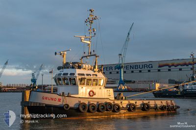
GRUNO4
Tug
Current Trip
ASSISTANCERIVEREMS
| Time Travelled | 2 h, 39 mins |
|---|---|
| Remaining Time | --- |
| Distance Travelled | 21.93 nm |
| Remaining Distance | --- |
| AVG Speed | 8.6 Knop |
| MAX Speed | 10.3 Knop |
| AVG Wind | 20 knots |
| MAX Wind | 20 knots |
| MIN Temp | -1.2°C / 29.84°F |
| MAX Temp | -0.8°C / 30.56°F |
| Djupgående | 3 m |
| Position mottagen | 5 m sen |
Current Position
| Longitud | --- |
|---|---|
| Latitude | --- |
| Status | Moored |
| Fart | 0.1 Knop |
| Kurs | 163° |
| Område | North Sea |
| Station | T-AIS |
| Position mottagen | 5 m sen |
Info
Information
The current position of GRUNO4 is in North Sea with coordinates 53.10437° / 7.36339° as reported on 2026-01-07 11:50 by AIS to our vessel tracker app. The vessel's current speed is 0.1 Knop
The vessel GRUNO4 (IMO: 9342669, MMSI: 246502000) is a Tug that was built in 2006 ( 20 År gammal ). It's sailing under the flag of [NL] Netherlands.
In this page you can find informations about the vessels current position, last detected port calls, and current voyage information. If the vessels is not in coverage by AIS you will find the latest position.
The current position of GRUNO4 is detected by our AIS receivers and we are not responsible for the reliability of the data. The last position was recorded while the vessel was in Coverage by the Ais receivers of our vessel tracking app.
The current draught of GRUNO4 as reported by AIS is 3 meters
Weather
| Temperature | -1.2°C / 29.84°F |
|---|---|
| Wind Speed | 20 knots |
| Direction | 182° S |
| Pressure | 1005.4 hPa |
| Humidity | 94.6 % |
| Cloud Coverage | 100 % |
Featured Company
Last Port Calls
| Port | Arrival | Departure | Time In Port |
|---|---|---|---|
| 2026-01-07 09:34 | 2026-01-07 10:16 | 42 m | |
| 2026-01-06 16:09 | 2026-01-07 08:26 | 16 h | |
| 2026-01-06 14:41 | 2026-01-06 15:04 | 23 m | |
| 2026-01-05 13:30 | 2026-01-06 12:23 | 22 h | |
| 2026-01-03 11:46 | 2026-01-05 08:26 | 1 d | |
| 2025-12-30 12:27 | 2026-01-03 09:08 | 3 d | |
| 2025-12-30 10:10 | 2025-12-30 11:26 | 1 h | |
| 2025-12-30 06:47 | 2025-12-30 07:33 | 45 m | |
| 2025-12-23 19:35 | 2025-12-30 03:46 | 6 d | |
| 2025-12-23 16:44 | 2025-12-23 18:42 | 1 h |
Last Trips
| Origin | Departure | Destination | Arrival | Distance | |
|---|---|---|---|---|---|
| 2026-01-07 08:26 | 2026-01-07 09:34 | 7.48 nm | |||
| 2026-01-06 15:04 | 2026-01-06 16:09 | 9.19 nm | |||
| 2026-01-06 12:23 | 2026-01-06 14:41 | 15.96 nm | |||
| 2026-01-05 08:26 | 2026-01-05 13:30 | 16.83 nm | |||
| 2026-01-03 09:08 | 2026-01-03 11:46 | 16.67 nm | |||
| 2025-12-30 11:26 | 2025-12-30 12:27 | 9.28 nm | |||
| 2025-12-30 07:33 | 2025-12-30 10:10 | 22.13 nm | |||
| 2025-12-30 03:46 | 2025-12-30 06:47 | 30.17 nm | |||
| 2025-12-23 18:42 | 2025-12-23 19:35 | 9.10 nm | |||
| 2025-12-23 14:17 | 2025-12-23 16:44 | 22.15 nm |
Events
| Tid | Event | Detaljer | Position / Dest | Information |
|---|---|---|---|---|
| 2026-01-07 11:50 | STOPPAR förflyttning | 0.93 nm, North West of PAPENBURG |
53.10437 / 7.36339
ASSISTANCERIVEREMS
|
Fart: 0.1 kn Kurs: 163° |
| 2026-01-07 09:54 | Status ändrad | Moored Default |
53.31428 / 7.34223
ASSISTANCERIVEREMS
|
Fart: 9.6 kn Kurs: 144° |
| 2026-01-07 09:53 | Status ändrad | Default Moored |
53.31799 / 7.33982
ASSISTANCERIVEREMS
|
Fart: 9.4 kn Kurs: 133.7° |
| 2026-01-07 09:16 | AVGÅTT HAMN |
|
53.33301 / 7.18082
ASSISTANCERIVEREMS
|
Fart: 7 kn Kurs: 128° |
| 2026-01-07 09:15 | Status ändrad | Moored Default |
53.33462 / 7.17833
[DE] EMDEN
|
Fart: 0.1 kn Kurs: 212° |
| 2026-01-07 09:15 | STARTAR förflyttning |
53.33462 / 7.17833
[DE] EMDEN
|
Fart: 6.4 kn Kurs: 167° |
|
| 2026-01-07 08:44 | STOPPAR förflyttning |
53.34018 / 7.18316
[DE] EMDEN
|
Fart: Kurs: 212° |
|
| 2026-01-07 08:38 | Status ändrad | Default Moored |
53.34009 / 7.18338
[DE] EMDEN
|
Fart: 7.3 kn Kurs: 40.6° |
| 2026-01-07 08:34 | ANLÄNDER HAMN |
|
53.33508 / 7.17965
[DE] EMDEN
|
Fart: 7 kn Kurs: 46.9° |
| 2026-01-07 07:46 | Byter havsområde | German part of the North Sea Dutch part of the North Sea |
53.32018 / 7.03293
North Sea
|
Fart: 7.5 kn Kurs: 82.2° |