
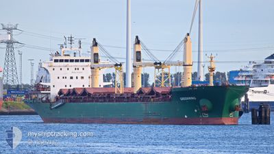
GREENWING
Bulk Carrier
Current Trip
SANTAREM / BRAZIL
| Time Travelled | 3 days |
|---|---|
| Remaining Time | --- |
| Distance Travelled | 885.96 nm |
| Remaining Distance | --- |
| AVG Speed | 12.5 Knop |
| MAX Speed | 17.4 Knop |
| AVG Wind | 6.6 knots |
| MAX Wind | 18.8 knots |
| MIN Temp | 22.1°C / 71.78°F |
| MAX Temp | 31.6°C / 88.88°F |
| Djupgående | 4.7 m |
| Position mottagen | 1 d sen |
Current Position
| Longitud | -50.74576° |
|---|---|
| Latitude | 0.19770° |
| Status | Under way using engine |
| Fart | 13.1 Knop |
| Kurs | 57.3° |
| Område | North Atlantic Ocean |
| Station | T-AIS |
| Position mottagen | 1 d sen |
Info
Information
The current position of GREENWING is in North Atlantic Ocean with coordinates 0.19770° / -50.74576° as reported on 2024-06-16 11:18 by AIS to our vessel tracker app. The vessel's current speed is 13.1 Knop
The vessel GREENWING (IMO: 9230921, MMSI: 538008597) is a Bulk Carrier that was built in 2002 ( 22 År gammal ). It's sailing under the flag of [MH] Marshall Is.
In this page you can find informations about the vessels current position, last detected port calls, and current voyage information. If the vessels is not in coverage by AIS you will find the latest position.
The current position of GREENWING is detected by our AIS receivers and we are not responsible for the reliability of the data. The last position was recorded while the vessel was in Coverage by the Ais receivers of our vessel tracking app.
The current draught of GREENWING as reported by AIS is 4.7 meters
Weather
| Temperature | 27.4°C / 81.32°F |
|---|---|
| Wind Speed | 17 knots |
| Direction | 108° ESE |
| Pressure | 1011.6 hPa |
| Humidity | 77 % |
| Cloud Coverage | 39 % |
Featured Company
Last Port Calls
| Port | Arrival | Departure | Time In Port |
|---|---|---|---|
| 2024-06-10 20:12 | 2024-06-15 05:45 | 4 d | |
| 2024-05-18 16:37 | 2024-05-19 14:56 | 22 h | |
| 2024-05-17 04:09 | 2024-05-17 04:48 | 38 m | |
| 2024-05-12 15:11 | 2024-05-13 19:24 | 1 d | |
| 2024-05-04 19:58 | 2024-05-04 20:31 | 33 m | |
| 2024-05-03 09:30 | 2024-05-03 10:36 | 1 h | |
| 2024-04-25 04:50 | 2024-05-03 00:42 | 7 d | |
| 2024-04-10 09:14 | 2024-04-12 20:19 | 2 d | |
| 2024-04-07 10:07 | 2024-04-09 13:51 | 2 d | |
| 2024-04-06 14:28 |
Most Visited Ports (Last year)
| Port | Arrivals | |
|---|---|---|
| 6 | ||
| 5 | ||
| 4 | ||
| 2 | ||
| 2 | ||
| 2 |
Last Trips
| Origin | Departure | Destination | Arrival | Distance | |
|---|---|---|---|---|---|
| 2024-05-19 10:56 | 2024-06-10 17:12 | 4074.43 nm | |||
| 2024-05-17 00:48 | 2024-05-18 12:37 | 297.57 nm | |||
| 2024-05-13 15:24 | 2024-05-17 00:09 | 763.13 nm | |||
| 2024-05-04 16:31 | 2024-05-12 11:11 | 768.02 nm | |||
| 2024-05-03 06:36 | 2024-05-04 15:58 | 296.16 nm | |||
| 2024-05-02 20:42 | 2024-05-03 05:30 | 77.90 nm | |||
| 2024-04-12 22:19 | 2024-04-25 00:50 | 2983.33 nm | |||
| 2024-04-09 15:51 | 2024-04-10 11:14 | 183.97 nm | |||
| 2024-04-06 16:28 | 2024-04-07 12:07 | 161.24 nm |
Events
| Tid | Event | Detaljer | Position / Dest | Information |
|---|---|---|---|---|
| 2024-06-16 11:22 | Status ändrad | Default Under way using engine |
.20366 / -50.73565
SANTAREM / BRAZIL
|
Fart: 13.1 kn Kurs: 57.3° |
| 2024-06-16 11:18 | UTANFÖR täckningsområde |
.19770 / -50.74576
North Atlantic Ocean
|
Fart: 13.1 kn Kurs: 57.3° |
|
| 2024-06-16 11:04 | Status ändrad | Under way using engine Default |
.17486 / -50.79013
SANTAREM / BRAZIL
|
Fart: 13.6 kn Kurs: 86° |
| 2024-06-16 11:02 | Status ändrad | Default Under way using engine |
.17440 / -50.79637
SANTAREM / BRAZIL
|
Fart: 13.5 kn Kurs: 85.2° |
| 2024-06-16 09:44 | Byter havsområde | Brazilian part of the North Atlantic Ocean Brazilian part of the South Atlantic Ocean |
.00700 / -51.02470
North Atlantic Ocean
|
Fart: 14.1 kn Kurs: 29.5° |
| 2024-06-16 07:59 | Status ändrad | Under way using engine Default |
-.22513 / -51.30313
SANTAREM / BRAZIL
|
Fart: 15.1 kn Kurs: 39° |
| 2024-06-16 07:50 | I täckningsområde |
-.21683 / -51.29660
South Atlantic Ocean
|
Fart: 15.2 kn Kurs: 38.5° |
|
| 2024-06-16 05:54 | Status ändrad | Default Under way using engine |
-.64999 / -51.60416
SANTAREM / BRAZIL
|
Fart: 14.6 kn Kurs: 33.5° |
| 2024-06-16 05:48 | UTANFÖR täckningsområde |
-.67056 / -51.61794
South Atlantic Ocean
|
Fart: 14.6 kn Kurs: 33.5° |
|
| 2024-06-16 05:39 | Status ändrad | Under way using engine Default |
-.70111 / -51.63815
SANTAREM / BRAZIL
|
Fart: 14.9 kn Kurs: 28° |