
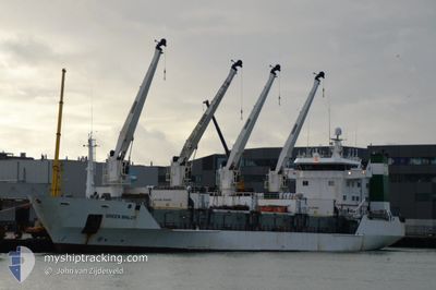
GREEN MALOY
Reefer
Current Trip
| Trip Time | --- |
|---|---|
| Trip Distance | --- |
| AVG Speed | --- |
| MAX Speed | --- |
| Djupgående | --- |
| AVG Wind | --- |
| MAX Wind | --- |
| MIN Temp | --- |
| MAX Temp | --- |
| Position mottagen | 2024-03-19 08:28 |
Current Position
| Longitud | -17.01103° |
|---|---|
| Latitude | 20.88686° |
| Status | Under way using engine |
| Fart | 0.2 Knop |
| Kurs | 346° |
| Område | North Atlantic Ocean |
| Station | T-AIS |
| Position mottagen | 2024-03-19 08:28 |
Info
Information
The current position of GREEN MALOY is in North Atlantic Ocean with coordinates 20.88686° / -17.01103° as reported on 2024-03-19 08:28 by AIS to our vessel tracker app. The vessel's current speed is 0.2 Knop and is currently inside the port of ABIDJAN.
The vessel GREEN MALOY (IMO: 8804579, MMSI: 311042400) is a Reefer that was built in 1990 ( 34 År gammal ). It's sailing under the flag of [BS] Bahamas.
In this page you can find informations about the vessels current position, last detected port calls, and current voyage information. If the vessels is not in coverage by AIS you will find the latest position.
The current position of GREEN MALOY is detected by our AIS receivers and we are not responsible for the reliability of the data. The last position was recorded while the vessel was in Coverage by the Ais receivers of our vessel tracking app.
The current draught of GREEN MALOY as reported by AIS is 6.3 meters
Weather
| Temperature | 29.1°C / 84.38°F |
|---|---|
| Wind Speed | 7 knots |
| Direction | 202° SSW |
| Pressure | 1010 hPa |
| Humidity | 78.1 % |
| Cloud Coverage | 100 % |
Featured Company
Most Visited Ports (Last year)
| Port | Arrivals | |
|---|---|---|
| 3 | ||
| 2 | ||
| 2 | ||
| 1 | ||
| 1 | ||
| 1 |
Last Trips
| Origin | Departure | Destination | Arrival | Distance | |
|---|---|---|---|---|---|
| 2024-04-14 20:10 | 2024-04-17 07:52 | 732.27 nm | |||
| 2024-04-09 07:09 | 2024-04-12 22:38 | 688.93 nm | |||
| 2024-04-04 21:55 | 2024-04-06 12:29 | 312.98 nm | |||
| 2024-03-16 16:52 | 2024-04-01 20:01 | 2106.02 nm | |||
| 2024-01-10 15:16 | 2024-03-15 21:24 | 2446.04 nm |
Events
| Tid | Event | Detaljer | Position / Dest | Information |
|---|---|---|---|---|
| 2024-04-27 07:58 | STOPPAR förflyttning |
5.26667 / -4.03167
[CI] ABIDJAN
|
Fart: Kurs: -1° |
|
| 2024-04-27 07:57 | ANLÄNDER HAMN |
|
5.26667 / -4.03167
[CI] ABIDJAN
|
Fart: 1.2 kn Kurs: 247° |
| 2024-04-27 05:54 | STARTAR förflyttning | 7.15 nm, South West of ABIDJAN |
5.21401 / -4.08826
MR NDB
|
Fart: 4.8 kn Kurs: 163° |
| 2024-04-26 19:41 | STOPPAR förflyttning | 7.02 nm, South West of ABIDJAN |
5.21556 / -4.08682
MR NDB
|
Fart: 0.3 kn Kurs: 255° |
| 2024-04-26 05:15 | STARTAR förflyttning |
4.53261 / -3.85992
MR NDB
|
Fart: 3.1 kn Kurs: 245° |
|
| 2024-04-26 02:49 | STOPPAR förflyttning |
4.52167 / -3.88833
MR NDB
|
Fart: Kurs: -1° |
|
| 2024-04-25 17:54 | STARTAR förflyttning | 6.34 nm, South West of ABIDJAN |
5.21856 / -4.06762
MR NDB
|
Fart: 7.4 kn Kurs: 175° |
| 2024-04-20 16:22 | STOPPAR förflyttning | 6.17 nm, South West of ABIDJAN |
5.22129 / -4.06657
MR NDB
|
Fart: 0.3 kn Kurs: 152° |