
GREEN CREST
Cargo
Current Trip
| Time Travelled | 14 h, 40 mins |
|---|---|
| Remaining Time | --- |
| Distance Travelled | 20.46 nm |
| Remaining Distance | --- |
| AVG Speed | 11.2 Knop |
| MAX Speed | 13.4 Knop |
| AVG Wind | 7.9 knots |
| MAX Wind | 9.9 knots |
| MIN Temp | 29.3°C / 84.74°F |
| MAX Temp | 30.7°C / 87.26°F |
| Djupgående | 5.7 m |
| Position mottagen | 2 h, 34 m sen |
Current Position
| Longitud | 100.63002° |
|---|---|
| Latitude | 13.33519° |
| Status | At anchor |
| Fart | 0.1 Knop |
| Kurs | 2° |
| Område | Gulf of Thailand |
| Station | T-AIS |
| Position mottagen | 2 h, 34 m sen |
Info
Information
The current position of GREEN CREST is in Gulf of Thailand with coordinates 13.33519° / 100.63002° as reported on 2024-05-12 00:45 by AIS to our vessel tracker app. The vessel's current speed is 0.1 Knop
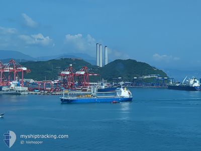
The vessel GREEN CREST (IMO: 9889629, MMSI: 538009002) is a Cargo It's sailing under the flag of [MH] Marshall Is.
In this page you can find informations about the vessels current position, last detected port calls, and current voyage information. If the vessels is not in coverage by AIS you will find the latest position.
The current position of GREEN CREST is detected by our AIS receivers and we are not responsible for the reliability of the data. The last position was recorded while the vessel was in Coverage by the Ais receivers of our vessel tracking app.
The current draught of GREEN CREST as reported by AIS is 5.7 meters
Weather
| Temperature | 29.3°C / 84.74°F |
|---|---|
| Wind Speed | 3 knots |
| Direction | 333° NNW |
| Pressure | 1010.5 hPa |
| Humidity | 72.4 % |
| Cloud Coverage | 92 % |
Featured Company
Events
| Tid | Event | Detaljer | Position / Dest | Information |
|---|---|---|---|---|
| 2024-05-12 00:45 | UTANFÖR täckningsområde |
13.33519 / 100.63002
Gulf of Thailand
|
Fart: 0.1 kn Kurs: 118.1° |
|
| 2024-05-11 23:03 | Status ändrad | At anchor Default |
13.33532 / 100.62959
TH BKK
|
Fart: 0.1 kn Kurs: 35° |
| 2024-05-11 22:57 | Status ändrad | Default At anchor |
13.33538 / 100.62953
TH BKK
|
Fart: Kurs: 35° |
| 2024-05-11 14:48 | Status ändrad | At anchor Under way using engine |
13.33609 / 100.63105
TH BKK
|
Fart: 0.3 kn Kurs: 283° |
| 2024-05-11 14:44 | STOPPAR förflyttning | 12.64 nm, South of BANGKOK |
13.33555 / 100.63141
TH BKK
|
Fart: 0.3 kn Kurs: 312° |
| 2024-05-11 13:47 | Djupgående ändrat | 5.7 9 |
13.28471 / 100.73515
TH BKK
|
Fart: 13.4 kn Kurs: 295.8° |
| 2024-05-11 13:47 | Destination ändrad | TH BKK TH SBP |
13.28471 / 100.73515
TH BKK
|
Fart: 13.4 kn Kurs: 295.8° |
| 2024-05-11 13:47 | ETA ändrat | 2024/05/11 14:00 2024/05/07 19:00 |
13.28471 / 100.73515
TH BKK
|
Fart: 13.4 kn Kurs: 295.8° |
| 2024-05-11 13:31 | Status ändrad | Under way using engine Default |
13.26116 / 100.78421
TH SBP
|
Fart: 13.2 kn Kurs: 296° |
| 2024-05-11 13:28 | Status ändrad | Default Under way using engine |
13.25594 / 100.79491
TH SBP
|
Fart: 13.1 kn Kurs: 296.2° |