

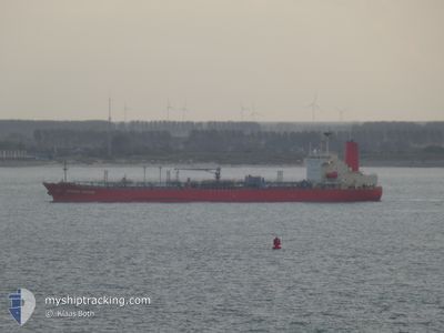
GRANDE RIVIERE
Tanker

Current Trip
| Time Travelled | 17 days |
|---|---|
| Remaining Time | 1 h, 58 mins |
| Distance Travelled | 5684.13 nm |
| Remaining Distance | 24.03 nm |
| AVG Speed | 12.9 Knop |
| MAX Speed | 16.7 Knop |
| AVG Wind | 13.2 knots |
| MAX Wind | 26 knots |
| MIN Temp | 3.7°C / 38.66°F |
| MAX Temp | 26.1°C / 78.98°F |
| Djupgående | 9.9 m |
| Position mottagen | 1 m sen |
Current Position
| Longitud | --- |
|---|---|
| Latitude | --- |
| Status | Under way using engine |
| Fart | 10.6 Knop |
| Kurs | 74.2° |
| Område | North Sea |
| Station | T-AIS |
| Position mottagen | 1 m sen |
Information
The current position of GRANDE RIVIERE is in North Sea with coordinates 51.95634° / 3.56202° as reported on 2025-03-02 11:56 by AIS to our vessel tracker app. The vessel's current speed is 10.6 Knop and is heading at the port of ROTTERDAM. The estimated time of arrival as calculated by MyShipTracking vessel tracking app is 2025-03-02 14:56 LT
The vessel GRANDE RIVIERE (IMO: 9733686, MMSI: 431156000) is a Tanker It's sailing under the flag of [JP] Japan.
In this page you can find informations about the vessels current position, last detected port calls, and current voyage information. If the vessels is not in coverage by AIS you will find the latest position.
The current position of GRANDE RIVIERE is detected by our AIS receivers and we are not responsible for the reliability of the data. The last position was recorded while the vessel was in Coverage by the Ais receivers of our vessel tracking app.
The current draught of GRANDE RIVIERE as reported by AIS is 9.9 meters
Weather
| Temperature | 4.6°C / 40.28°F |
|---|---|
| Wind Speed | 5 knots |
| Direction | 148° SSE |
| Pressure | 1035.8 hPa |
| Humidity | 81.4 % |
| Cloud Coverage | --- |


Featured Company
Last Port Calls
| Port | Arrival | Departure | Time In Port |
|---|---|---|---|
| 2025-02-08 19:25 | 2025-02-12 19:28 | 4 d | |
| 2025-01-15 01:15 | 2025-01-15 23:17 | 22 h | |
| 2025-01-10 08:16 | 2025-01-11 14:22 | 1 d | |
| 2025-01-05 15:04 | 2025-01-06 18:14 | 1 d |
Most Visited Ports (Last year)
| Port | Arrivals | |
|---|---|---|
| 7 | ||
| 6 | ||
| 4 | ||
| 3 | ||
| 2 | ||
| 2 |
Last Trips
| Origin | Departure | Destination | Arrival | Distance | |
|---|---|---|---|---|---|
| 2025-01-15 23:17 | 2025-02-08 19:25 | 6207.10 nm | |||
| 2025-01-11 14:22 | 2025-01-15 01:15 | 1011.48 nm | |||
| 2025-01-06 18:14 | 2025-01-10 08:16 | 568.18 nm | |||
| 2024-12-16 21:26 | 2025-01-05 15:04 | 4093.95 nm |
Events
| Tid | Event | Detaljer | Position / Dest | Information |
|---|---|---|---|---|
| 2025-03-02 08:46 | ETA ändrat | 2025/03/02 13:00 2025/03/02 12:00 |
51.78432 / 2.71814
NLRTM
|
Fart: 12.1 kn Kurs: 49° |
| 2025-03-02 08:43 | Byter havsområde | Dutch part of the North Sea Belgian part of the North Sea |
51.77916 / 2.70635
North Sea
NLRTM
|
Fart: 12.3 kn Kurs: 64° |
| 2025-03-02 06:58 | Byter havsområde | Belgian part of the North Sea French part of the North Sea |
51.50833 / 2.27775
North Sea
NLRTM
|
Fart: 13.5 kn Kurs: 46.5° |
| 2025-03-02 04:44 | Byter havsområde | French part of the North Sea United Kingdom part of the North Sea |
51.14195 / 1.80191
North Sea
NLRTM
|
Fart: 14.7 kn Kurs: 59.7° |
| 2025-03-02 04:25 | Byter havsområde | United Kingdom part of the North Sea French part of the North Sea |
51.09367 / 1.70551
North Sea
NLRTM
|
Fart: 14.7 kn Kurs: 44.9° |
| 2025-03-02 03:58 | Byter havsområde | French part of the North Sea French part of the English Channel |
51.01944 / 1.58445
North Sea
NLRTM
|
Fart: 14 kn Kurs: 45.8° |
| 2025-03-02 01:22 | Status ändrad | Under way using engine Default |
50.53084 / 1.11065
NLRTM
|
Fart: 14.4 kn Kurs: 48° |
| 2025-03-02 01:18 | Status ändrad | Default Under way using engine |
50.51982 / 1.09040
NLRTM
|
Fart: 14.2 kn Kurs: 49.5° |
| 2025-03-02 01:12 | Status ändrad | Under way using engine Default |
50.50501 / 1.06351
NLRTM
|
Fart: 14.1 kn Kurs: 52° |
| 2025-03-02 01:02 | Status ändrad | Default Under way using engine |
50.48286 / 1.01035
NLRTM
|
Fart: 14.2 kn Kurs: 63.2° |