

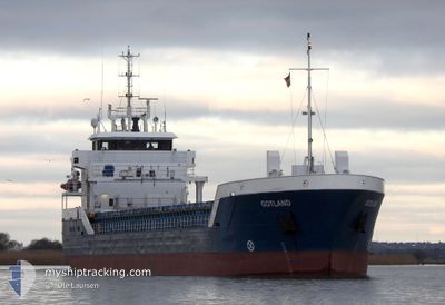
GOTLAND
General Cargo

Current Trip
| Time Travelled | 1 day |
|---|---|
| Remaining Time | 1 day |
| Distance Travelled | 189.55 nm |
| Remaining Distance | 240.42 nm |
| AVG Speed | 7.5 Knop |
| MAX Speed | 12.3 Knop |
| AVG Wind | 6.6 knots |
| MAX Wind | 13.2 knots |
| MIN Temp | 4.1°C / 39.38°F |
| MAX Temp | 14.2°C / 57.56°F |
| Djupgående | 5.2 m |
| Position mottagen | 1 m sen |
Current Position
| Longitud | --- |
|---|---|
| Latitude | --- |
| Status | Under way using engine |
| Fart | 9.1 Knop |
| Kurs | 70.8° |
| Område | Baltic Sea |
| Station | T-AIS |
| Position mottagen | 1 m sen |
Information
The current position of GOTLAND is in Baltic Sea with coordinates 54.59374° / 12.75384° as reported on 2025-03-28 14:19 by AIS to our vessel tracker app. The vessel's current speed is 9.1 Knop and is heading at the port of GDANSK. The estimated time of arrival as calculated by MyShipTracking vessel tracking app is 2025-03-29 16:14 LT
The vessel GOTLAND (IMO: 9411824, MMSI: 211882460) is a General Cargo that was built in 2012 ( 13 År gammal ). It's sailing under the flag of [DE] Germany.
In this page you can find informations about the vessels current position, last detected port calls, and current voyage information. If the vessels is not in coverage by AIS you will find the latest position.
The current position of GOTLAND is detected by our AIS receivers and we are not responsible for the reliability of the data. The last position was recorded while the vessel was in Coverage by the Ais receivers of our vessel tracking app.
The current draught of GOTLAND as reported by AIS is 5.2 meters
Weather
| Temperature | 9.6°C / 49.28°F |
|---|---|
| Wind Speed | 8 knots |
| Direction | 197° SSW |
| Pressure | 1010.5 hPa |
| Humidity | 62.4 % |
| Cloud Coverage | --- |


Featured Company
Events
| Tid | Event | Detaljer | Position / Dest | Information |
|---|---|---|---|---|
| 2025-03-28 11:32 | Byter havsområde | German part of the Baltic Sea Danish part of the Baltic Sea |
54.41472 / 12.11651
Baltic Sea
PLGDN
|
Fart: 9.5 kn Kurs: 89.2° |
| 2025-03-28 08:50 | Upptäckt i hav | Danish part of the Baltic Sea |
54.51527 / 11.42160
Baltic Sea
PLGDN
|
Fart: 9.3 kn Kurs: 114.8° |
| 2025-03-28 07:43 | ETA ändrat | 2025/03/29 20:00 2025/03/29 17:00 |
54.58324 / 11.15842
PLGDN
|
Fart: 9 kn Kurs: 112.8° |
| 2025-03-28 06:13 | Upptäckt i hav | German part of the Baltic Sea |
54.55925 / 10.76665
Baltic Sea
PLGDN
|
Fart: 9.3 kn Kurs: 84.2° |
| 2025-03-28 05:40 | Byter havsområde | Danish part of the Baltic Sea German part of the Baltic Sea |
54.55120 / 10.62117
Baltic Sea
PLGDN
|
Fart: 9.2 kn Kurs: 84.4° |
| 2025-03-28 04:13 | Byter havsområde | German part of the Baltic Sea German part of the North Sea |
54.46227 / 10.27525
Baltic Sea
PLGDN
|
Fart: 9.4 kn Kurs: 40.3° |
| 2025-03-28 03:21 | STARTAR förflyttning | 1.29 nm, South West of STICKENHΟRN SPORT |
54.36554 / 10.14606
PLGDN
|
Fart: 4 kn Kurs: 102° |
| 2025-03-28 02:44 | STOPPAR förflyttning | 1.34 nm, South West of STICKENHΟRN SPORT |
54.36590 / 10.14295
PLGDN
|
Fart: 0.3 kn Kurs: 107° |
| 2025-03-27 21:20 | STARTAR förflyttning | 0.21 nm, South West of FISCHERHUTTE |
54.15133 / 9.36903
PLGDN
|
Fart: 3.5 kn Kurs: 56° |
| 2025-03-27 20:59 | Status ändrad | Under way using engine Default |
54.15038 / 9.36681
PLGDN
|
Fart: Kurs: 0° |