

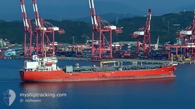
GINGA OCELOT
Tanker B

Current Trip
| Time Travelled | 13 days |
|---|---|
| Remaining Time | --- |
| Distance Travelled | 3631.56 nm |
| Remaining Distance | --- |
| AVG Speed | 11.7 Knop |
| MAX Speed | 14.7 Knop |
| AVG Wind | 9.5 knots |
| MAX Wind | 24 knots |
| MIN Temp | 17.5°C / 63.5°F |
| MAX Temp | 29.4°C / 84.92°F |
| Djupgående | 11 m |
| Position mottagen | 6 m sen |
Current Position
| Longitud | --- |
|---|---|
| Latitude | --- |
| Status | At anchor |
| Fart | |
| Kurs | 31° |
| Område | Indian Ocean |
| Station | T-AIS |
| Position mottagen | 6 m sen |
Information
The current position of GINGA OCELOT is in Indian Ocean with coordinates -20.12456° / 57.47563° as reported on 2025-02-13 05:04 by AIS to our vessel tracker app. The vessel's current speed is 0 Knop
The vessel GINGA OCELOT (IMO: 9581423, MMSI: 538005077) is a Tanker B It's sailing under the flag of [MH] Marshall Is.
In this page you can find informations about the vessels current position, last detected port calls, and current voyage information. If the vessels is not in coverage by AIS you will find the latest position.
The current position of GINGA OCELOT is detected by our AIS receivers and we are not responsible for the reliability of the data. The last position was recorded while the vessel was in Coverage by the Ais receivers of our vessel tracking app.
The current draught of GINGA OCELOT as reported by AIS is 11 meters
Weather
| Temperature | 28.3°C / 82.94°F |
|---|---|
| Wind Speed | 5 knots |
| Direction | 117° ESE |
| Pressure | 1012.5 hPa |
| Humidity | 74.2 % |
| Cloud Coverage | 10 % |


Featured Company
Last Port Calls
| Port | Arrival | Departure | Time In Port |
|---|---|---|---|
| 2025-01-28 19:12 | 2025-01-30 12:09 | 1 d | |
| 2025-01-25 23:45 | 2025-01-28 00:31 | 2 d | |
| 2025-01-15 17:07 | 2025-01-22 01:19 | 6 d | |
| 2025-01-01 01:07 | 2025-01-03 14:33 | 2 d |
Most Visited Ports (Last year)
| Port | Arrivals | |
|---|---|---|
| 4 | ||
| 4 | ||
| 4 | ||
| 2 | ||
| 2 | ||
| 2 |
Last Trips
| Origin | Departure | Destination | Arrival | Distance | |
|---|---|---|---|---|---|
| 2025-01-28 03:31 | 2025-01-28 22:12 | 13.73 nm | |||
| 2025-01-22 04:19 | 2025-01-26 02:45 | 34.46 nm | |||
| 2025-01-03 19:33 | 2025-01-15 20:07 | 3030.89 nm | |||
| 2024-11-21 17:26 | 2025-01-01 06:07 | 7394.57 nm |
Events
| Tid | Event | Detaljer | Position / Dest | Information |
|---|---|---|---|---|
| 2025-02-13 05:06 | Status ändrad | Default At anchor |
-20.12454 / 57.47564
MU PLU
|
Fart: Kurs: 31° |
| 2025-02-13 05:04 | Status ändrad | At anchor Default |
-20.12456 / 57.47563
MU PLU
|
Fart: 0.1 kn Kurs: 36° |
| 2025-02-13 04:48 | Status ändrad | Default At anchor |
-20.12456 / 57.47546
MU PLU
|
Fart: Kurs: 43° |
| 2025-02-13 04:45 | Status ändrad | At anchor Default |
-20.12453 / 57.47546
MU PLU
|
Fart: Kurs: 43° |
| 2025-02-13 04:18 | Status ändrad | Default At anchor |
-20.12463 / 57.47528
MU PLU
|
Fart: 0.1 kn Kurs: 50° |
| 2025-02-13 04:09 | Status ändrad | At anchor Default |
-20.12470 / 57.47511
MU PLU
|
Fart: 0.1 kn Kurs: 51° |
| 2025-02-13 04:06 | Status ändrad | Default At anchor |
-20.12465 / 57.47516
MU PLU
|
Fart: 0.1 kn Kurs: 48° |
| 2025-02-13 04:03 | Status ändrad | At anchor Default |
-20.12467 / 57.47519
MU PLU
|
Fart: 0.2 kn Kurs: 45° |
| 2025-02-13 03:45 | Status ändrad | Default At anchor |
-20.12463 / 57.47549
MU PLU
|
Fart: 0.1 kn Kurs: 48° |
| 2025-02-13 03:42 | Status ändrad | At anchor Default |
-20.12465 / 57.47544
MU PLU
|
Fart: 0.2 kn Kurs: 48° |