

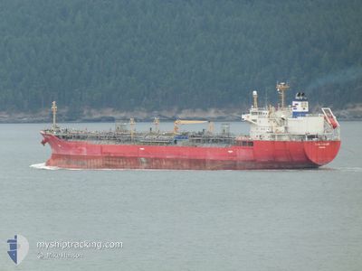
GINGA COUGAR
Oil/Chemical Tanker

Current Trip
IDWET
| Time Travelled | 4 days |
|---|---|
| Remaining Time | --- |
| Distance Travelled | 1339.03 nm |
| Remaining Distance | --- |
| AVG Speed | 12.6 Knop |
| MAX Speed | 14.5 Knop |
| AVG Wind | 11.2 knots |
| MAX Wind | 21 knots |
| MIN Temp | 15.9°C / 60.62°F |
| MAX Temp | 28.2°C / 82.76°F |
| Djupgående | 10.5 m |
| Position mottagen | 4 d sen |
Current Position
| Longitud | --- |
|---|---|
| Latitude | --- |
| Status | Under way using engine |
| Fart | 13 Knop |
| Kurs | 199.1° |
| Område | North Pacific Ocean |
| Station | T-AIS |
| Position mottagen | 4 d sen |
Information
The current position of GINGA COUGAR is in North Pacific Ocean with coordinates 34.24915° / 140.79010° as reported on 2025-03-26 10:32 by AIS to our vessel tracker app. The vessel's current speed is 13 Knop
The vessel GINGA COUGAR (IMO: 9321861, MMSI: 353108000) is a Oil/Chemical Tanker that was built in 2005 ( 20 År gammal ). It's sailing under the flag of [PA] Panama.
In this page you can find informations about the vessels current position, last detected port calls, and current voyage information. If the vessels is not in coverage by AIS you will find the latest position.
The current position of GINGA COUGAR is detected by our AIS receivers and we are not responsible for the reliability of the data. The last position was recorded while the vessel was in Coverage by the Ais receivers of our vessel tracking app.
The current draught of GINGA COUGAR as reported by AIS is 10.5 meters
Weather
| Temperature | 28.1°C / 82.58°F |
|---|---|
| Wind Speed | 14 knots |
| Direction | 73° ENE |
| Pressure | 1011.7 hPa |
| Humidity | 77.4 % |
| Cloud Coverage | 22 % |


Featured Company
Last Port Calls
| Port | Arrival | Departure | Time In Port |
|---|---|---|---|
| 2025-03-25 10:25 | 2025-03-26 08:54 | 22 h | |
| 2025-02-03 23:20 | 2025-02-05 04:48 | 1 d | |
| 2025-01-22 21:11 | 2025-01-24 05:34 | 1 d | |
| 2025-01-18 19:56 | 2025-01-19 17:42 | 21 h | |
| 2025-01-13 14:35 | 2025-01-14 10:22 | 19 h | |
| 2025-01-02 19:21 | 2025-01-04 06:42 | 1 d |
Most Visited Ports (Last year)
| Port | Arrivals | |
|---|---|---|
| 5 | ||
| 4 | ||
| 3 | ||
| 3 | ||
| 2 | ||
| 2 |
Last Trips
| Origin | Departure | Destination | Arrival | Distance | |
|---|---|---|---|---|---|
| 2025-02-05 04:48 | 2025-03-25 10:25 | 3797.43 nm | |||
| 2025-01-24 05:34 | 2025-02-03 23:20 | 2898.09 nm | |||
| 2025-01-19 17:42 | 2025-01-22 21:11 | 42.34 nm | |||
| 2025-01-14 10:22 | 2025-01-18 19:56 | 1168.41 nm | |||
| 2025-01-04 06:42 | 2025-01-13 14:35 | 1373.18 nm | |||
| 2024-12-22 11:07 | 2025-01-02 19:21 | 641.31 nm |
Events
| Tid | Event | Detaljer | Position / Dest | Information |
|---|---|---|---|---|
| 2025-03-26 10:35 | Status ändrad | Default Under way using engine |
34.23860 / 140.78801
IDWET
|
Fart: 13 kn Kurs: 199.1° |
| 2025-03-26 10:32 | UTANFÖR täckningsområde |
34.24915 / 140.79010
North Pacific Ocean
IDWET
|
Fart: 13 kn Kurs: 199.1° |
|
| 2025-03-26 10:07 | Status ändrad | Under way using engine Default |
34.33534 / 140.82314
IDWET
|
Fart: 12.4 kn Kurs: 197° |
| 2025-03-26 10:06 | Status ändrad | Default Under way using engine |
34.33870 / 140.82431
IDWET
|
Fart: 12.7 kn Kurs: 195.6° |
| 2025-03-26 02:47 | Djupgående ändrat | 10.5 5.5 |
35.70449 / 141.15169
IDWET
|
Fart: 12.9 kn Kurs: 188° |
| 2025-03-26 02:47 | Destination ändrad | IDWET HKHKG |
35.70449 / 141.15169
IDWET
|
Fart: 12.9 kn Kurs: 188° |
| 2025-03-26 02:47 | ETA ändrat | 2025/04/02 17:00 2025/03/15 13:00 |
35.70449 / 141.15169
IDWET
|
Fart: 12.9 kn Kurs: 188° |
| 2025-03-26 01:58 | Status ändrad | Under way using engine Default |
35.85646 / 141.13136
HKHKG
|
Fart: 12.4 kn Kurs: 127° |
| 2025-03-26 01:44 | I täckningsområde |
35.85646 / 141.13136
North Pacific Ocean
|
Fart: 12.3 kn Kurs: 127.7° |
|
| 2025-03-25 23:54 | AVGÅTT HAMN |
|
35.93716 / 140.70641
HKHKG
|
Fart: 6.6 kn Kurs: 44° |