
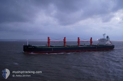
GEORGIA M
Bulk Carrier
Current Trip
| Time Travelled | 13 days |
|---|---|
| Remaining Time | --- |
| Distance Travelled | 3361.36 nm |
| Remaining Distance | --- |
| AVG Speed | 11 Knop |
| MAX Speed | 14.8 Knop |
| AVG Wind | 11.4 knots |
| MAX Wind | 34.6 knots |
| MIN Temp | 3.4°C / 38.12°F |
| MAX Temp | 27.8°C / 82.04°F |
| Djupgående | 10.6 m |
| Position mottagen | 7 d sen |
Current Position
| Longitud | --- |
|---|---|
| Latitude | --- |
| Status | Under way using engine |
| Fart | 10.4 Knop |
| Kurs | 154.8° |
| Område | North Pacific Ocean |
| Station | T-AIS |
| Position mottagen | 7 d sen |
Info
Information
The current position of GEORGIA M is in North Pacific Ocean with coordinates 30.14349° / -119.57905° as reported on 2025-02-22 09:33 by AIS to our vessel tracker app. The vessel's current speed is 10.4 Knop and is heading at the port of SANTOS. The estimated time of arrival as calculated by MyShipTracking vessel tracking app is 2025-03-27 12:00 LT
The vessel GEORGIA M (IMO: 9616618, MMSI: 538004498) is a Bulk Carrier that was built in 2012 ( 13 År gammal ). It's sailing under the flag of [MH] Marshall Is.
In this page you can find informations about the vessels current position, last detected port calls, and current voyage information. If the vessels is not in coverage by AIS you will find the latest position.
The current position of GEORGIA M is detected by our AIS receivers and we are not responsible for the reliability of the data. The last position was recorded while the vessel was in Coverage by the Ais receivers of our vessel tracking app.
The current draught of GEORGIA M as reported by AIS is 10.6 meters
Weather
| Temperature | 26.8°C / 80.24°F |
|---|---|
| Wind Speed | 7 knots |
| Direction | 167° SSE |
| Pressure | 1008 hPa |
| Humidity | 78.8 % |
| Cloud Coverage | 20 % |
Featured Company
Last Trips
| Origin | Departure | Destination | Arrival | Distance | |
|---|---|---|---|---|---|
| 2025-01-25 10:06 | 2025-02-13 22:20 | 4710.80 nm | |||
| 2024-12-21 02:48 | 2025-01-21 09:15 | 8028.29 nm |
Events
| Tid | Event | Detaljer | Position / Dest | Information |
|---|---|---|---|---|
| 2025-02-22 09:38 | Status ändrad | Default Under way using engine |
30.13084 / -119.57192
BR SSZ
|
Fart: 10.4 kn Kurs: 154.8° |
| 2025-02-22 09:33 | Status ändrad | Under way using engine Default |
30.14349 / -119.57905
BR SSZ
|
Fart: 10.4 kn Kurs: 155° |
| 2025-02-22 09:33 | UTANFÖR täckningsområde |
30.14349 / -119.57905
North Pacific Ocean
|
Fart: 10.4 kn Kurs: 154.8° |
|
| 2025-02-22 09:29 | I täckningsområde |
30.14349 / -119.57905
North Pacific Ocean
|
Fart: 10.4 kn Kurs: 154.8° |
|
| 2025-02-22 07:39 | Status ändrad | Default Under way using engine |
30.44757 / -119.75040
BR SSZ
|
Fart: 10.2 kn Kurs: 152.5° |
| 2025-02-22 07:34 | Status ändrad | Under way using engine Default |
30.46037 / -119.75769
BR SSZ
|
Fart: 10.2 kn Kurs: 152° |
| 2025-02-22 07:34 | UTANFÖR täckningsområde |
30.46037 / -119.75769
North Pacific Ocean
|
Fart: 10.2 kn Kurs: 152.5° |
|
| 2025-02-22 07:27 | Status ändrad | Default Under way using engine |
30.47693 / -119.76736
BR SSZ
|
Fart: 10.1 kn Kurs: 152.1° |
| 2025-02-22 05:51 | Status ändrad | Under way using engine Default |
30.73230 / -119.90051
BR SSZ
|
Fart: 10.7 kn Kurs: 158° |
| 2025-02-22 05:46 | Status ändrad | Default Under way using engine |
30.74472 / -119.90660
BR SSZ
|
Fart: 10.7 kn Kurs: 157.6° |